


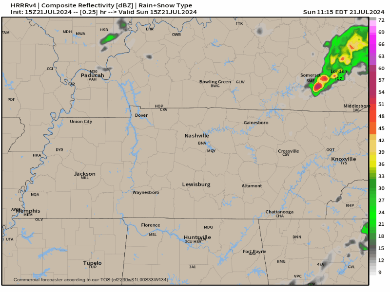
Morning rain and storms SE of us this morning. Seen by mid level water vapor imagery:

Lightningstorms for some of us are likely late this afternoon.
- Exactly when and where is unclear. Long live the summertime wattery.
- Unlikely all of us will get rain.
HRRR model for today, time stamp upper right (subtract 1 hour):
Storms may hang on past dark. Nothing severe outlooked, but heavy rain, CG (cloud to ground) lightning, and maybe strong straight line winds are potential hazards.
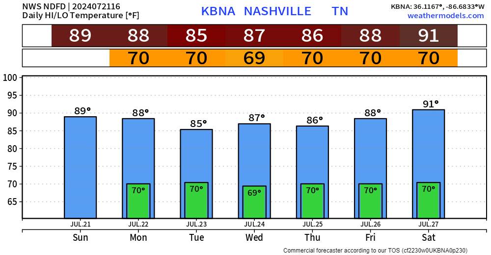
Randomly spaced heavy rain showers and storms are possible every day this week, moreso in the afternoon vs mornings.
- Monday afternoon and Thursday night got “likely” tags in NWS-Nashville forecast grids.
- But it could rain/storm at any time this week.
- All ingredients in place: shortwaves, a weak frontal passage, high dewpoints (upper 60°s no thanks), summertime heat.
- No severe weather outlooked.
WPC’s Excessive Rain Outlook says 5% to 15% probability of flash flooding within 25 miles of us Monday through at least Thursday.
Cloud cover will prevent big temps.
 Log In To Facebook To Comment