
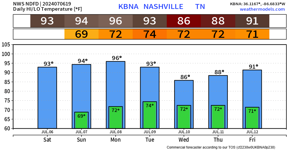
High temps still in the low 90s today and Sunday, but will be somewhat tolerable thanks to dewpoints in the mid 60s.
70°+ dewps return Monday, along with rain chances, most likely in the afternoon + evening.

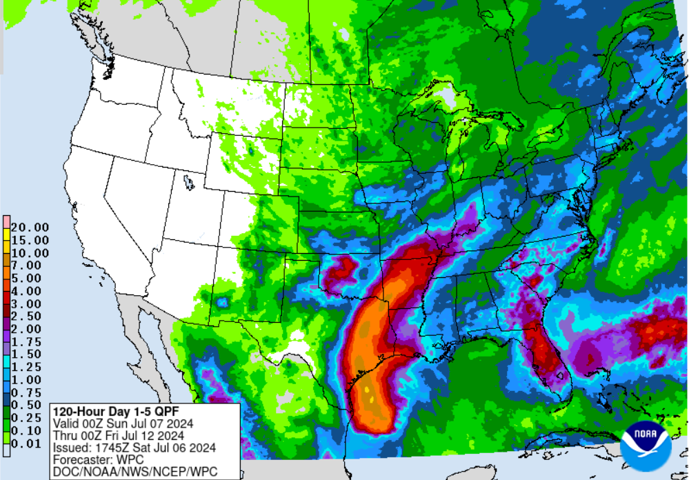
Tuesday and Wednesday may end up being our wettest days of the week, thanks to some influence from Beryl. Although, it likely won’t be named Beryl by the time it makes it our way.
No hazardous weather is expected for us. Currently, the heaviest rainfall is expected to stay to our west, leaving us with rainfall totals somewhere in the one to three inches range. Nothing we can’t handle, and we could use the rain. Local grass and gardens rejoice.
Lower rain chances stick around Thursday and beyond. Temps will also be a tad “cooler”.
Categories: Featured Blog