


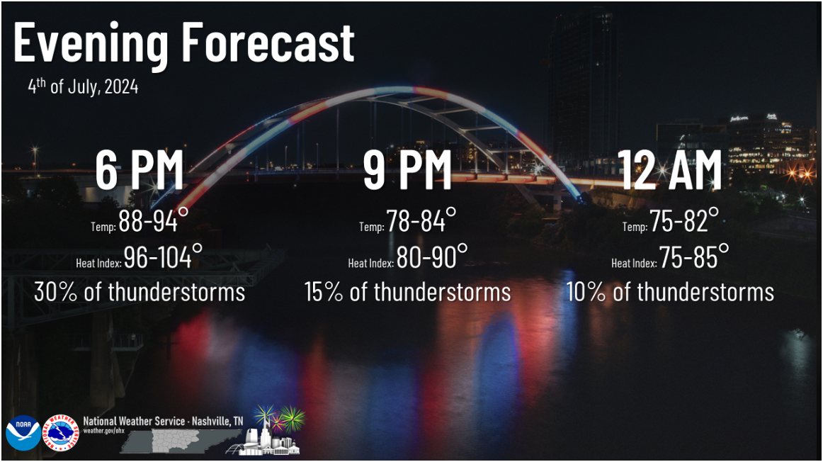
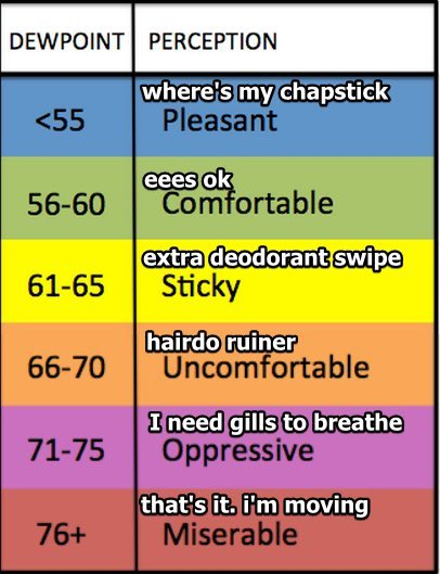
Bad humid today and tonight. Dewpoints in the low 70s.
Isolated pop up storm possible mid/late afternoon. In a random, mysterious spot.
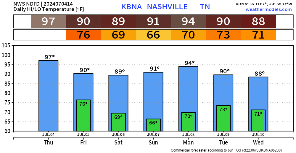
High today 97° + high dews = 104° max heat index. Heat Advisory in effect. Dewpoints will drop Friday night into the weekend. Still humid. Just not as bad as today.
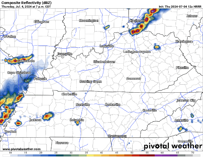
Slightly nervy about fireworks because the HRRR is popping up a few local rainers 7 PM – 10 PM. Rain, lightning, nothing else. We’re probably OK! Be good scouts and be prepared.
Light winds and a temp inversion may trap firework smoke, creating a hazy scene similar to the scene depicting F.S. Key writing the SSB.
Forecasts and fireworks won’t replace your eye, ear, finger, or brain.
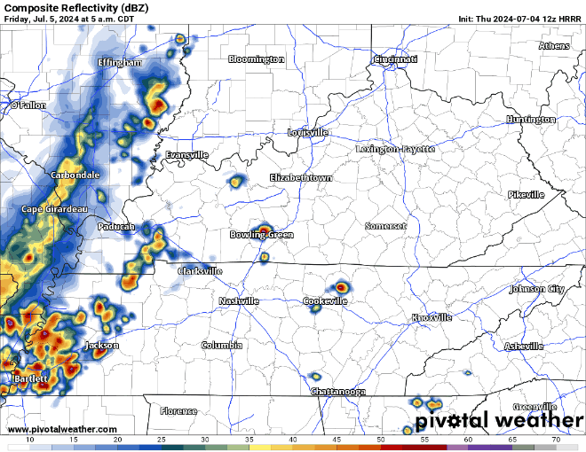
Friday morning storm complex should pass mostly south of us. Thankful for the rain. Not worried about severe. HRRR model below:
Rain chances return late Monday into next week.
Getting Beryl related questions like “will it come here?” It’s too far away for any forecast. No way it would be “Beryl” by the time it got here, if it got here, which right now looks unlikely.
 Log In To Facebook To Comment