
The heat and humidity has return and will stick around for a few days. Heat index values will be around the century mark today.
Tomorrow the heat and dewpoint combo will turn up just a bit further, sending heat index values past Heat Advisory criteria.
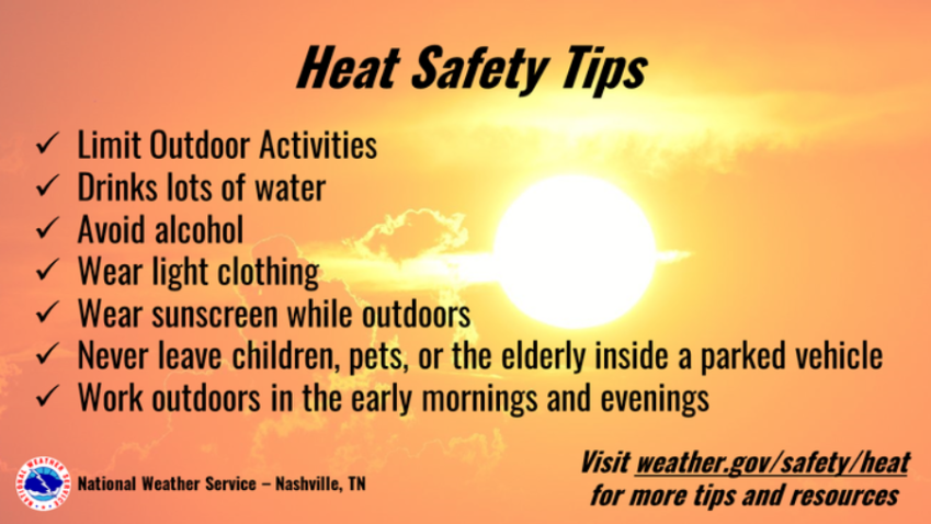
From 1p – 7p, heat index values up to 110° will be possible. If you must be outside, be sure to take plenty of breaks and drink plenty of water. Check in on friends + family who may not have access to A/C.
Good (?) news is that we could see some scattered showers/storms to help take the edge off the temps.
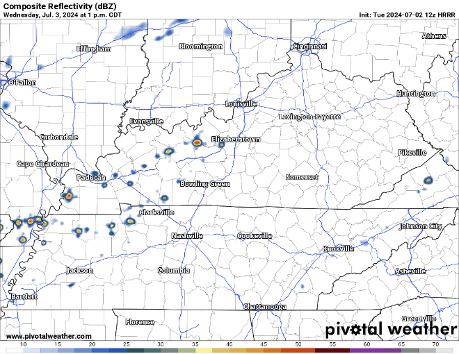
HRRR shows a good bit of showers/storms across our area. Not sure if there will be this much coverage, but good signs for those who are looking to beat the heat. A storm or two could be strong, but widespread severe weather is not expected.
The heat + dewp combo will stay for the 4th of July, and another Heat Advisory may be needed.
We will yet again have scattered showers/lightningstorms to dodge. Most likely timing will be afternoon/early evening, with diminishing coverage as we head towards sunset/firework time. I doubt everyone will see rain, but those that do could see some heavy rain, lightning and some gusty winds. Will be a good idea to have an indoor place to take shelter if out BBQing or swimming.
Friday looks like our rainiest day as a cold front pushes thru our area. Timing still a bit fuzzy. At least the rain will keep the temps down a bit?
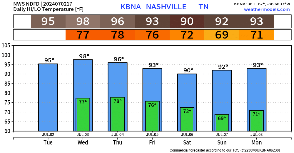
Saturday afternoon thru Sunday appear to be dry, before rain chances return at the beginning of next week. High temps in the 90s as far as the eye can see.
Categories: Featured Blog