
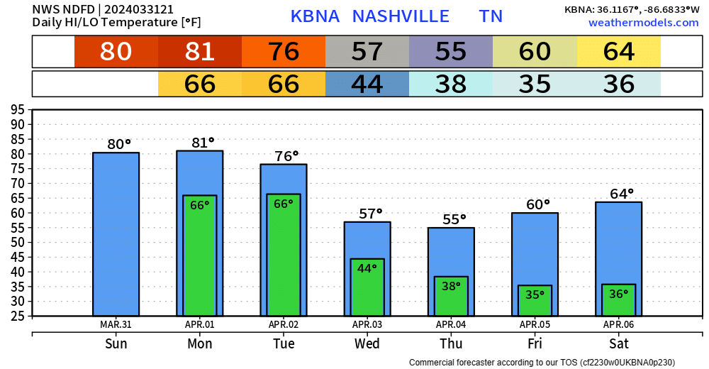
Very nice Easter day going on.
Monday will be another warm and probably dry day. Overnight Monday we could see a few showers/storms, but the majority of the activity should stay to our north.
Our main focus continues to be the threat of severe weather Tuesday.

Both our counties are outlooked with a 15% chance of severe weather within 25 miles.
Confidence is growing that our environment will be supportive of severe weather.
It appears we will have sufficient moisture and CAPE (storm fuel), but a few other factors, such as wind shear, are still in question.
Timing:
We are still too far out to get into specifics, but a rough and subject to change timeframe right now appears to be 1 – 8pm Tuesday.
“Storm modes may be a mix bag of clusters, supercells, or line segments.” – NWS Nashville
The isolated nature of the storms means everyone might not see severe weather, or even rain.
The severe threat should end shortly after sunset Tuesday.
Hazards:
The SPC does not release probabilities for each hazard until tomorrow, but right now it appears that all hazards, damaging-winds, hail, and tornadoes will be possible.
Right now, the greatest chances of severe weather are to our north in Kentucky, but this could change. This also doesn’t mean we are in the clear.
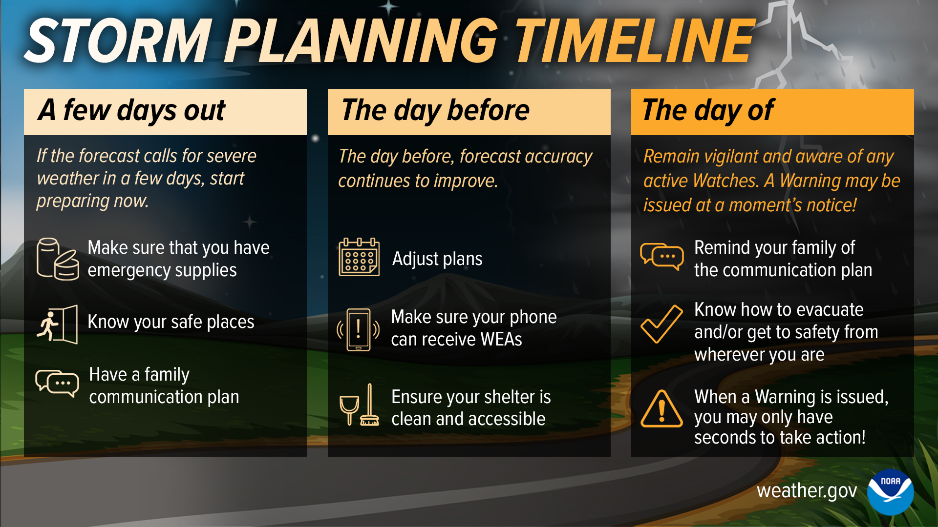
How to Prepare:
No need to panic, but a great time to stay informed and be[come] prepared.
You may know there is a threat for severe weather Tuesday, but does your family? Friends? Neighbors? It may not be the coolest conversation starter, but it could be an important one.
Have a severe weather plan, even if you don’t experience severe weather Tuesday, we’re entering our peak severe season, it won’t hurt to have one for the future. Know the difference between a Watch and a Warning and know where to go if a Tornado Warning is issued for you.
Be able to pinpoint your house/school/work on a map!
Continue to stay informed and check back for updates. We’ll be posting updates frequently over the next couple days.
Wednesday thru the rest of the week looks dry and a lot cooler. More frost/freeze opportunities towards the end of the week.
Categories: Featured Blog