

My anxiety level rising for Thursday night. What looked like a meh line incoming is now in range of convective allowing models like the HRRR. Those models show strong/severe storms arriving late night Thursday or the wee hours Friday AM.
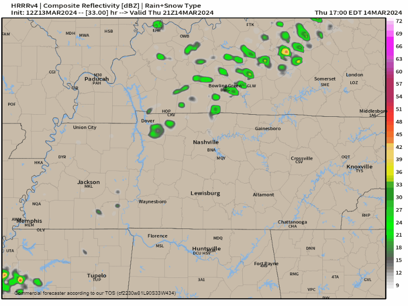
That’s the 12z HRRR model above: line arriving around midnight (timing may change) late Thursday night into Friday morning. Data shows storm-making ingredients aplenty:
✅ Lift.
✅ Sufficient moisture, dewpoints low/mid 60s.
✅ CAPE over 1000 j/kg.
✅ curved hodographs with severe-sufficient shear.
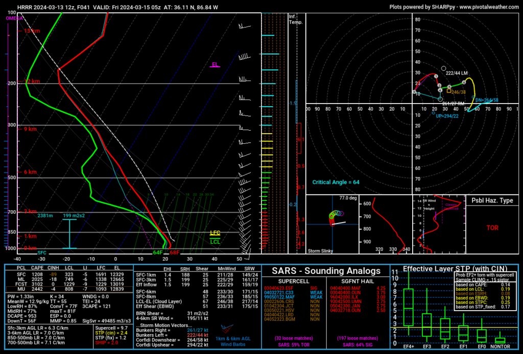
Previous model runs showed way less SBCAPE (that’s good!) and a surface inversion (also good!). But now that’s changing. SBCAPEs in other models are running 400+ (enough to make bad storms). Add HRRR as the high-end outlier with SBCAPE 1,200 j/kg, and this has my full attention now. Especially since the HRRR removes the surface inversion right as the line arrives. And the HRRR is often the first to catch on to the truth, fast.
Hazards include heavy rain, lightning, straight line winds, hail, and tornado.
This recent model data shift toward worse storms is not itself cause for alarm. But it has raised my anxiety a little. If the shift becomes a trend, we could be in for a long night Thursday night into Friday morning. Expect another long form blog tonight.
👉🏽 To Do: review your tornado safety terms and have shelter plans. Prepare. Plan to be near shelter tomorrow night. If this event doesn’t materialize (knock on wood), there will likely be another one this spring. Prep time won’t be wasted.
More tonight.
Categories: Tweet