
We got some decent rainfall today, enough for a good soak, but escaped any flooding worries thankfully.
We’ll continue the trend of receiving manageable rain tomorrow, but with a very low-end chance of a strong storm with some damaging straight-line winds.
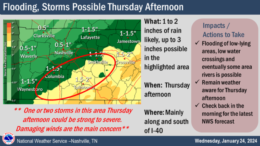
0.5 – 1.5″ of additional rainfall is possible tomorrow, we should be able to handle that just fine. If caught under a thunderstorm, a few places could see a little more than that.
NWS Nashville has circled the area (red circle above) in which they think one or two strong storms could be possible with some damaging wind threat. Although a majority of that area is to our south and east.
Timing:
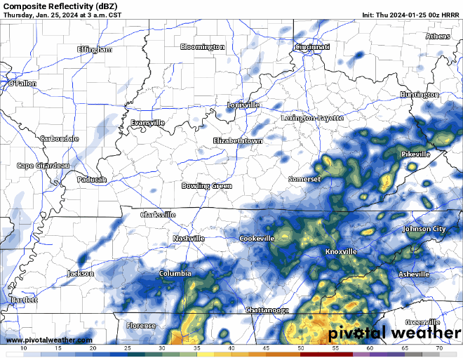
The HRRR model (above) shows some showers arriving during the AM commute, a break, then more rain around lunchtime. The rain around lunchtime would be the time we could see some thunderstorms, and potentially some gusty winds. Technically we are not outlooked for any severe weather right now, but worth keeping an eye on.
Maybe one more shot at some light showers Thursday around sunset.
Friday looks dry, more rain moves in Saturday, rain totals look around 0.5 – 1″ right now. Not worried about any severe weather currently but could rainout some outdoor plans during the day.
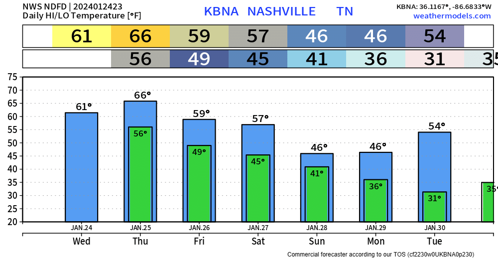
Although it was a wet day, we did manage to get up to 61° today, which felt great. We’ll stay on the mild side throughout the remainder of the work week.
Quick References:
Weather changes constantly.
Follow @NashSevereWx on Twitter for any changes to this forecast.
Live coverage during tornado and severe thunderstorm warnings:

Look good.
Support the mission.

We are 100% community supported. No ads. No subscription fees. Keep it free for everyone.


Categories: Forecast Blogs (Legacy)
You must be logged in to post a comment.