Some showers currently moving thru, these should be quick and of little consequence. The big blob of scary, rain-out looking rain to our west, the HRRR model (below) expects it to fizzle out and become a distant memory of the past, except maybe some showers. Best chance for some showers would be early-afternoon, if you see any at all.
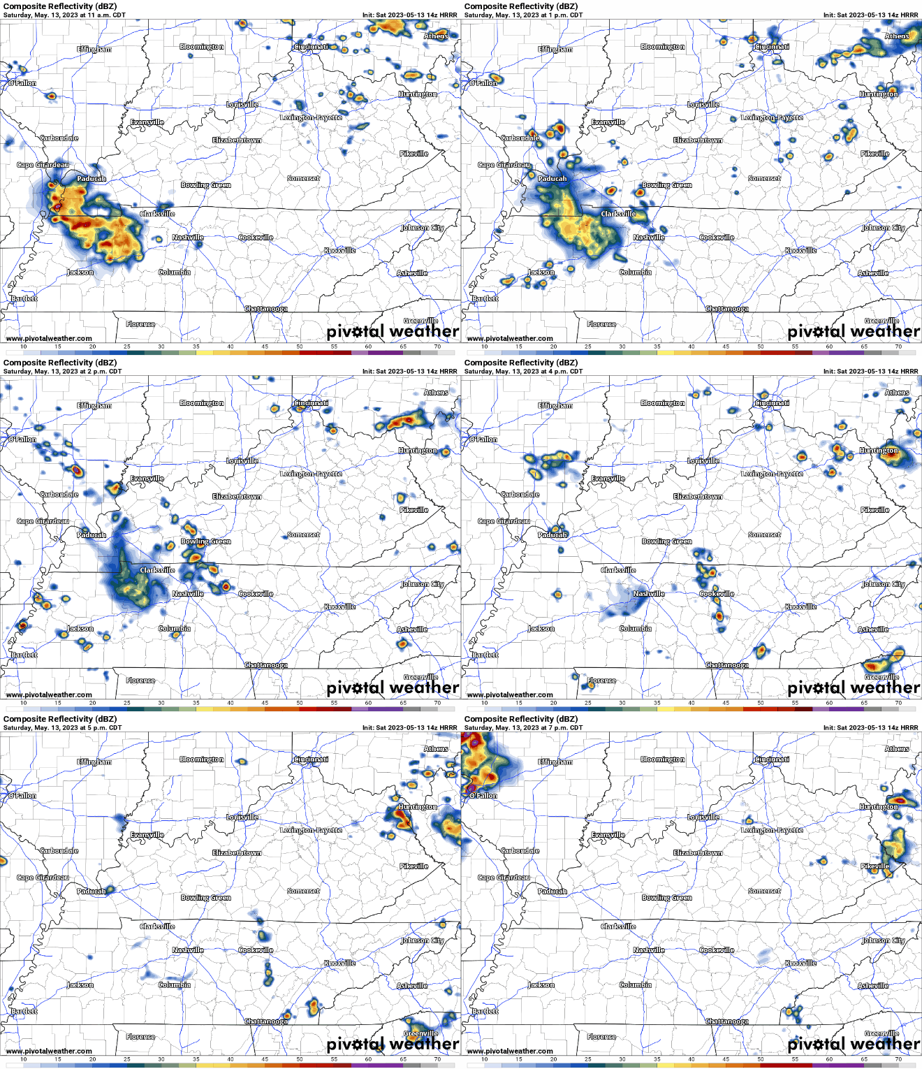
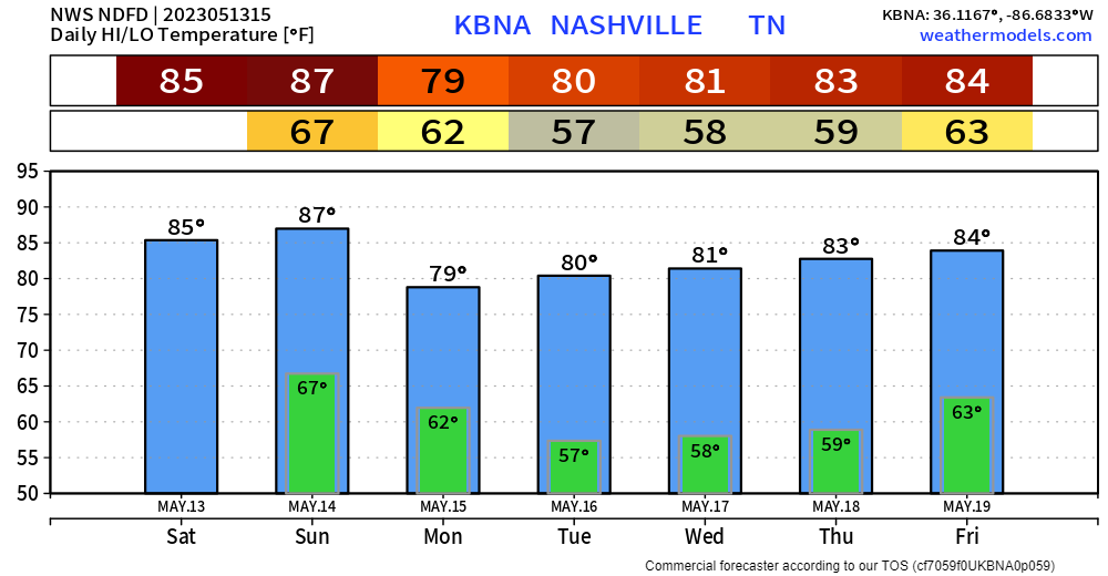
In fact, those two chances of rain talked about yesterday – it now just looks like this is it. The rest of your Saturday looks a-okay. Hopefully the sun can show itself later, but regardless it’ll still be warm today, with the heat index reaching to near 90°.
The weather looks to cooperate for the most part for Mother’s Day. It knows not to mess with moms.
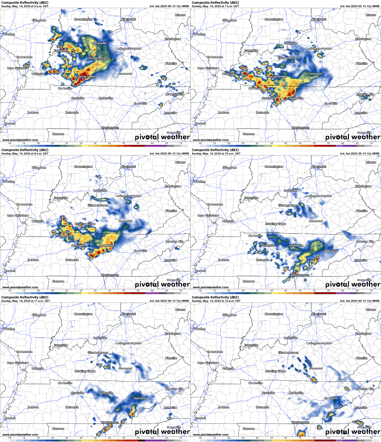
The HRRR model (above) shows some showers, maybe a storm, pushing thru during the morning. The other chance of rain would be evening, when maybeee a pop-up shower/storm would move through quickly, but you have a better chance of staying dry than seeing anything. High temps will be warm, nearing 90°.
Monday afternoon will have Wattery chances. Tuesday – Thursday look nice and should be dry for the most part. Hopefully you can look like this.

Quick References:
Weather changes constantly.
Follow @NashSevereWx on Twitter for any changes to this forecast.
We are 100% community supported. No ads. No subscription fees. Keep it free for everyone.
Categories: Forecast Blogs (Legacy)




You must be logged in to post a comment.