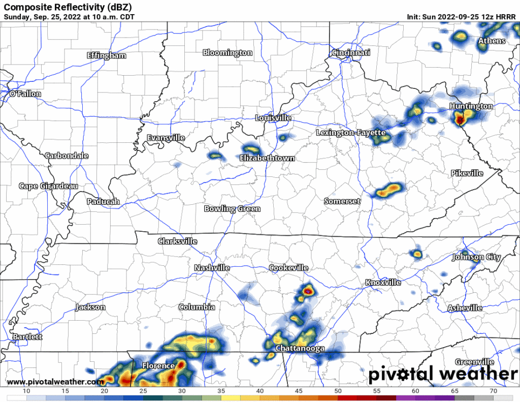
Rain today should miss us.
South and east of us according to the HRRR model 👇🏽.

No promises but activities today look good.
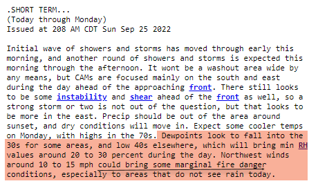
Maybe don’t burn things tomorrow.
Where the ground is dry, when relative humidity drops, and where wind is picking up, you should not burn things. Fire loves dry ground, winds, and low relative humidity. This will be Monday, which “could bring some marginal fire danger.”

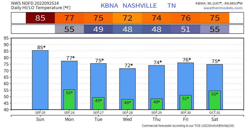
After that, well, nothing?

For most of the week anyway.
The cooler temps you ordered will be delivered Monday.

Will Ian Rain On Us Next Weekend? IDK
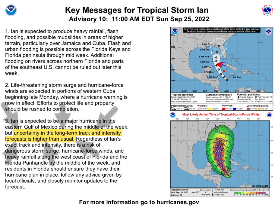
Science Nerds with their Science Computers right now think Ian will be a Florida Gulf Coast landfalling hurricane.
Uncertainty is always present with hurricane forecasting several days away. Ian’s forecast has more uncertainty than usual.

Srsly tho. All the models bring Ian into the Gulf of Mexico. Once it gets there, the models are all:

The latest trend has been to send Ian further west in the Gulf. That would put Ian’s remnants into Middle Tennessee as a weakened, early weekend, rainmaker. We probably need the rain. You may not want it, tho, because you like fun.
An eastern track will steer Ian’s remnants /checks notes/ yeah east of us. Missing us.
(I trust you to handle the phrase “Ian’s remnants” strictly scientifically as intended, please don’t land in our replies with your jokes. We can handle this like adults. It is our duty.)
This weakened, early weekend Ian’s remnants forecast is … informed, low reliability speculation.
Models could just as easily move the track further east, and out of the mid state, or keep some intensity to the closed low, so a lot of uncertainty still remains.
NWS-Nashville, 9/25/22, AM Forecast Discussion
Quick References:
Weather changes constantly.
Follow @NashSevereWx on Twitter for any changes to this forecast.
We are 100% community supported. No ads. No subscription fees. Keep it free for everyone.


 Log In To Facebook To Comment