


Our counties are currently under a Winter Storm Warning (in effect until 8pm tonight). According to the NWS:
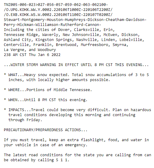
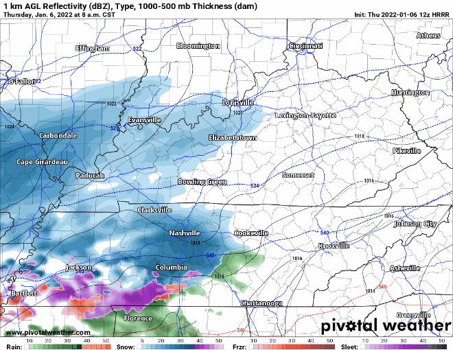
Can expect 3 to 5+ inches of accumulation… higher amounts could be seen locally. Let it be known that this is an all snow event. None of the freezing rain/sleet. Seeing pretty quick accumulation from flurries already.
Please do not travel. We know some major roads are completely impassable, and the detours aren’t in any better condition. If you absolutely have to travel, take a winter weather kit with you with warm clothes, blankets, food/water. We’ve been through this kind of thing before, and you can find yourself in a jam in a hurry.
Most of the snow flurries/showers will be out around dinnertime tonight:
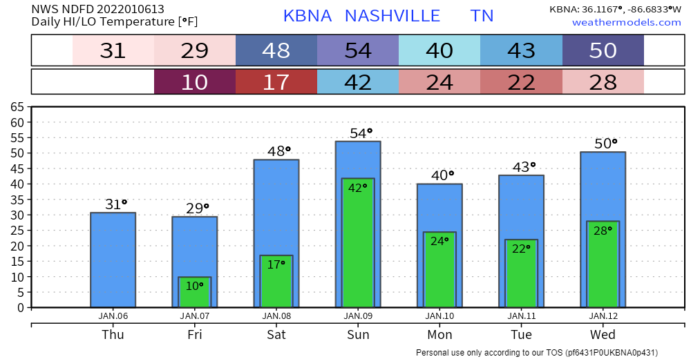
The COLD
Aside from the snow, low temperatures tonight into tomorrow morning will be dangerously cold. The current low is forecast to be 11° with some single digits around. This will make snow removal/road melting extremely difficult. Protect vulnerable pipes. Take precautions for animals. If you have a heat pump for your HVAC, check the outside unit and make sure it’s not sucking in a bunch of snow/ice and getting clogged up. Be careful walking outside. Check on vulnerable people near you.
Looking Ahead
Snow should start to melt off Saturday afternoon AKA the beginning of a warming trend. Highs around 50 should do the trick. Quick turnaround to the next weather maker. Possibility for widespread showers and maybe a thunderstorm or two Saturday night into Sunday.
Quick References:
Weather changes constantly.
Follow @NashSevereWx on Twitter for any changes to this forecast.
Live coverage during tornado and severe thunderstorm warnings:
Look good.
Support the mission.
We are 100% community supported. No ads. No subscription fees. Keep it free for everyone.
 Log In To Facebook To Comment