


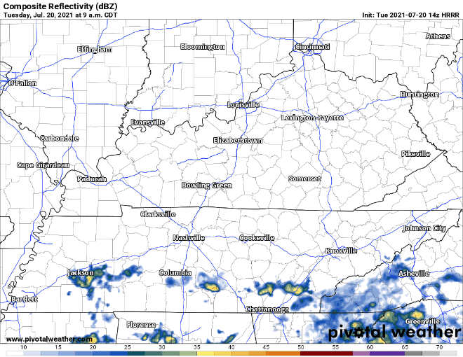
Rain continues south of us today. We may see an upper level low spin a few showers in here this afternoon along and south of I-40. Nothing like yesterday, though. Here’s the HRRR model:
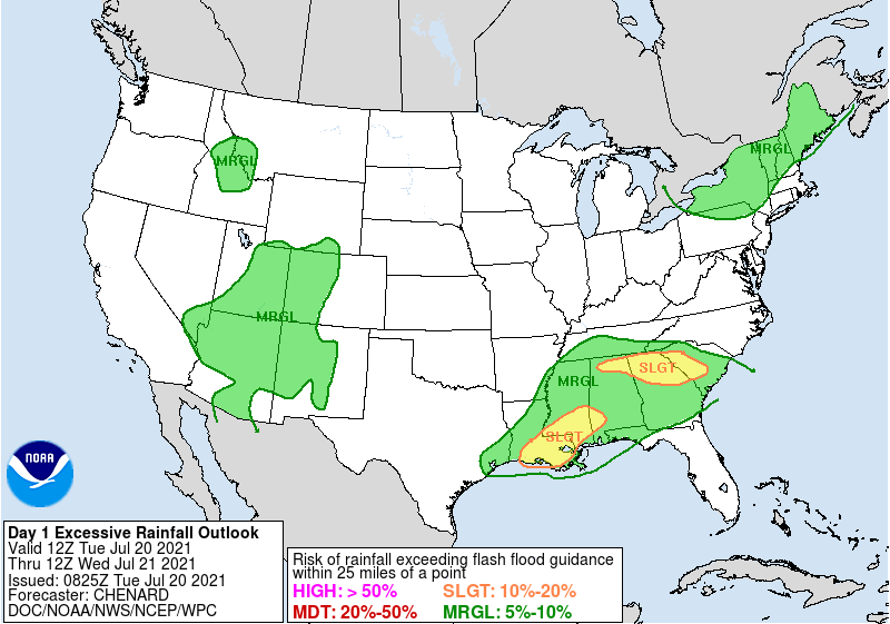
Our soil is saturated so WPC included those generally along and south I-40 in it’s 5% to 10% probability of flash flooding. Meh, but something to watch.
Alright when is this rain going to go?
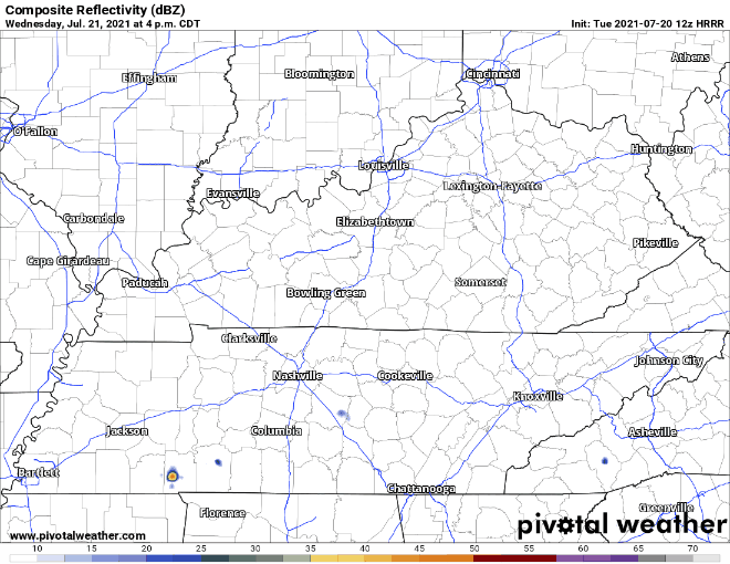
Wednesday is the beginning of the end. HRRR shows isolated showers and storms stick around our area late afternoon to evening and then don’t bother us again. Again, the majority of the rain Wednesday stays south of I-40. Still prepare for quick downpours and lightning, but Wednesday looks way more dry than what we have been experiencing, woohoo!
Thursday looks fairly dry and similar to Wednesday with few scattered showers.
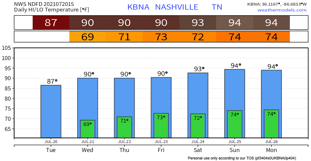
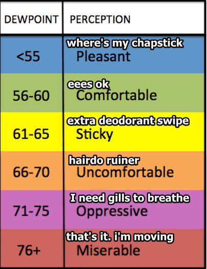
Get ready to sweat. Wednesday high temps rise to the low 90’s. They’ll stay there at least through the weekend. Dew points also rise back into the low 70’s sticking around for the beginning of next week. This will not be fun.
Thunderstorms popping up randomly each afternoon — beginning Wednesday — will continue through the weekend. It’s a storm lottery with lightning and maybe gusty winds. These are not tornadomakers.
 Log In To Facebook To Comment