
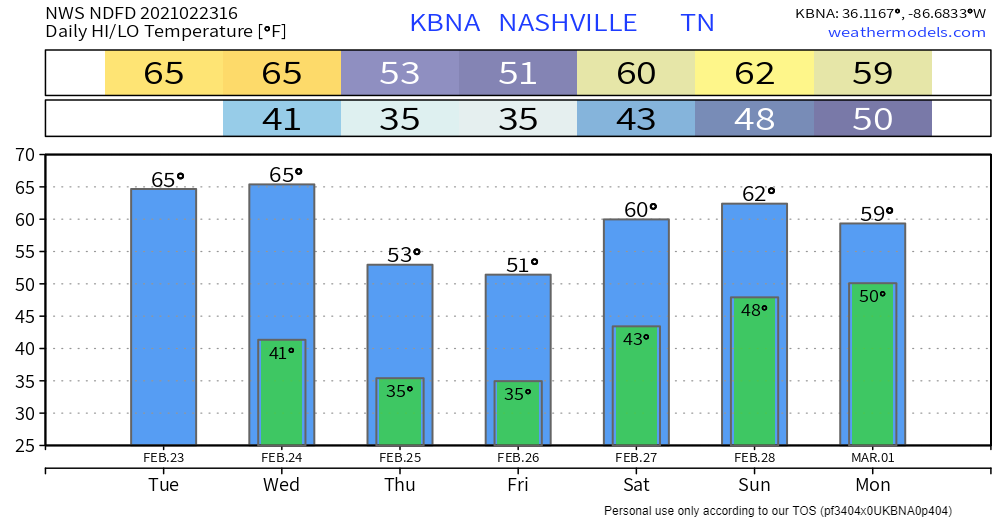
Still have snow in your yard? Yeah. It’ll be gone today or tomorrow.
NWS Area Forecast Discussion
Sunshine and warmer temps?

Highs the next couple days will be 10° above average.
Showers Wednesday Night
The HRRR has showers beginning to come through the area around 9 PM. They should be out of the area before daybreak Thursday, giving way to more sunshine Thursday afternoon.
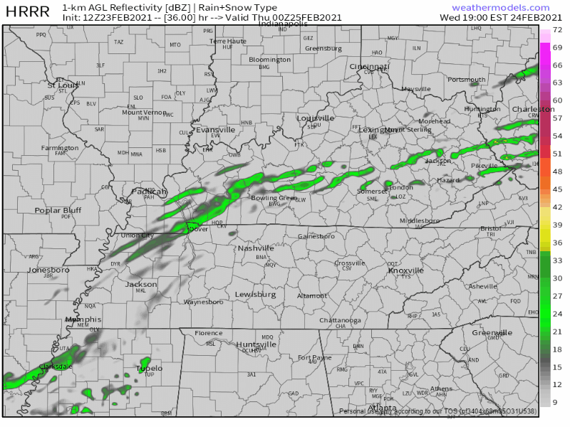
This is very little rain. Meh.
Heavier Rain Off & On This Weekend
It’ll come in waves. Exact ETAs remain iffy due to poor model resolution. Two ideas put forth by global models from the GFS and Euro:
The Euro model has rain in the morning Friday, gone by noon. Then a second wave early Saturday morning. Then rain shifts off and on through Tuesday night.
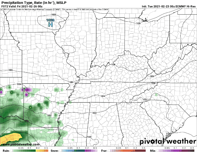
The GFS model has rain staying to our south Friday, then the first wave coming through at around 3 am Saturday until noon. The second wave begins Sunday morning and turns off and on until it’s gone Monday morning.
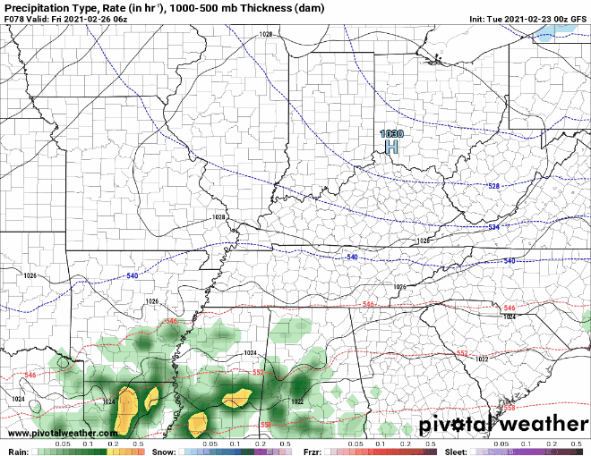
This does look to be a pretty big rain maker.
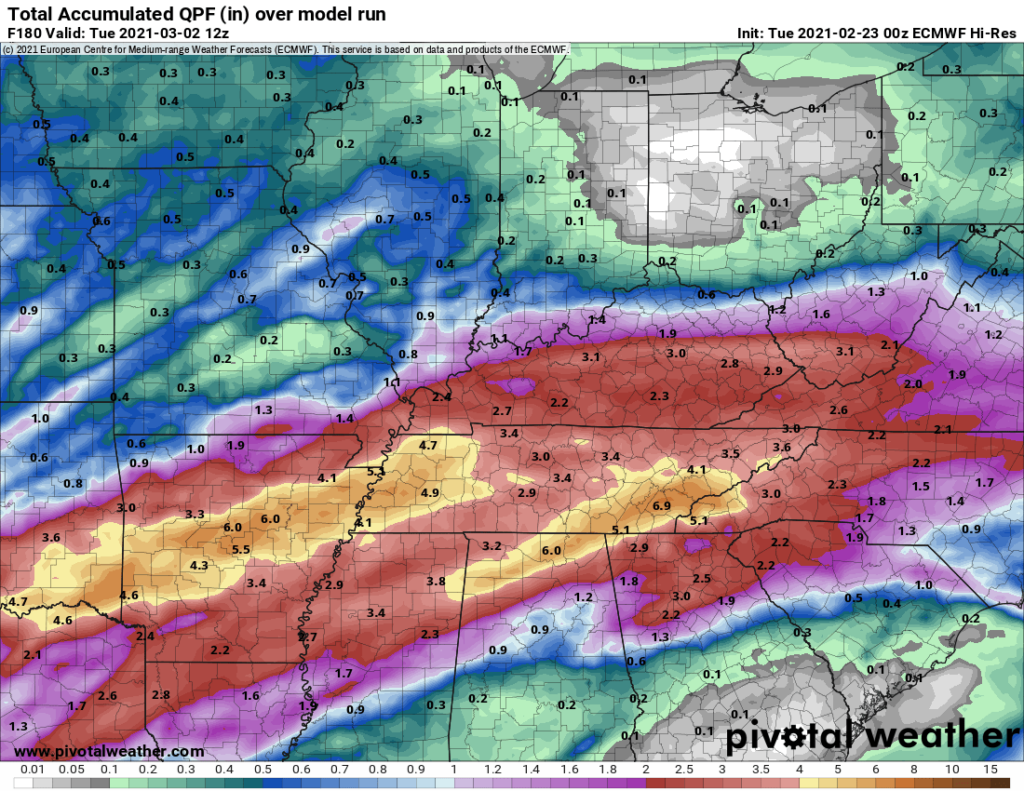
Between now and 6 am Tuesday, the Euro model predicts 3 inches total.
For the same time frame, the GFS predicts around an inch and a half.
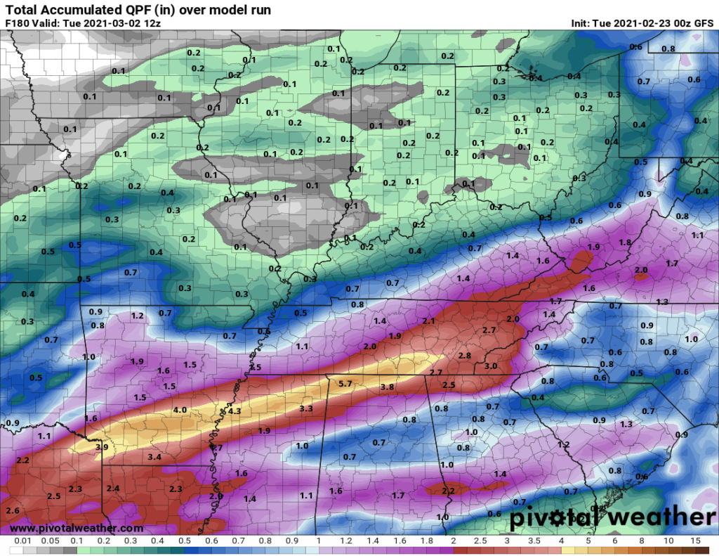
There could be locally higher amounts. The heaviest rain will set up along a stationary front, so a narrow area will stretch east to west somewhere across our region. Models are sure that narrow heavy rain area will develop, but they don’t know exactly where. Flooding is possible, but with rain turning on and off, there should be enough drain time to keep impacts down (or non-existent).
This event is still several days out. This will be something to watch in the coming days.
Categories: Forecast Blogs (Legacy)
You must be logged in to post a comment.