
Let’s Start With Something Important…
Clean off your car.
It’ll only take a few minutes to do:
And keep windshields from looking like this:
Sunshine Returns
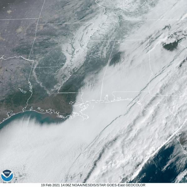
The GOES-East satellite still shows some snow cover this morning.
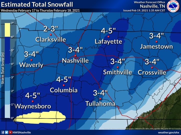
The National Weather Service estimates 3 to 4 inches of snow fell between Wednesday and Thursday.
We’re finally gonna see some sunshine today, but temps will still be around freezing. What does this mean for the remaining snow and ice?
The sun will help start the melting process throughout the day. However, snow has a high albedo, or it is very reflective. Once sunlight hits the snow, it will be reflected right back at you.
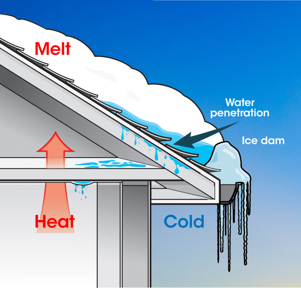
You may have noticed some icicles hanging from your roof. Although these are pretty to look at, they could signal an ice dam. This is a layer of ice that will keep melting snow from draining off of the roof. There are a couple ways to get rid of these ice dams, such as raking off the snow or throwing socks filled with calcium chloride on the roof to melt some of the ice.
Another hard freeze will come overnight. This will cause any snow that melted to refreeze. Look out for some more black ice Saturday morning.
Calmer Forecast Ahead
Temps will warm up Saturday, which will really kickoff the melting process.
A couple showers are possible overnight Sunday into Monday morning, but it doesn’t look to be a washout event. Around a quarter of an inch is currently expected.
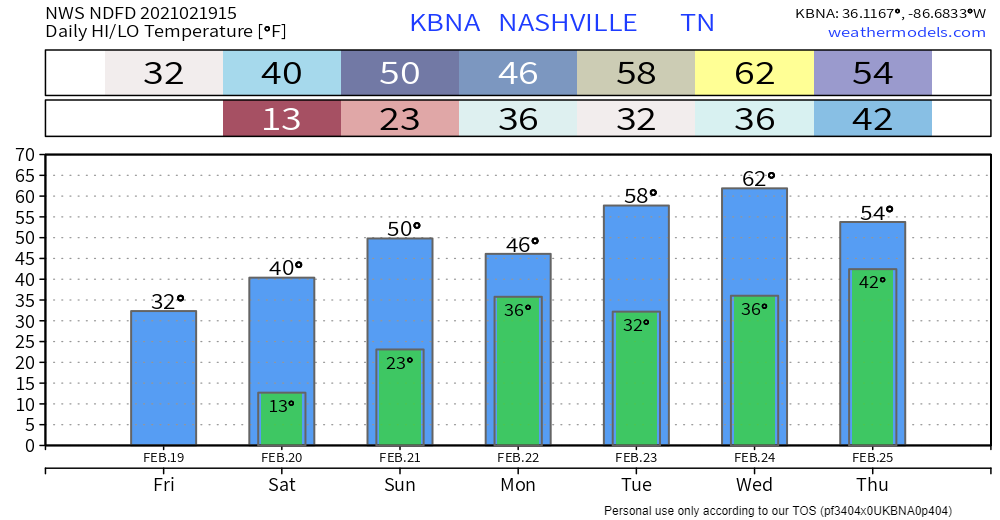
A warming trend will start to take place next week, with temps even getting into the lower 60s by Wednesday.

Categories: Forecast Blogs (Legacy)
You must be logged in to post a comment.