
Clouds moved in overnight and will continue to hang out through the afternoon.
The HRRR shows rain beginning around 9 pm. The bulk of the rain should be out of the area by 4 am, but there could be a few showers lingering through 6 am. Around a half of an inch of rain is possible.
The big question: will it snow?

Right now, models are still in disagreement. The HRRR (above) shows primarily cold rain for us with snow to our north, south, and east. With this model, those lingering showers Sunday morning seem to be our best bet at seeing any winter precip.
The Euro model, on the other hand, shows some mixed precip possibly transitioning into snow around midnight.
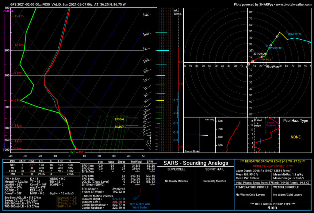
The GFS model gives a little more hope for snow lovers. It shows the chance of some snow showers around midnight.
The biggest factor will be temps.
This will be another event where a few degrees up or down will be a huge difference not only on what type of precip gets to the surface, but if snow will stick.
NWS Forecast Discussion
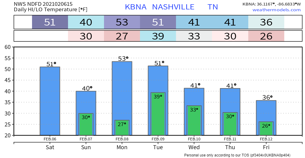
Temps may be cold enough aloft for frozen precip to form, but they look to be too warm for anything to stick. At midnight, a sounding from the GFS model has surface temps around 40°.
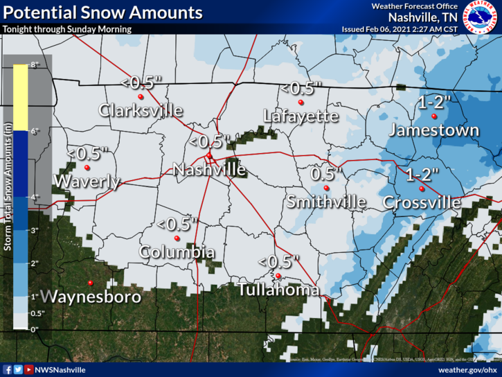
If frozen precip does form and the surface temps get low enough, we will see little accumulation. The National Weather Service predicts we’ll see less than half of an inch of snow.
Looking Ahead
We’ll dry out Sunday and Monday before several systems are expected to come through.
The first system will come through Tuesday, which could bring some rain.
The next system will come through Wednesday. We should just see some rain during the afternoon, but as temps begin to drop overnight, we could see a transition into snow.
The last system will move through Thursday. Right now it looks like a cold front will also move through Thursday night, which could give us our best chance at some accumulating snow.

These events are still several days out so models could quickly change.
Categories: Forecast Blogs (Legacy)
You must be logged in to post a comment.