
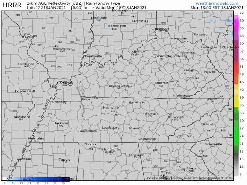
Rain overnight tonight should stay to our north and south. But we can’t rule out a couple sprinkles falling in your backyard. HRRR model shows snow north, rain south, we’re in the middle.
Models Disagree About Wednesday Night – Friday
Another system is coming but models disagree exactly when.
The Euro model shows a couple rounds of rain between Wednesday night and Friday afternoon. The first round starting between 6 pm and midnight on Wednesday, ending by noon Thursday. The second round starts late morning or early afternoon hours Friday, then gone around 6 pm.
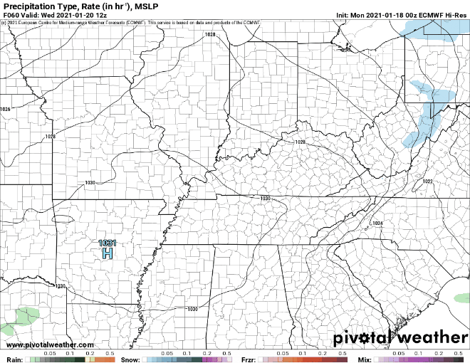
That’s “if” the Euro is “right.”
The GFS model, on the other hand, shows rain beginning at around 3 am Thursday and clearing the area by 9 pm.
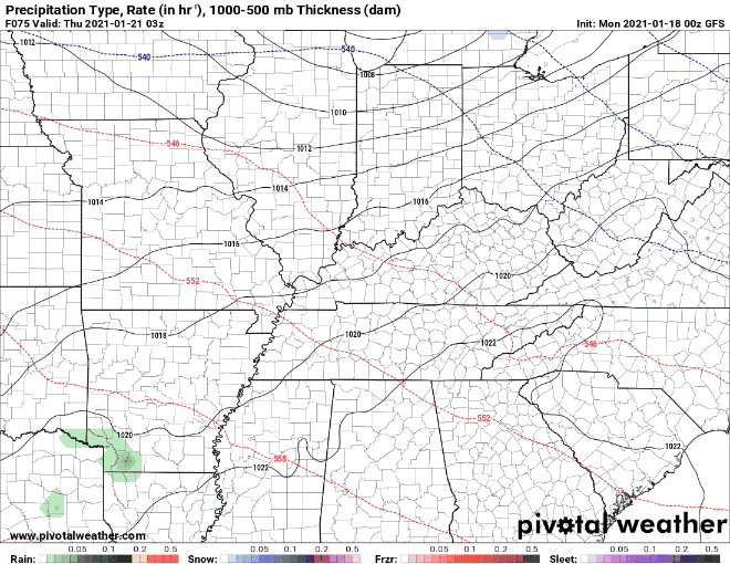
Both models have most of the heavy rain staying to our south. Neither model expects a local washout, about a half inch of rain spread out over several hours.
Confidence is low in this forecast because of these model differences. Higher resolution models will come in range tonight to give us a better idea.
Sunday/Monday
We dry out Saturday. Another system incoming Sunday (?) could start as snow before switching to rain. That system may delay to Monday (models conflict), and …
Should this scenario pan out, our neck of the woods would likely see quite a warmup along with a does of heavy rain and possibly some thunderstorms.
NWS Area Forecast Discussion
Thunderstorms happen in the winter, so something (else) to watch.
Categories: Forecast Blogs (Legacy)
You must be logged in to post a comment.