
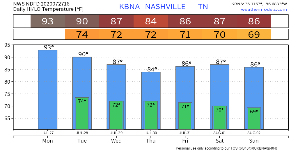
Monday
We’re still following that typical summertime pattern: hot and humid with some afternoon storms.
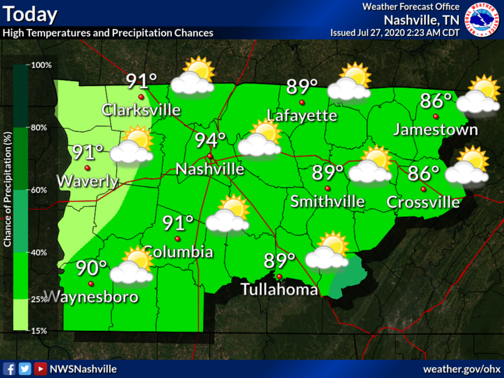
The dew point will reach around 73° today. This will help those heat index values to get up into the upper 90s and possibly even 100 in some areas.
That dew point will also continue to help spark those scattered afternoon storms.
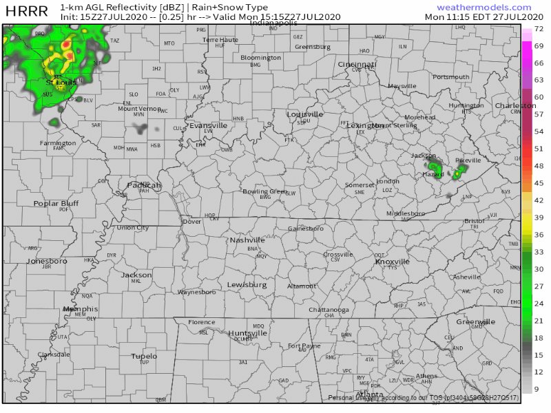
Developing storms should be leaving the area around midnight.
Even with the models, it’s still hard to pinpoint what locations will be impacted (if any). You may see some rain while your friend 15 minutes away doesn’t.
Severe weather is currently not forecast with these storms. If you are impacted, you could see some heavy rain, cloud-to-ground lightning, and some gusty winds. If you have outdoor plans this afternoon, keep an eye out on the radar!
Tuesday
A cold front will approach from the north, but likely not push all the way through the area on Tuesday. But, temps should back off a smidge due to increased cloud cover and rain.

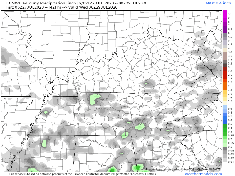
Rain chances will begin to increase throughout the day. Models are showing that we will be looking at some more scattered showers and storms. Some people may get wet while others stay dry.
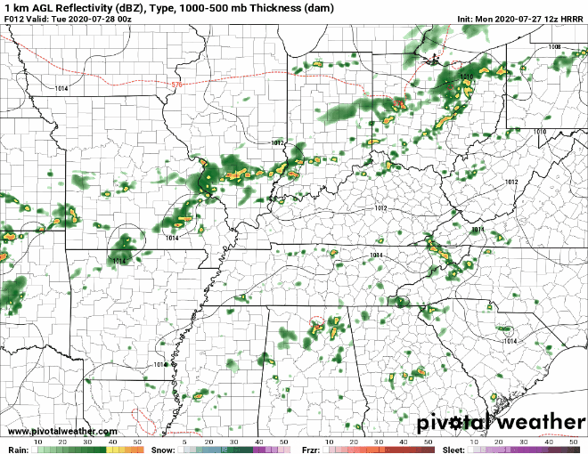
Severe storms are still not in forecast, but we could continue to see some heavy rain, CG (cloud-to-ground lightning, and gusty winds with some of the heavier storms.
Rain totals right now are anywhere from a tenth of an inch to a quarter of an inch for Tuesday. Areas impacted by heavier storms could have locally higher amounts.
Looking Ahead
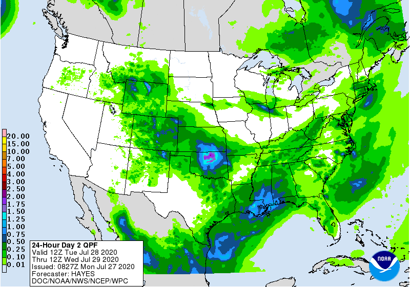
Showers and thunderstorms will become more organized throughout the week. Severe storms are not in forecast, but heavy rain is currently the big focus.
Through Saturday, the Weather Prediction Center is predicting anywhere from 3 to 4 inches of rain across Middle Tennessee. There could be some locally higher amounts for areas impacted by downpours from heavier storms.
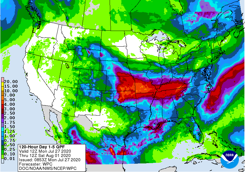
Avoid flooded roadways: turn around, don’t drown!
Because of the added cloud cover, we’ll be looking at some relief from those temps. Highs are looking to be in the mid to upper 80s.
Categories: Forecast Blogs (Legacy)
You must be logged in to post a comment.