
Friday
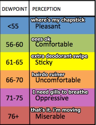
At 10 am, the heat index has already been recorded at 90° and the dew point at 72°.

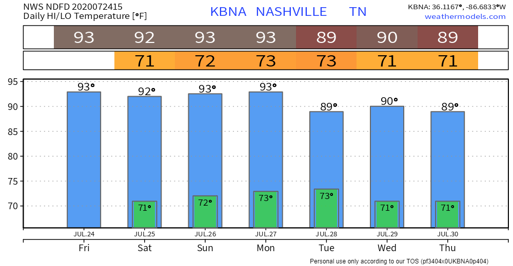
Heat index values will be in the upper 90s today, but some places could see some feel-like temps of 100.
The dew point will stay in the lower 70s today, which could help to spark some showers and storms.
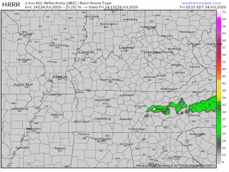
The HRRR shows storms beginning to develop around 2 pm, but should be out of the area before midnight. These will be much like the storms we’ve been seeing: lots of cloud to ground lightning, heavy rain, and some gusty winds.
Some people will get wet while others don’t see a drop. If you have plans this afternoon, make sure to keep an eye on the radar!
This Weekend
It will follow the same setup we’ve been seeing, just with some slightly lower storm chances.

Saturday we’re looking at heat index values in the mid to upper 90s, reaching around 97°.
Sunday will be much of the same, reaching as high as 99°.
Dew point values will remain in the lower 70s, making it feel super sticky outside.
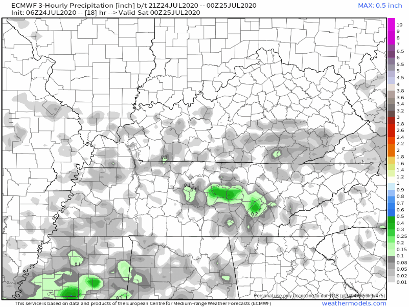
Although the storm chances are lower, they aren’t zero. The main time frame they will begin to form (if they do) will be anywhere from 2 pm to 8 pm. Although there’s currently no severe weather in the forecast, some of the more intense storms will continue to have cloud to ground lightning, heavy rain, and gusty winds.
These summertime storms are hard to pinpoint, even with these models. Keep up with the future forecasts if you have afternoon plans this weekend!
Looking Ahead
The heat is here to stay.

A system may be coming through the area on Tuesday, increasing our rain chances. It’s still far out, so models are having a hard time agreeing on timing and intensity.
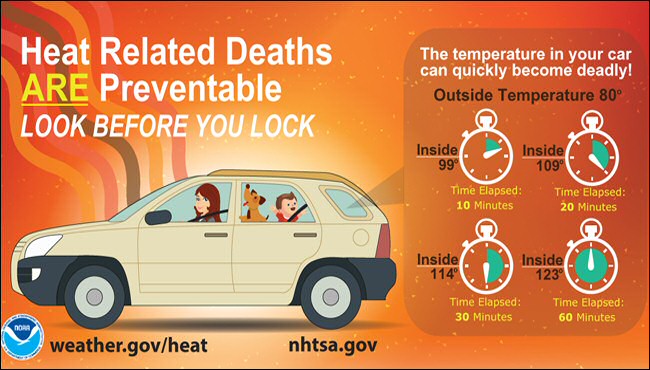
Heat Safety
The total amount of car deaths for the nation has risen to 11.
Make sure to do a double check of your backseat before getting out of the car. Don’t just leave your windows cracked – temps in the car will still rise very quickly.
Categories: Forecast Blogs (Legacy)
You must be logged in to post a comment.