


Partly Sunny Today, More Sunshine Tomorrow
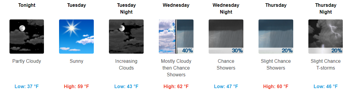
Today and tomorrow both look pretty fantastic for the middle of November. Today, expect more clouds than tomorrow.

Depending on how much clearing we have this afternoon, our temperatures may be a little warmer than expected. If we get more clearing this afternoon, expect highs in the upper-50s, if not, temps will likely stay around the mid-50s for our high.
Tomorrow, with the additional sunshine, expect temps to reach the upper-50s, maybe even topping off in the low-60s.
Showers Return Sometime Wednesday
After our brief few days of sunny skies, expect showers to return Wednesday afternoon into the evening. Models do vary by a few hours with exact timing, luckily it doesn’t appear like this will be a washout.
Some of these showers may linger into Thursday, but again it doesn’t look like a lot of accumulation is expected with this system.
Keeping an Eye on Friday Night/Saturday’s Cold Front
First of all, there is still a lot of model uncertainty by the end of this week. Both the Euro and GFS are showing a strong cold front moving through our area sometime Friday night into Saturday. Specific ETAs vary.
Severe-weather ingredients may be present, which is why the Storm Prediction Center has highlighted us as an area to watch.
Storm Prediction Center has “outlooked” us for severe storm potential Friday. It’s a pretty large area tho. Something to watch this week. pic.twitter.com/JfPTLS7xuH
— NashSevereWx (@NashSevereWx) November 13, 2017
Given all of the uncertainties between models, there really isn’t much helpful information we can say at this point other than it should be a wet day. We will continue to keep an eye on this system through the remainder of the week.


 Log In To Facebook To Comment