
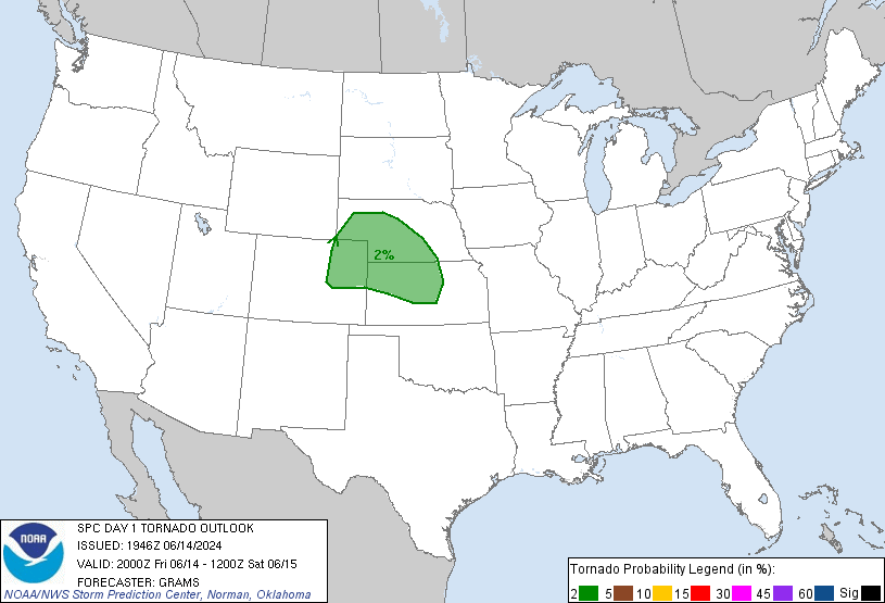
The 3 p.m. update from the Storm Prediction Center was largely unchanged for us. The probabilities of “x” happening within 25 miles of you today:
- Damaging Winds (58mph+): 30%
- Large Hail (1″+): 15%
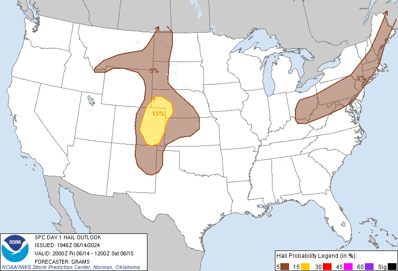
- Tornado: 2%:
Afternoon thunderstorms (previously advertised as “Round 1”) haven’t developed as predicted by weather models, likely due to a “cap” up in the atmosphere preventing a large amount of thunderstorm energy from being released. Also limiting afternoon thunderstorms has been some “mixing,” causing drier dewpoints to come on down . . .
. . . to the surface. At 7 a.m., our dewpoint was 71; by 3 p.m., it was 67.
This afternoon, our local NWS office wrote that a MCS (large thunderstorm cluster) should arrive in Middle Tennessee tonight. The most likely area to get these storms appears to be off to our north-east. The MCS looks unlikely to miss us completely, if only because Nashville is currently hosting an American Meteorological Association meeting, which always has some strong/severe event. God enjoys storming on the weather community.
Behold the models. Use for guidance, not Gospel:
The HRRR whacks us with the MCS at 11 p.m. tonight:

The RAP agrees (in low definition). 11 p.m.:
 Again, give these models some grace — they’ll vary by a few hours here or there. Use for guidance, not Gospel! Get a weather radio or wake-me-up app in case you have to go to bed early tonight, and consult all reliable weather sources. If you’re going to be outside when these storms arrive, don’t bother using an umbrella. The wind will destroy it. Wear rain gear.
These storms will also deliver a LOT of rain. I don’t recommend driving in it. Lightning should also be impressive.
Additional information and during-the-storm updates can be found on Twitter @NashSevereWx.
Categories: Forecast Blogs (Legacy)