


A couple of storms have popped up to our southwest as expected and will continue to throughout the evening. These storms could contain heavy rain, lightning, gusty winds and small hail.
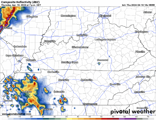
The HRRR model above advertises those evening storms coming from the SW, and then a line of weakening showers/storms coming thru in the early hours of Friday morning. Model guidance has been pretty consistent with thinking this line weakens a lot before it arrives, but still could contain some strong winds, small hail, and lightning. The tornado threat is very low, but it isn’t zero.
Stay connected this evening and tonight. If you have any outdoor plans this evening, be sure to have a way to get updates, especially if you see the sky getting dark. These storms will at least carry some heavy rain and a good bit of lightning, you do not want to be caught outside.
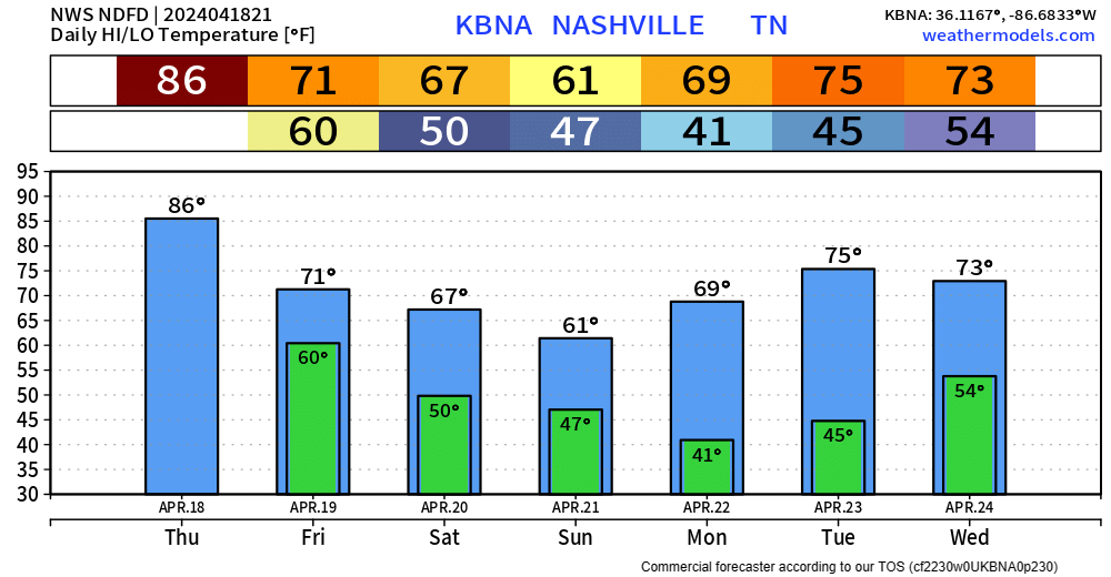
A few showers could be left over by sunrise Friday, but we should be left with a mostly dry day.
Saturday and Sunday carry low chances of some showers, but models currently think most of the activity stays to our south. Weekend outdoor events look okay for now, but this could change.
We’ll cool-down this weekend compared to the 80s from this week. Temps early next week warm right back up into the 70s.
 Log In To Facebook To Comment