


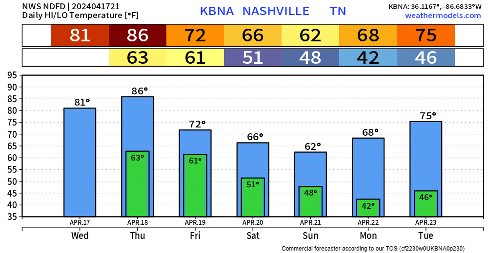
Another very warm day is in store Thursday, high temperature expected to end up around 86°. Record high at BNA is 88°, could get close to at least tying.
Thursday evening into the overnight hours, a line of storms with heavy rain, lightning and gusty winds are expected drop down I-24, therefore nicknamed an “I-24 Special”, although it is debatable if they are actually special.
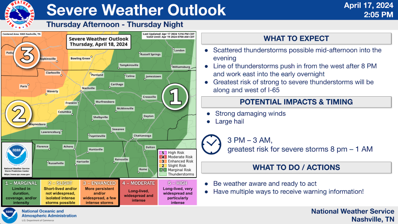
The Storm Prediction Center has the NW portion of Davidson + WillCo. in a 15% chance of damaging straight-line winds within 25 miles, while the rest of us are in a 5% chance of damaging straight-line winds within 25 miles. Try not to pay too much attention to exactly where the dividing line is, everyone has a low-end chance of seeing damaging straight-line winds. Hail is a possibility, but a lesser threat. The threat for tornadoes is expected to be confined to our NW, we are not included in any probabilities.
Timing wise, the HRRR model thinks isolated storms could form ahead of the main line around 8pm or so. The I-24 Special is not expected to arrive until after midnight.
Our main concern will be heavy rain, lightning, and a low probability of damaging straight-line winds. Deets may change between now and then, be sure to stay connected for any updates.
Good news is that most of the funny business should be gone by Friday sunrise, with only a few leftover showers by morning rush hour. Rest of Friday should be dry.
Some isolated showers cannot be ruled out Saturday and Sunday afternoon, but chances will be relatively low.
Temperatures this weekend will be noticeably cooler than what we’ve been dealing with this week.
 Log In To Facebook To Comment