
Observations


Located 2 miles north of the TN/KY border, this is the closest reliable road temperature sensor we have (all times Eastern):

Records


Severe Weather Outlooks

Today’s Probability of a Tornado within 25 miles of a point

Today’s Probability of a Damaging Wind Gust (58+ mph) within 25 miles of a point

Today’s Probability of Large Hail (1″) within 25 miles of a point


Tomorrow’s Convective (Severe Weather) Outlook from the Storm Prediction Center


Next 48 Hours
Temp
Dewpoint
Rain
Wind Chill
Wind Speed & Direction
Thunderstorms
Snow
Freezing Rain
Sleet
Fog
Sky Cover % (Cloudiness)
NOAA Regional Radar

Current Warnings Overlaid Atop Radar:


Current Severe Thunderstorm Watches and Tornado Watches
(a “watch” means conditions are favorable for the formation of severe thunderstorms and/or tornadoes)

Current Storm Prediction Center Severe (Convective) Weather Outlook (with National Radar)

GOES Water Vapor Imagery

GOES Visible Satellite

GOES Infrared Satellite

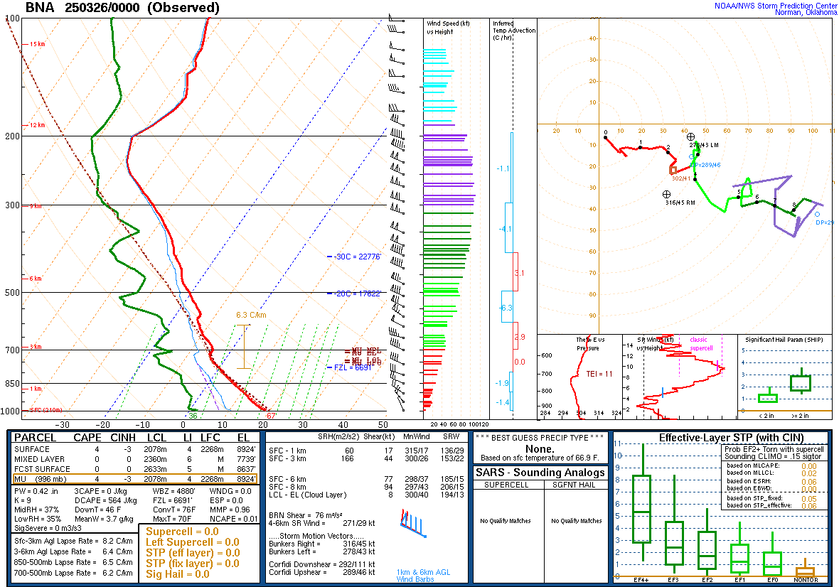
Latest Official BNA Sounding (OHX)
300 mb Analysis

500mb Analysis Winds/Pressure at 18,000 feet

700 mb Analysis

850 mb Analysis

925 mb Analysis:

Surface Analysis

(click here for pdf with warning criteria)