


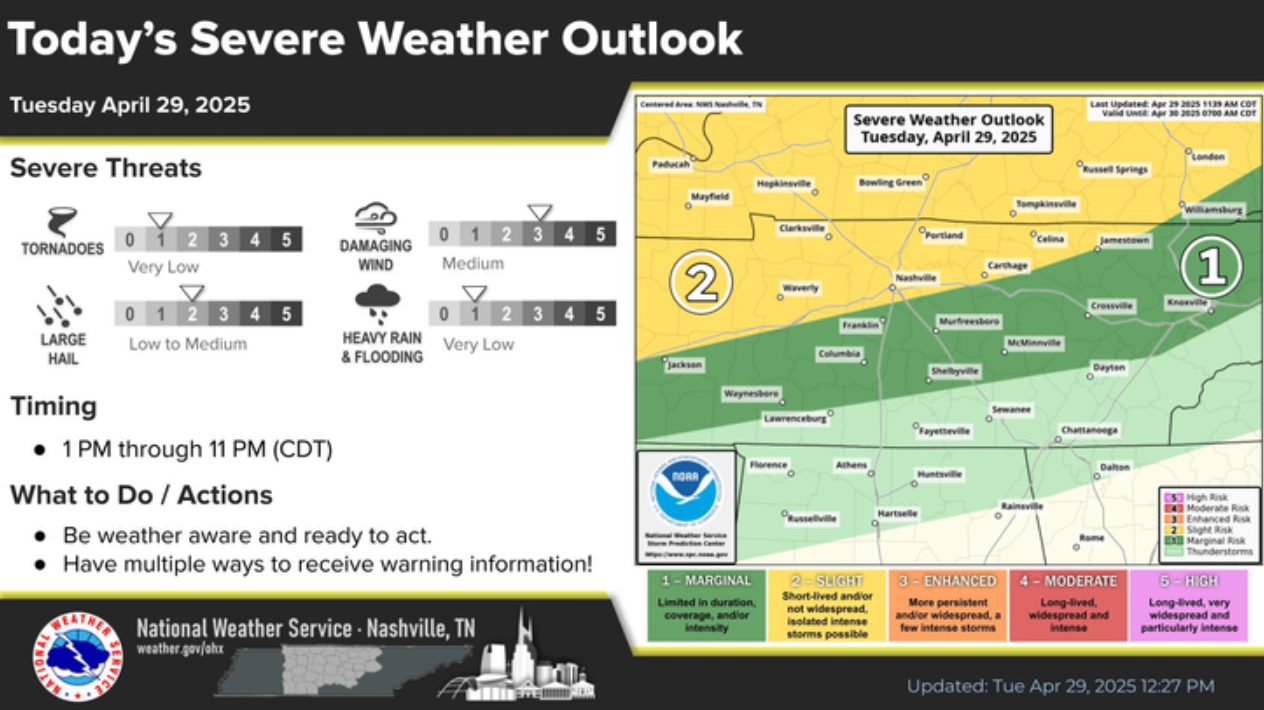
Steep lapse rates aloft punched up large hail today. Hail was technically severe (1″ in diameter) for many, especially in north Franklin to Cool Springs to Brentwood. Wind driven hail made impacts worse. You may have a hail damaged roof.
 Log In To Facebook To Comment
Low to medium rain chances will be with us from Wednesday thru at least Monday.
Good news is that it likely won’t rain every day and rainfall totals look fairly light.
NWS Blend of Models thinks we only see about 0.5 – 1″ of rain thru Monday evening – good news for ballfields.
Leave a Reply
You must be logged in to post a comment.
Tuesday will be our only certain dry day of this week – although I feel fairly confident most of us will get at least one more dry day out of this week, just hard to say which one!
GFS and Euro models are not in good agreement about how this week plays out – except for both agreeing that we’ll have no severe worries.
Leave a Reply
You must be logged in to post a comment.
While there are no shortages of rain chances this week, overall, it doesn’t look like a lot of rain – so there’s good news.
On/off (mostly off) light showers will continue to move thru for the remainder of today (Sunday). NBD, just a nuisance.
Leave a Reply
You must be logged in to post a comment.
Unfortunately we just cannot shake these rain chances.
Rain will be on/off (mostly on) thru early this afternoon before transitioning to being more scattered in nature for the remainder of today. Thankfully we won’t have any severe weather to deal with, but you could hear the occasional rumble of thunder. No good news for rolly ball games.
Leave a Reply
You must be logged in to post a comment.
Well, good news is that we should be rain-free for the remainder of the day – knock on wood.
Rain returns Saturday morning, lasting thru the afternoon. Not a good forecast for rolly ball games.
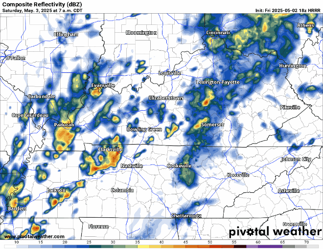
Not expecting any severe weather, but we could see an embedded thunderstorm or two. Most evening plans should be mostly dry – besides a possible quick shower or two.
Leave a Reply
You must be logged in to post a comment.
An isolated shower/storm will be possible thru this evening, with a low chance of a storm reaching severe criteria. Only hazards today would be gusty winds and/or small hail. Not worried about tornadoes today.
Leave a Reply
You must be logged in to post a comment.
As new model data continues to come in, thinking on timing and coverage of rain/storms has changed a bit from previous days.
Still think most of us stay dry today (Wednesday) with the exception of maybe a quick shower or two for a few folks. No severe weather expected, and any shower/storm would collapse fairly quick.
Leave a Reply
You must be logged in to post a comment.
Random scattered showers/storms will be possible thru this evening. Although most should be below severe limits, one or two may produce some gusty winds and hail. The atmosphere just doesn’t look supportive of tornadoes today for us.
Leave a Reply
You must be logged in to post a comment.
TL;DR:
- Scattered afternoon showers/storms possible Tuesday, Wednesday, and Friday afternoons/evenings
- Widespread showers/storms likely Thursday PM
- Relatively low chance of a strong to severe storm on Tuesday and Thursday
- Hot temps all work week before a “cool” down before the weekend
Rain chances will return Tuesday afternoon, although most of the activity is expected to stay to our north.
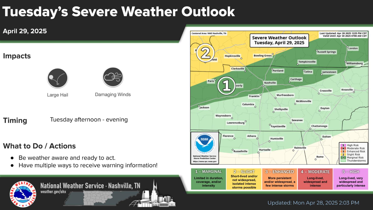
However, with any storm that does make it this far south, we’ll have a very low chance of a strong to severe storm, with gusty winds and hail being the concerns.
Leave a Reply
You must be logged in to post a comment.