
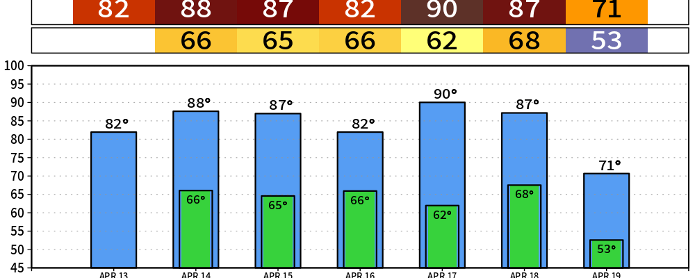
Scattered light showers will continue thru this afternoon. Rainfall totals will be light, but it’s better than nothing. The clouds and rain will also help keep our temperatures down a good bit. Highs expected to get into the low 80s, but we might not make it there.
From Tuesday thru Saturday, with the exception of Thursday, we will threaten our daily record highs each day. Quite the stretch of abnormally warm temperatures. If we hit 90° on Friday, that would tie the second earliest date Nashville has reached that mark. Our average first 90° day is May 27.
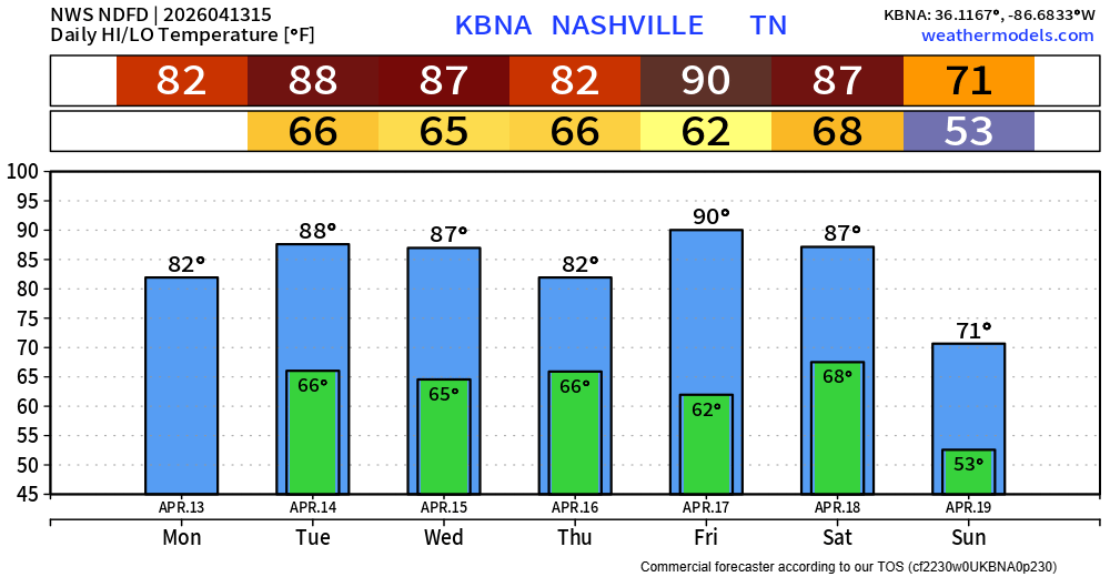
Reason for the lower temps on Thursday will be due to some showers and storm chances sometime during the afternoon/evening. No hazardous weather is expected, but hopefully we can see some halfway decent rainfall totals to help alleviate our worsening drought. Unfortunately, this looks to be a light rain with totals under 0.25″.
We finally will get a cold front to push thru, probably sometime Saturday night/Sunday morning that will bring our temperatures down to closer to average. We’ll also see some rain chances along the front. Good news, no severe weather is currently expected. Bad news, rainfall totals also look fairly light with this. More details on this as we get closer.

Categories: Featured Blog