
The remainder of our Friday will be dry and warm. As of 2:30p, temperatures are in the mid 80s, flirting with our daily record high of 86° set back in 2012.
The first half of Saturday will be nice. We’ll warm back up to the low to mid 80s.
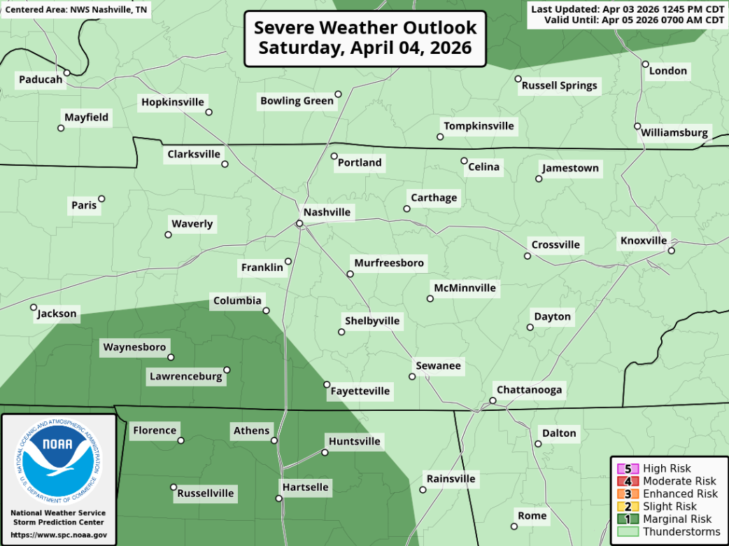
We are still expecting a line of showers and storms to move thru sometime Saturday evening along a cold front.
The good news is that we are still not included in any severe probabilities – while some general thunderstorms with some gusty winds can’t be ruled out, things should remain below severe limits.
Looking at specific timing, the HRRR model has the line arriving around 4p, +/- an hour or so. Any outdoor plans you may have, including dinner plans, will likely need rain gear. Rainfall totals will generally be 0.5 – 1″.

More good news is that models are all in very good agreement that the rain will move out prior to sunrise, leaving any sunrise services or any other Easter Sunday plans you have dry, with cooler (although still fairly mild) temperatures.
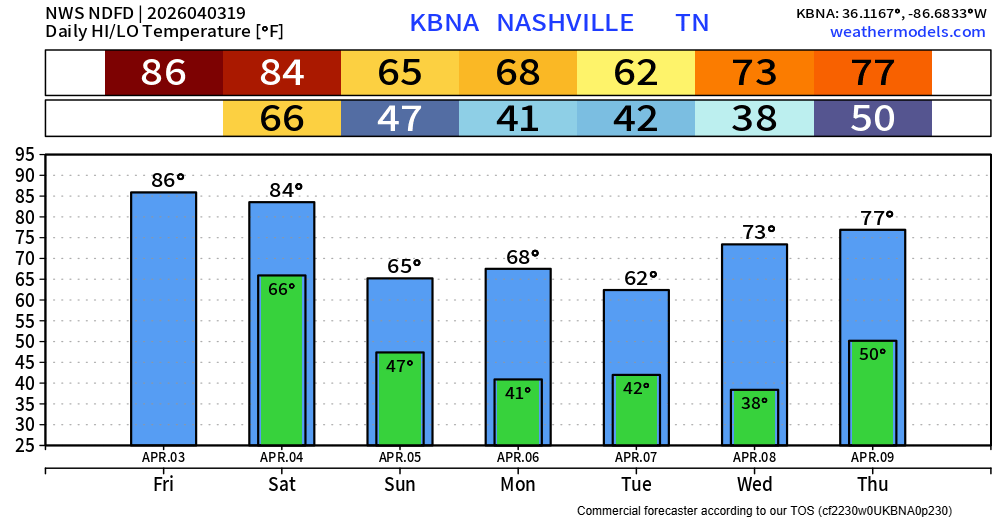
No additional rain chances are currently in the forecast thru late next week. Some frost in a few places will be possible early next week as well – but no sub-freezing temperatures are expected, as it is looking more and more likely we are done with those.
Categories: Featured Blog