
If you thought March felt abnormally warm – you’d be correct. It was actually the 2nd warmest March on record with an average temperature of 60.3° (warmest is 61.1° in 2012).
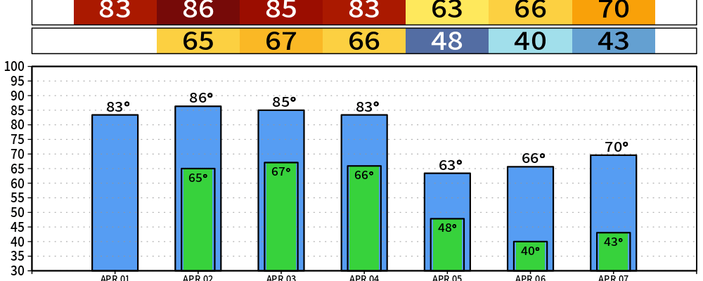
No April Fools jokes here – just high temperatures continuing to be ~20° above average.
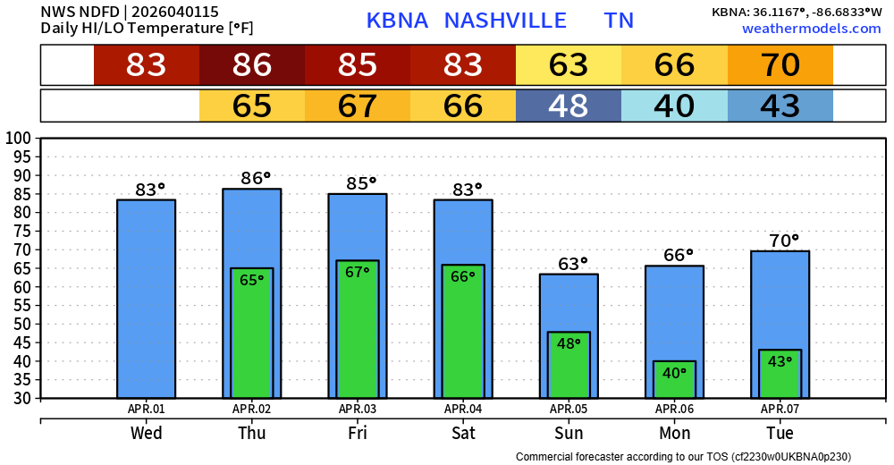
We “cool” down a bit after out cold front passes thru on Saturday night, but by “cool” down I mean temperatures will just be around average.
Regarding rain/storm chances, the HRRR model is less excited about our chances for a pop-up shower/storm this afternoon. Other models, such as the RRFS model, still think we have a shot. Models are good, but far from perfect. We’ll be keeping an eye on things, and those with outdoor plans this afternoon should keep an eye on things. No severe weather concerns, but any storm could certainly produce lightning.
Low rain chances return Friday morning, continuing thru the afternoon. Most of us should stay dry but can’t rule out a shower/non-severe storm for some.
Our highest rain chances of the week will come in sometime Saturday PM, as a cold front moves thru, likely bringing widespread showers/storms to the area. Although we are currently not outlooked with any severe probabilities, we’ll keep an eye on any model trends.
The good news is that we’ll likely at least get some decent rain from this, likely near 1″. Helping make up for our lack of rain during March, when we were about 3″ below average rainfall for the month. But also low enough to avoid any flooding concerns.
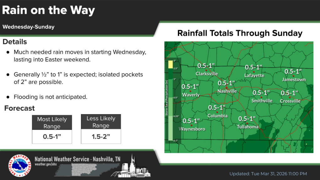
More good news is that models generally think the rain should be out of here by sunrise on Sunday morning, so any Easter plans you might have (including sunrise services) are looking dry, although cooler.
Early look at next week suggests things look generally dry and mild.
Categories: Featured Blog