
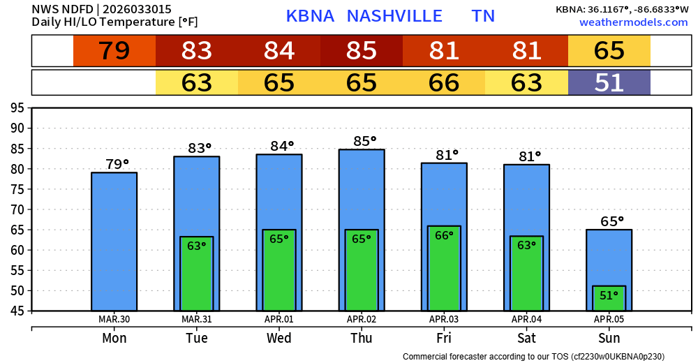
Our high temperatures will sit comfortably above our average high for this time of year (mid 60s) all week long. In fact, our low temps will match our average high temps.
Highs in the low to mid 80s will be common thru Saturday. Hello Spring.
We remain dry until Wednesday, when rain/storm chances start to pick back up.
There’s still model disagreement on how things play out – shocking!
Low to medium rain chances exists Wednesday thru Sunday. As of right now, the “highest” rain chances look to be Wednesday PM, Thursday PM, and Saturday PM. Although I say that very lightly, as things could certainly change. In the coming days, we can get more into the specifics, especially on timing.
For now, we are not outlooked with any probabilities for severe weather. Models currently don’t think we see all the necessary ingredients needed for severe weather. General thunderstorms? Yeah, probably. But for now, I’m not really seeing any severe concerns.
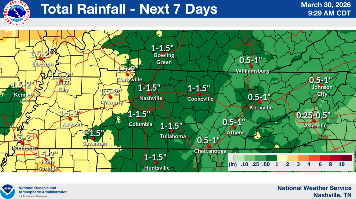
However, this will bring at least some decent rainfall totals. Helpful, since we are about 5″ below average on rainfall so far this year. Totals look to be in the 1 – 1.5″ range over the next week. Won’t totally erase our deficit, but it’ll help – and also low enough to avoid any flooding concerns.
Categories: Featured Blog