
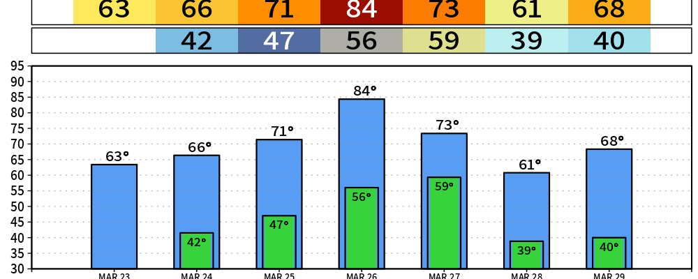
After two straight days of tying the daily record high (89° and 88° for Saturday and Sunday, respectively), a cold front has moved thru and cooled us down to closer to average for this time of the year.
Breezy conditions, along with low humidity values will cause fire danger to be slightly elevated today. Be cautious with any outdoor burning today.
We will slowly warm up this week, back to the mid 80s by Thursday.
However, the mid 80s will only stick around for one day this time, as another cold front will push thru on Friday.
Speaking of Friday, that’s when our only rain chances this week exist – although they look fairly meh right now. Just a low to medium chance of some showers – no hazardous weather expected. More specifics later this week.
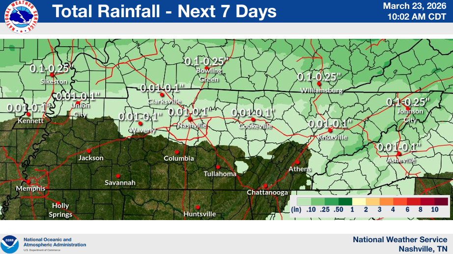
Rainfall totals over the next week look like…not much.
Categories: Featured Blog