
- Widespread damaging straight-line winds up to 75 mph possible, isolated tornadoes cannot be ruled out
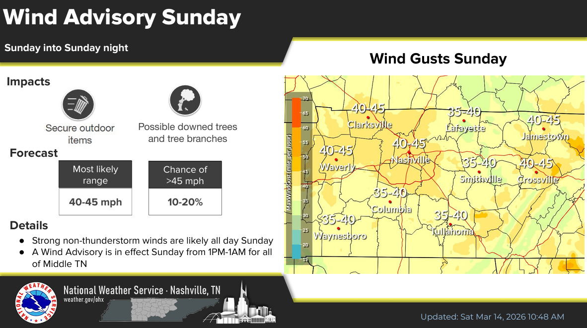
- Wind Advisory starts at 1p Sunday for gusts up to 45 mph before the storms
- Sharp drop off in temperatures post cold front, flurries possible Monday
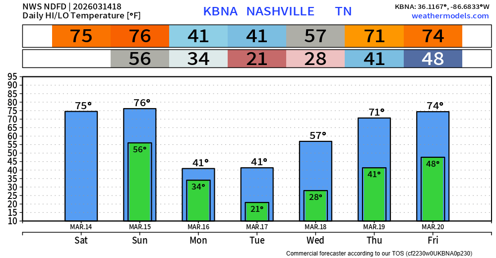
Before we get into the severe talk, today thru Sunday afternoon will be nice. Well above average temperatures, with plenty of sun.
A Wind Advisory will go into effect starting at 1p on Sunday. Wind gusts before the storms may reach up to 40 mph. Be sure to secure any outdoor furniture – also not a bad idea to take care of any lingering tree branches that may be damaged from the ice storm if you are able to.
All eyes continue to be on our severe weather threat Sunday evening/night, with the main threat being potentially widespread, perhaps significant, damaging straight-line winds.
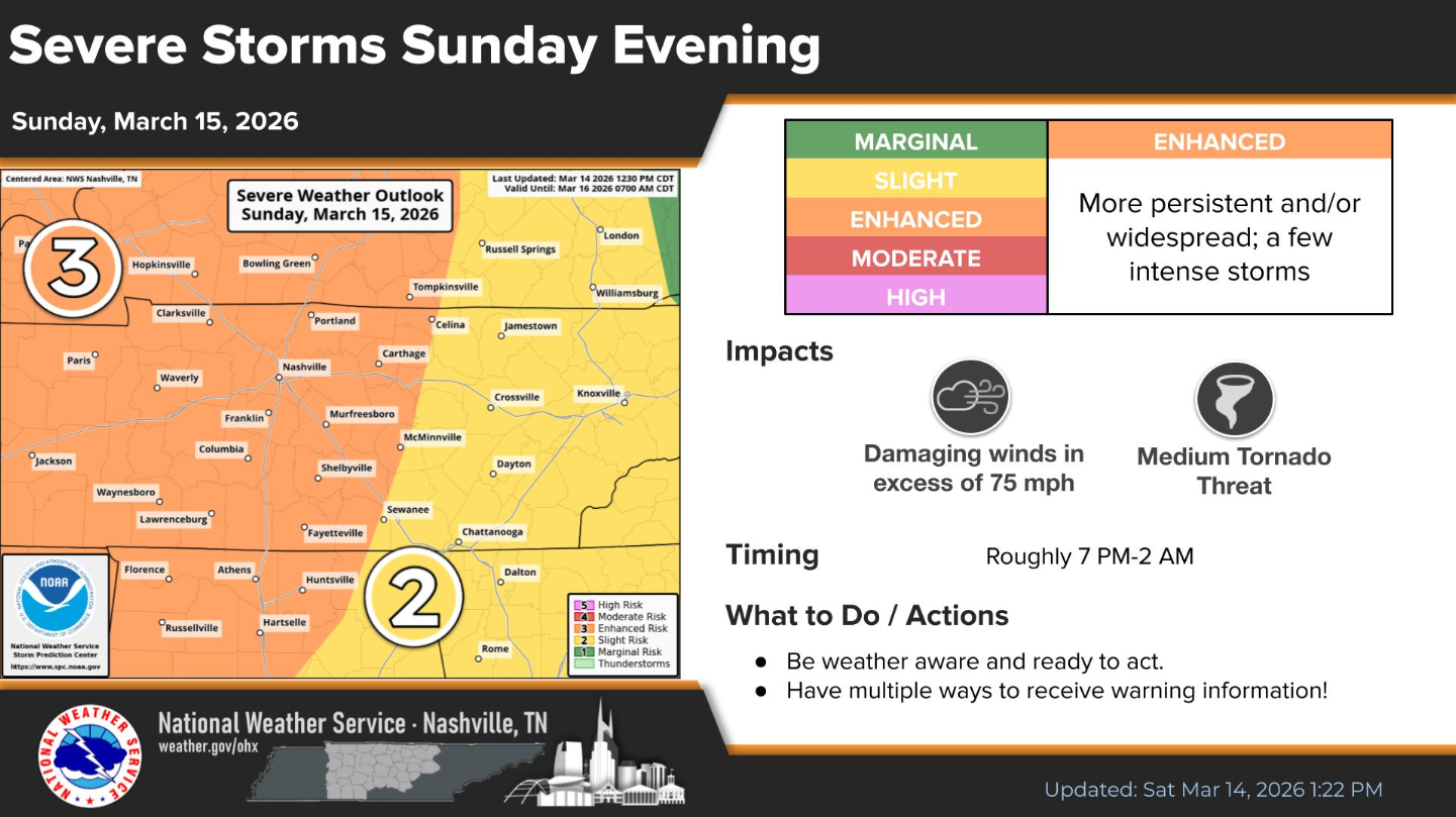
We are outlooked with the following probabilities from the Storm Prediction Center, all valid within 25 miles:
- 30-44% chance of damaging straight-line winds (potentially up to 75 mph)
- 10-14% chance of a tornado (with a reasonable max intensity of EF2)
- we are not outlooked with any hail probabilities
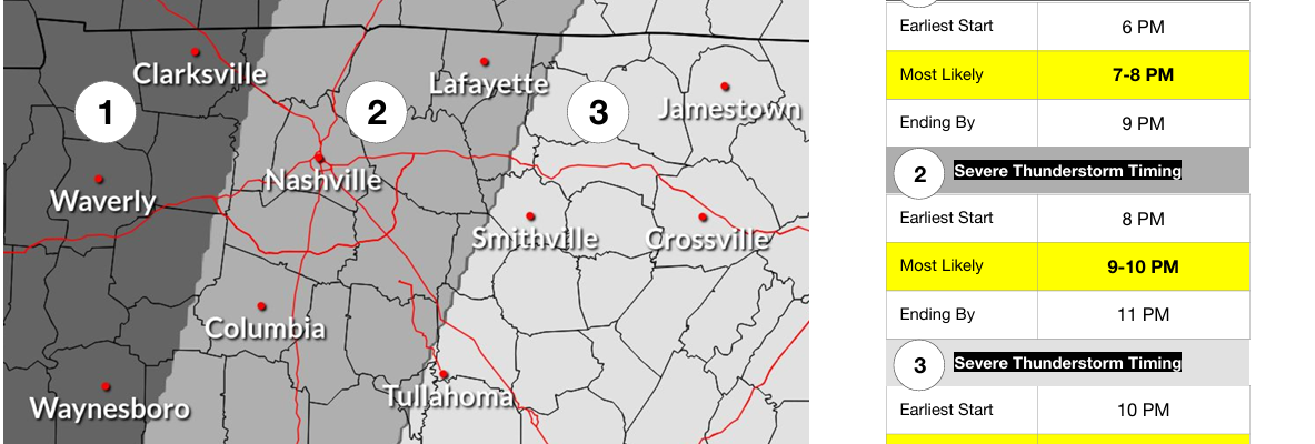
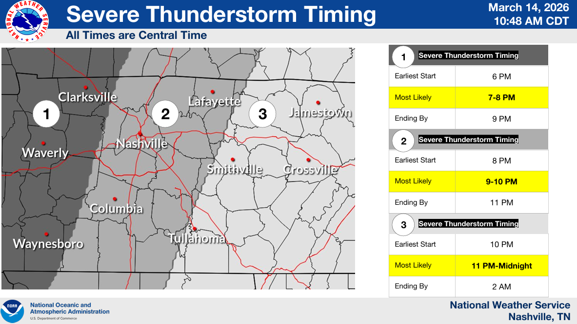
Timing:
The best timeframe we currently have is 8p – 11p, most likely between 9p – 10p. This is subject to change, stay connected!
Although not everyone will see severe weather – now is the time to prepare. If you do go to bed before the storms arrive, having a way to wake up if a warning is issued for you will be very important. NOAA Weather Radio, Wireless Emergency Alerts on your phone, a wake-me-up app – do not rely on sirens to wake you up.
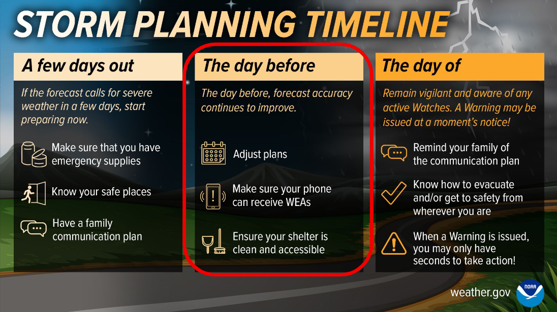
With these types of set ups, things will move fast. The line of storms will likely be moving quickly, and you may not have much of a heads up if a warning is issued for you. All the more reason to know now where your safe place is. We have an article here with more information on preparation: What To Do – Nashville Severe Weather
This is a relatively low probability of a high impact event. Although it’s more likely you don’t see severe weather, it’s best to prepare and be ready. If a warning is issued for any portion of our two counties, we’ll go live on our YouTube channel and follow the storms all the way thru. We also have a great article to help combat storm anxiety: Taking Care of Storm Anxiety – Nashville Severe Weather
Following the cold front, things will feel entirely different on Monday and Tuesday. It’s possible we see some flurries on Monday, most of us will likely see no accumulation, but perhaps a dusting on some grassy areas/elevated surfaces. Low temperatures will also be well below freezing Monday and Tuesday night – protect any loved plants.
Temperatures will warm back up fairly quickly, back into the 70s by Thursday.
Categories: Featured Blog