
- Possibly significant (75+ mph), widespread damaging winds possible Sunday night, along with a low-end tornado threat
- Windy during the day on Sunday before the storms
- Cold temperatures return post cold front early next week, hard freeze Monday night
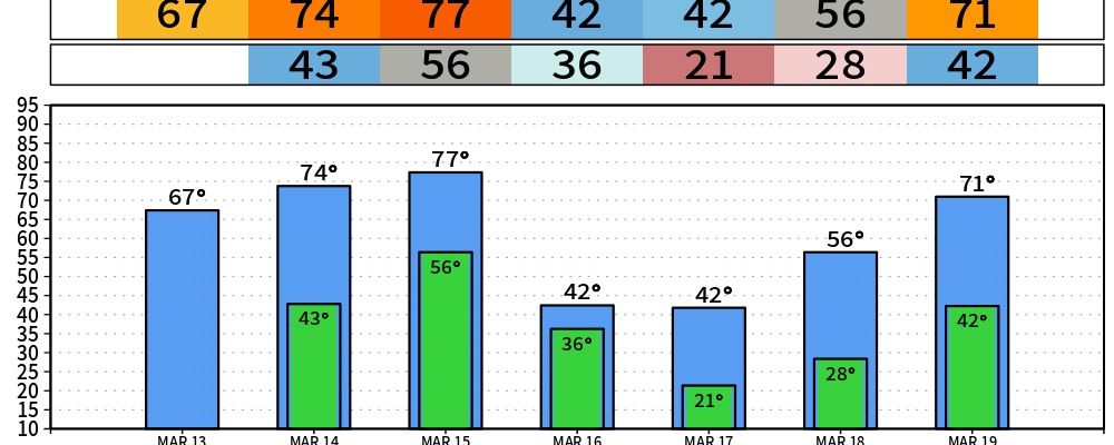
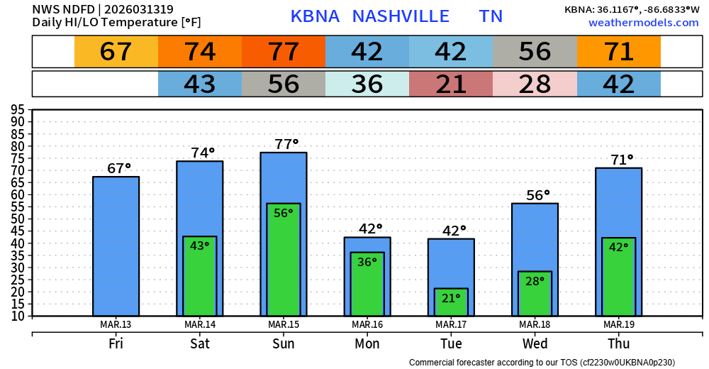
Before we get into the severe weather talk, I will briefly hit on today and Saturday. Which there’s not much to talk about, the rest of today and Saturday will be quite nice. Cold temps tonight, but we warm up nicely on Saturday with highs in the mid 70s – no rain.
Sunday during the day will be nice as well, besides the wind gusts up to 40 mph possible. A Wind Advisory will likely be needed during this time. Highs reach into the upper 70s.
All eyes are on our severe weather potential Sunday night.
The latest Storm Prediction Center update has upped our probabilities again. Both of our counties have a 30% possibility of severe weather occurring within 25 miles, with the potential for some severe storms to be significant – particularly the damaging straight-line winds. We will get the individual probabilities for each hazard (damaging winds, tornado, hail) starting on Saturday.
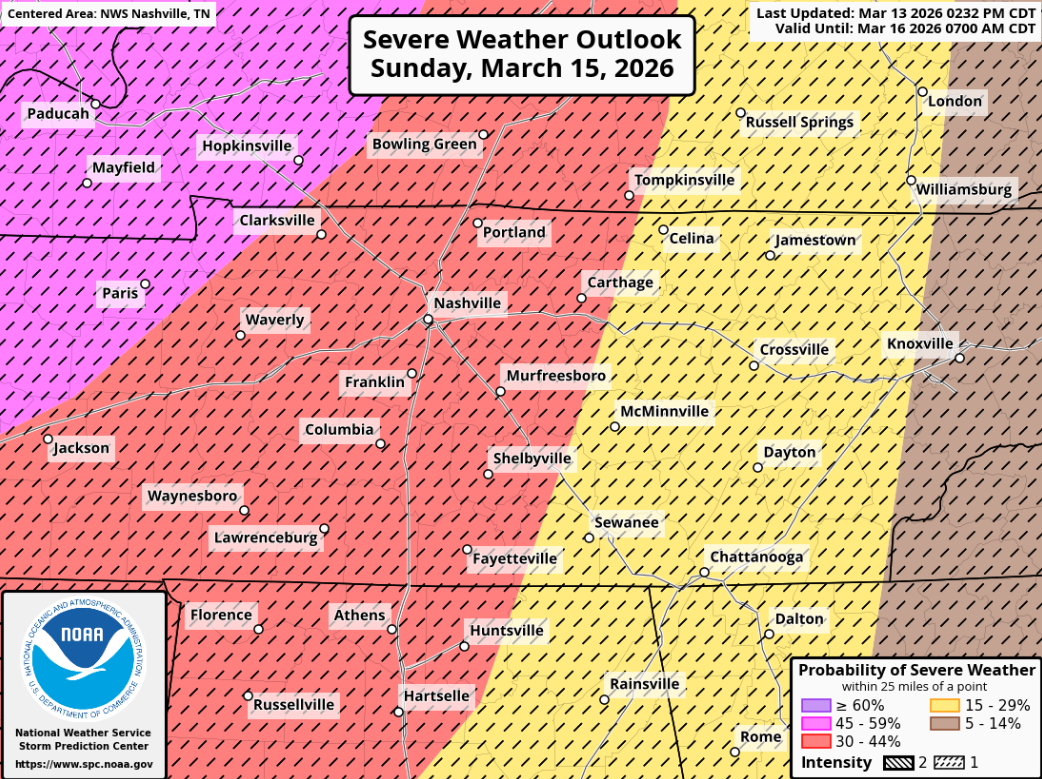
Models continue to come into agreement that the ingredients will be available for severe weather – especially wind shear. The upper-level dynamics of the system are fairly impressive. We are likely looking at a line of storms along a strong cold front pushing thru.
Timing wise, it’s hard to get more specific than Sunday night right now. I do think the window of severe weather will eventually be narrowed down to a fairly tight timeframe with the system being fast moving – however that will not likely be until the day of until that is realized.
Now is the time to prepare for the potential for widespread damaging winds. This includes the possibility of downed trees and power outages. With signs pointing to this being an overnight threat, having a way to wake up if a warning is issued for you will be important. NOAA Weather Radio, Wireless Emergency Alerts on your phone, wake-me-up app, the more the merrier. Also, tell a friend to tell a friend.
Things can certainly change. We’ll keep y’all posted with all the latest information as it comes in. We’ll all get thru this together. Talk of severe weather can raise some heartrates – understandably so. We have an article to help with storm anxiety: Taking Care of Storm Anxiety – Nashville Severe Weather – prepared, not scared!
Temperatures will quickly drop after the passage of the cold front. Highs Monday and Tuesday will only get up to the mid 40s, with a hard freeze expected Monday night. We may even see a few flakes fly Monday, but no impacts/accumulation expected. If you have anything already planted, be sure to protect those.
Long-range models indicate warm temperatures return later next week.
Categories: Featured Blog