
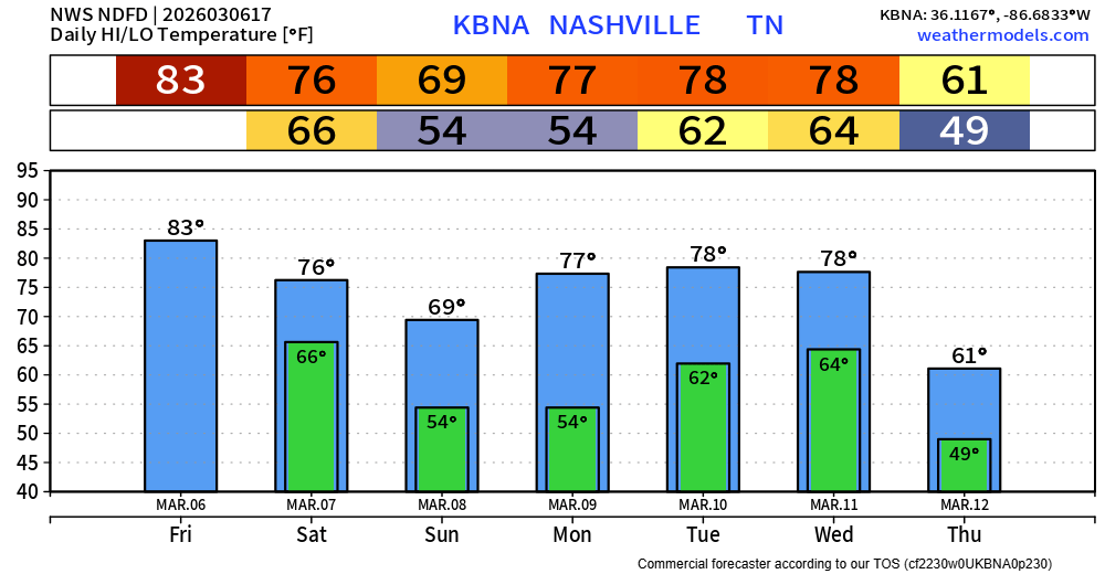
It will feel absolutely nothing like early March today. As of 11a we are already at 79°, likely on our way to breaking the daily record high of 83° – around 25° above average.
There’s a very low chance a quick shower passes thru this afternoon – but most of us will stay dry, if not all of us.
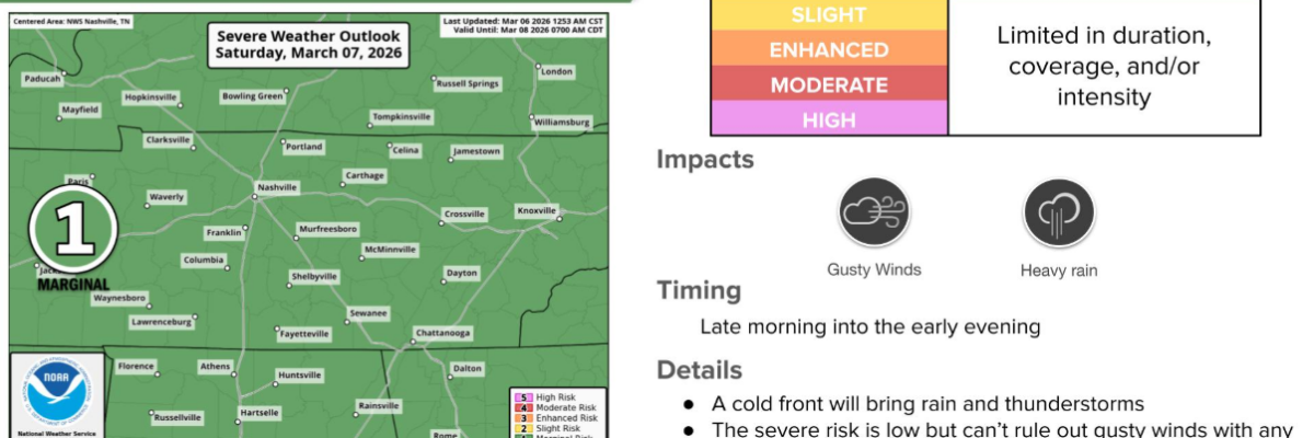
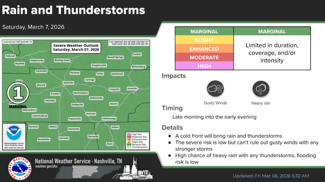
We continued to be outlooked with low-end probabilities by the Storm Prediction Center for Saturday, specifically a 5% chance of damaging straight-line winds and a 2% chance of a tornado – all within 25 miles.
The main threat will be the damaging straight-line winds.
Expected arrival of storms has moved up just a bit.
A rough ETA would be 11a – 3p. That could very well change, but at the time of writing, this is the best timeframe we have.
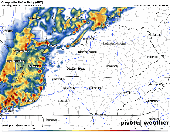
The 12z HRRR is on the earlier half of this timeframe, showing storms moving in before noon on Saturday. This is just one run of one model. This is just to give an idea of how things could play out.
This is a low-end threat, but not zero. We’ll be watching all of this, keeping y’all updated on all of our socials. In the chance there is a warning issued for any part of our two counties, we’ll go live on our YouTube channel.
It’s also a good time to make sure you have multiple ways to receive warnings. Whether it’s a NOAA Weather Radio, Wireless Emergency Alerts on your phone, an app – the more the merrier. It’s relatively unlikely you do get a warning tomorrow, but with Spring coming up, it’s as good of a time as ever to get prepared.
Sunday should be dry, but medium rain/storm chances stay in the forecast Monday – Wednesday. Highest chances come around on Wednesday as another cold front swings through. As of right now, we aren’t outlooked with any severe probabilities for any of these days.
Temperatures remain above average.
Categories: Featured Blog