
Rain should start to taper off this afternoon, clearing out by this evening. Clouds will hang around all day, keeping temperatures down all day. Today will be our “coolest” day for the foreseeable future.
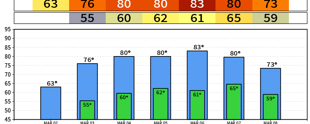
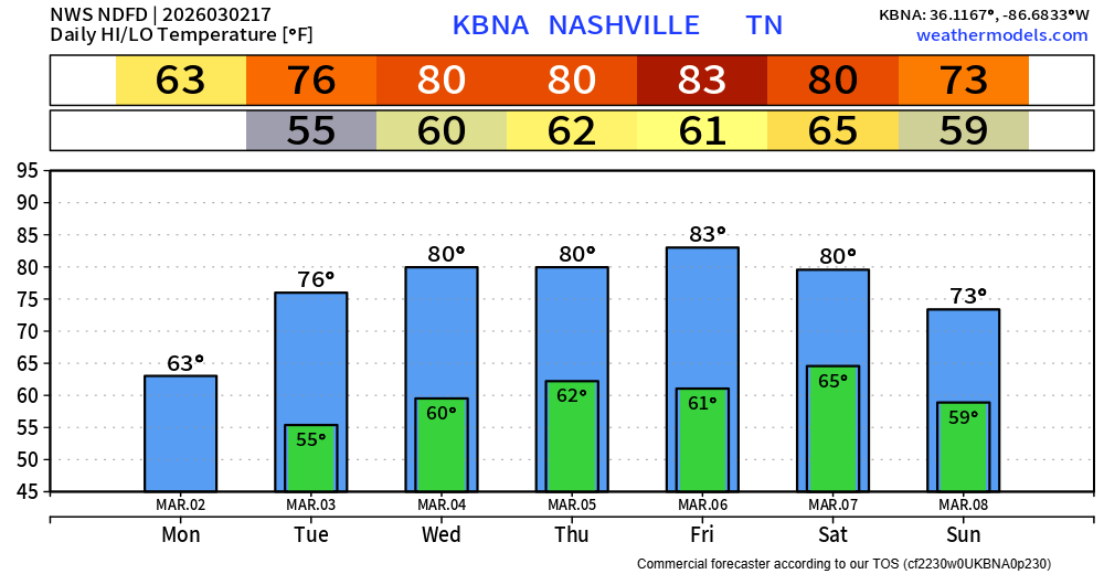
High temperatures this week will be nothing short of warm – some days I’d just say hot – for the remainder of the forecast. Highs will be 20 – 25° above average.
We’ll threaten daily records highs most days on the back half of this week.
Wednesday –> Forecast = 80° | Record = 84° (1976)
Thursday –> Forecast = 82° | Record = 80° (1910)
Friday –> Forecast = 85° | Record = 83° (1910)
Saturday –> Forecast = 83° | Record = 80° (2000)
Even our low temperatures will be warmer than our normal highs.
This doesn’t mean we are completely done with cold weather. If I had to bet, I would say we get at least one more cold snap thru the end of the month, even early April is not a stranger to some cooler temperatures. But for now, we can enjoy the Spring-like temperatures.
The remainder of the work week looks to be relatively quiet. Current models suggest most, if not all of us, stay dry thru Friday. Thursday has the “best” odds of a quick shower in the afternoon/evening, but those odds are still fairly low.
Our pattern turns to more “unsettled” starting on Saturday, with rain chances returning and continuing thru at least early next week. However, there is still a good amount of uncertainty with models and exactly how things play out – although this is expected this far out.
Rainfall amounts, timing, and intensity are all still up in the air. For now, we are not outlooked with any severe probabilities by the Storm Prediction Center, those are all out to our west, confined to the Plains for the most part.
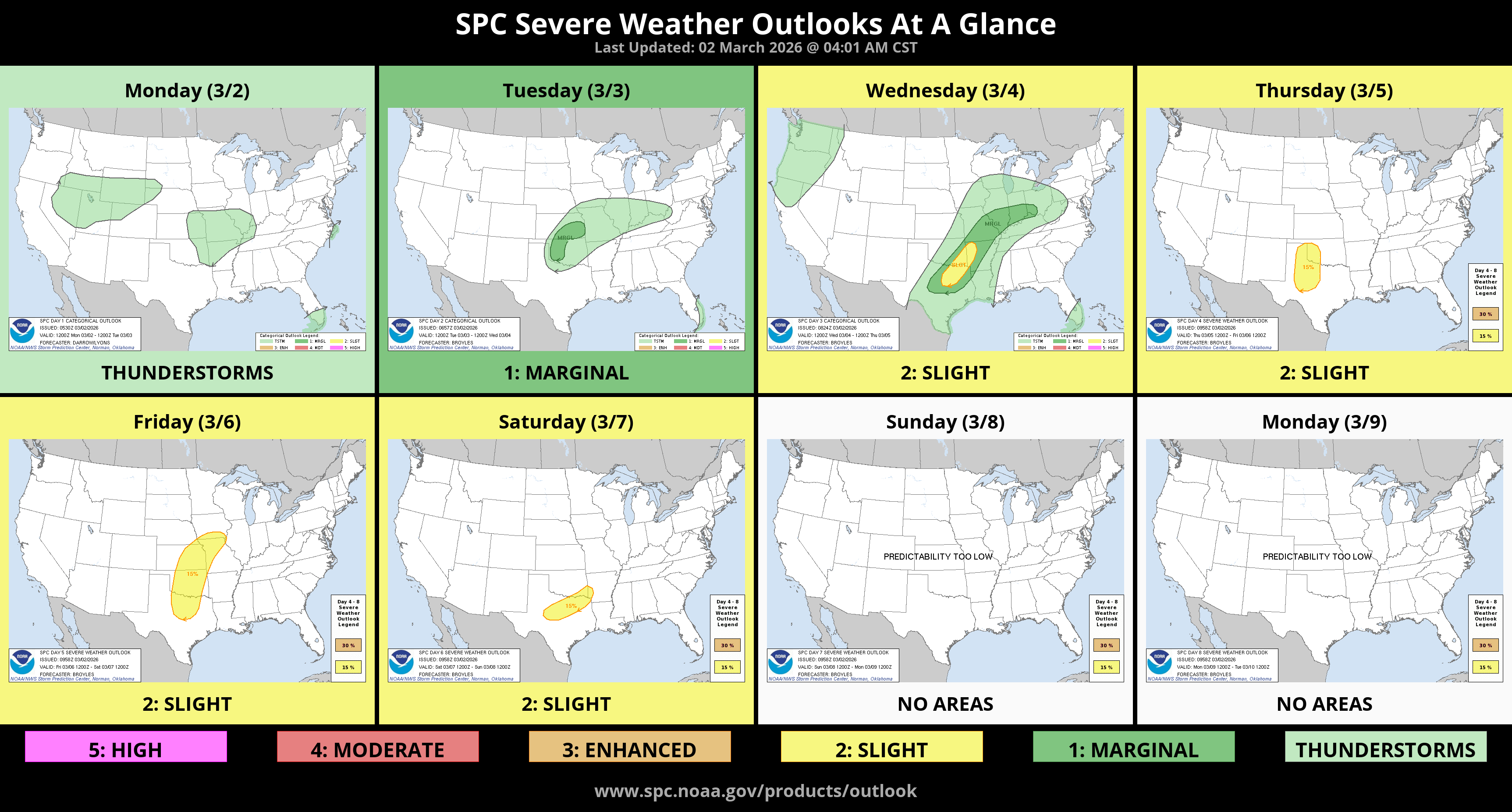
This is something we’ll be watching and will keep y’all posted.
It is March, which is the beginning of our Spring severe season. We have a good thread here to help you be prepared, not scared.
Speaking of Storm Prediction Center, they are rolling out some new changes to their severe weather outlooks beginning tomorrow, March 3. This will not change our messaging much, if at all, but if you are interested in learning more about these new changes, they put together a great informative video you can find here:
Categories: Featured Blog