
Most of us have seen some flurries this morning. Those will continue to be possible over the next couple of hours – but no impacts expected, just cool to see. If you are snow-deprived, you can find some pictures from the Northeast, where from NYC to Boston they are experiencing a blizzard.
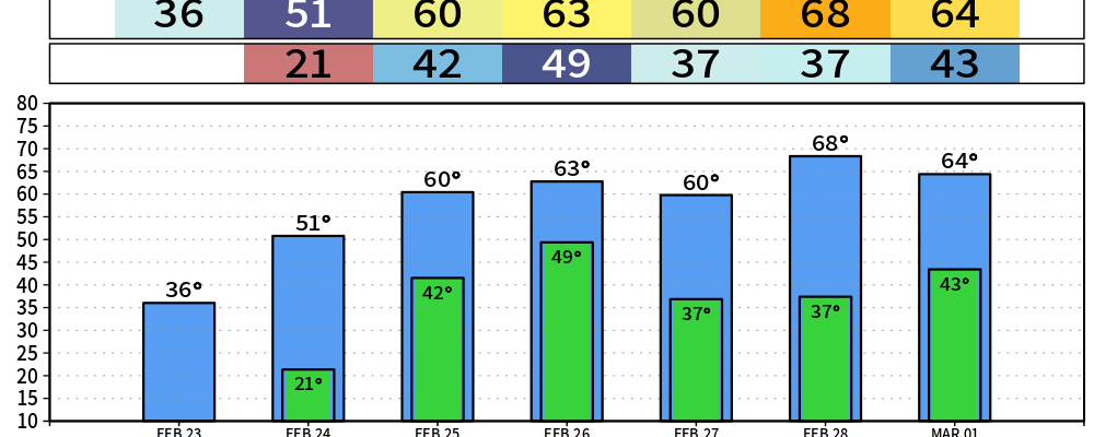
We are also getting a reminder that it is indeed still Winter. Most of got down near 20° this morning. Highs will only “warm” up into the mid 30s, and wind chills will likely stay below freezing all day.
Temperatures will yet again dip down to near 20° tonight, so jackets will be needed again as you head out the door on Tuesday. March can still get very cold, and our average last freeze isn’t until March 31st.
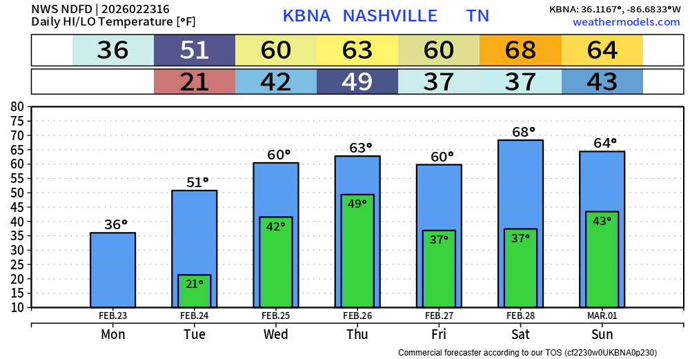
A warming trend will occur throughout the week, with plenty of highs in the 60s throughout the week, avoiding the freezing mark at night.
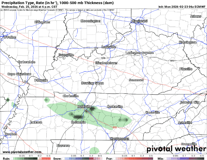
All is quiet until Wednesday evening or so when rain chances return.
Those chances will stick around throughout the majority of the day Thursday as well. It’s likely we see some good rainfall from this, which isn’t the worst thing – we are about 2″ below our average rainfall so far this year.
The Euro model (below) gives a guess, but long story short – Thursday looks wet with perhaps some rumbles of thunder. No severe weather expected. ~1 – 1.5″ of rain currently in the forecast.
Signs point to us clearing out by Friday, and for now, a dry and warm weekend is expected.
Categories: Featured Blog