
Our messaging has changed a bit, although not dramatically, from the past couple of days.
Long-story short [as possible], expected CAPE values (storm fuel) have trended up – mostly thanks to less cloud coverage than previous expected. This, along with sufficient shear (changing of wind direction/speed with height) has led the Storm Prediction Center to re-introduce low-end probabilities for severe weather. Although the threat is conditional, based upon several ingredients aligning.
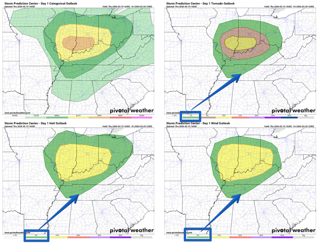
We have a 5% chance of damaging straight-line winds and/or hail, along with a 2% chance of a tornado within 25 miles.
These are very-low end probabilities, but they are not zero.
Timing:
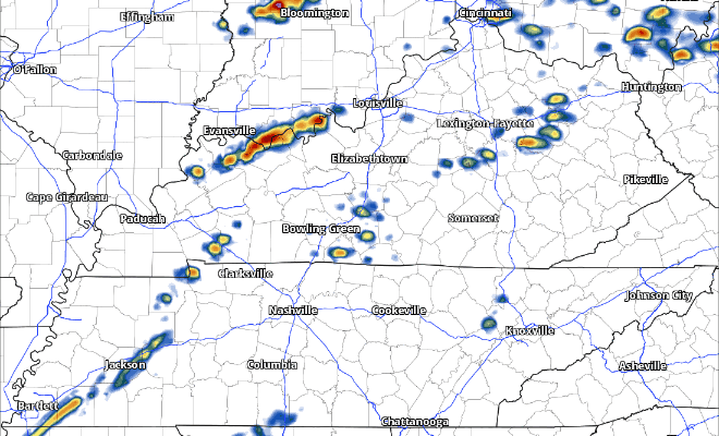
During the day today, we should be fairly quiet. Something we’ll be watching (but that is currently not expected) will be for any storms to pop up this afternoon and evening. Our environment would be favorable for a severe threat at this time, but there isn’t expected to be any sort of lifting mechanism – AKA, nothing to make the storms get going/form.
The main focus for storms won’t come until tonight, closer to 10p – midnight (subject to change) – when a cold front will push thru the area.
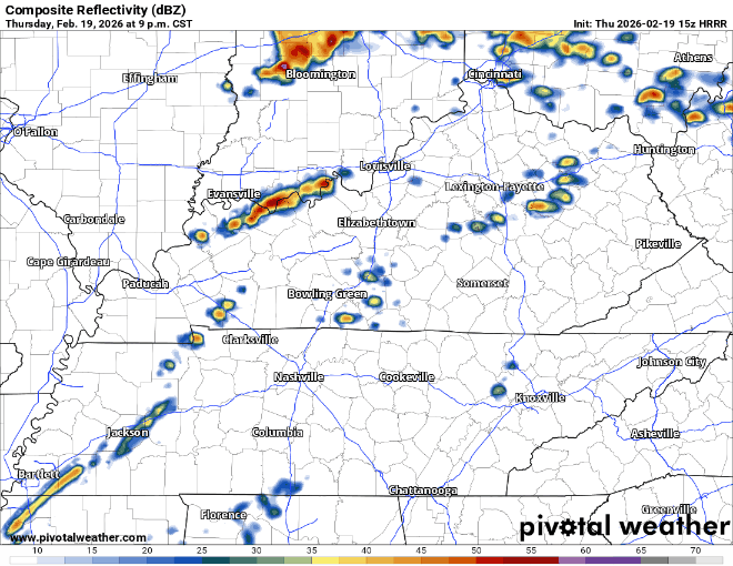
The main threat will be damaging straight-line winds, but some hail or a tornado cannot be ruled out.
We’ll be watching this conditional threat closely. Something that will help reduce (but not eliminate) our severe chances will be how late the storms arrive. As the sun goes down and we lose our daytime heating, we’ll also start to lose some of our storm fuel. This could cause the storms to be more elevated, which would be positive news for us.
Stay connected and remain weather aware throughout today and tonight. We’ll be posting updates on all of our socials as needed. In the low chance a warning is issued, we’ll go live on our YouTube channel.
Have multiple ways to receive warnings. NOAA Weather Radio, the Wireless Emergency Alerts on your phone, your favorite warning app, etc. Again, this is a very low-end threat – but it’s always better to be prepared, especially with Spring right around the corner.
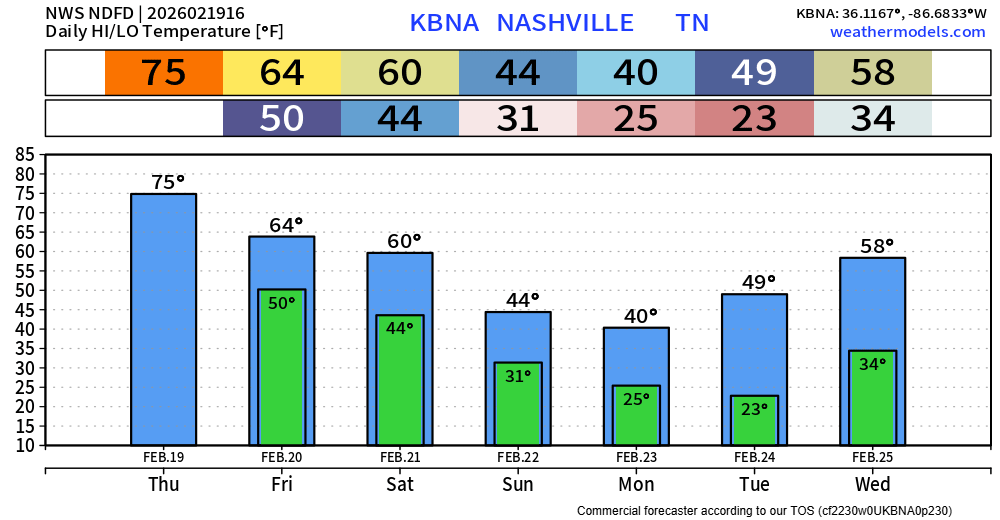
We should be dry Friday and most of the day on Saturday. Low chances of showers return Saturday evening.
Very warm temps today ahead of the storms, thanks to gusty winds from the SW ushering in warm, moist air.
Temps stay fairly mild Friday and Saturday before a surge of cooler air arrives Sunday, hanging around thru the first part of next week. Warmer air, and possibly rain chances, return by the middle of next week.
Categories: Featured Blog