
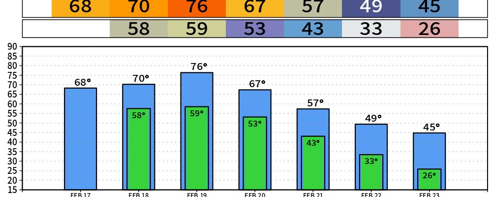
High temperatures will get near the 70° mark today thru Friday, even into the mid 70s on Thursday – pushing the daily record high of 76°. That’s around 20-25° above average.
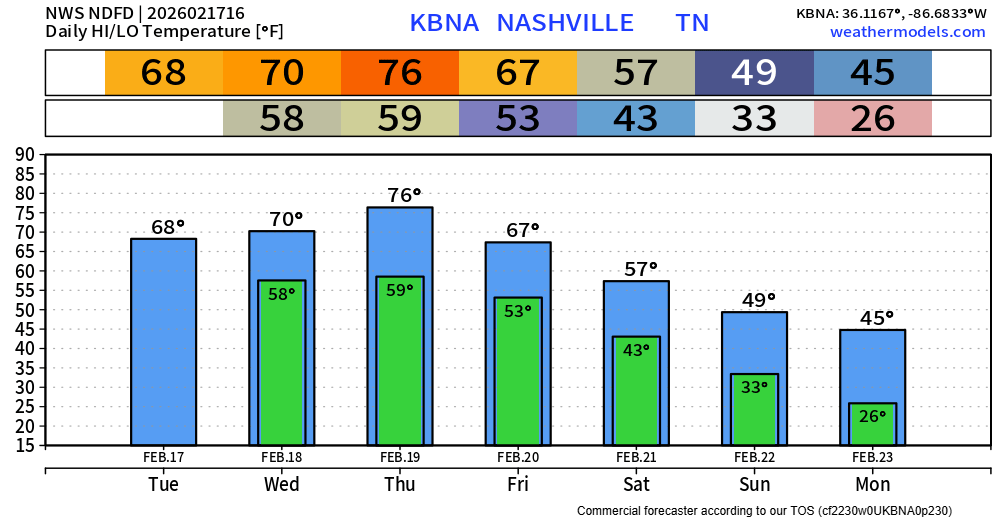
These Spring-like temps won’t last forever. We cool down a good bit after our cold front pushes thru on Friday, starting next week off slightly below average. Long-range models suggest warmer temps return by the middle of next week.
Our first chance of rain will come around Wednesday evening thru early Thursday morning. We could see a couple passing showers, maybeee a rumble of thunder – but nothing too noteworthy. Majority of the showers will be gone in time for the rush hour Thursday AM.
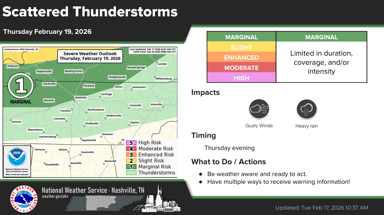
Our second “wave” of rain potential will come Thursday evening/night, with perhaps a thunderstorm or two.
The Storm Prediction Center has outlooked areas N of I-40 with a 5% chance of severe weather within 25 miles, accounting for the very low-end potential for some gusty winds. However, as mentioned in yesterday’s blog, CAPE values (storm fuel) continue to look very lackluster – which leads me to think the majority of any strong to severe storms will stay situated to our north. Regardless, this is something we will certainly keep an eye on.
Rain should be mostly off to our east come Friday morning, leaving us with a dry day on Friday.
Some additional light showers will be possible early Saturday morning, and again Saturday evening. This looks to just be rain – no hazardous weather.
To dodge the rain and cooler temps on Saturday, come join us (and lots of others) at Trevecca starting at 9a for SWAD. It truly is something I look forward to every year. Great event for people of all ages. More information can be found here:
Categories: Featured Blog