
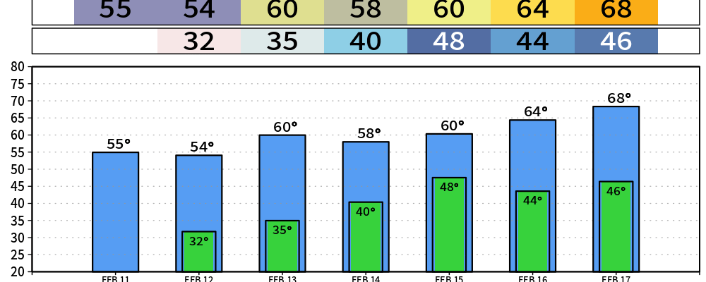
We’re about 20° colder than we were 24 hours ago – that’s thanks to a cold front that moved thru overnight that brought a little bit of rain with it.
We’ll experience a slow warming trend as we get into this weekend, although not as warm as the 77° we saw on Tuesday, but still comfortably above average.
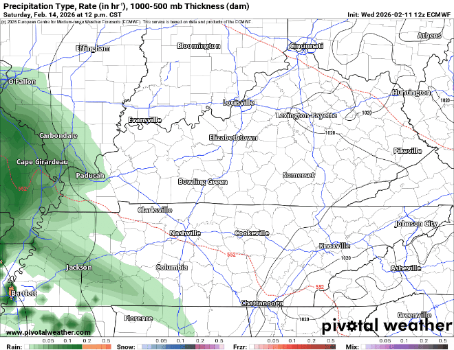
Models have begun to come towards more of an agreement, and we can now narrow down our timeframe of rain chances to Saturday evening thru midday Sunday – although this is subject to change.
This looks like a good, beneficial rain – with no hazardous weather expected. Rainfall totals have come down a bit, so we aren’t expecting any flooding issues – along with the surface low being situated to our south = no severe weather.
I believe the Euro has a decent guesstimate on how things play out, looping from Saturday afternoon to Sunday afternoon:
We’ll start to dry back out on Sunday, with no additional rain chances thru at least the middle of next week. Temperatures remain above average.
I will continue to plug the SKYWARN Storm Spotter classes and as well as Severe Weather Awareness Day, both organized by the wonderful folks at NWS Nashville. I can’t recommend attending one (or both) more.
NWS Nashville is offering several free, online SKYWARN Storm Spotter classes over the next month or so. This is a great opportunity to learn information that can really make a difference with reporting, especially with Spring right around the corner. I highly recommend trying to attend one!
Severe Weather Awareness Day (SWAD) is also right around the corner. This is another great event that NWS Nashville puts on. It’s a day full of meeting other weather nerds, listening to some great presentations, and more. More info here:
Categories: Featured Blog