
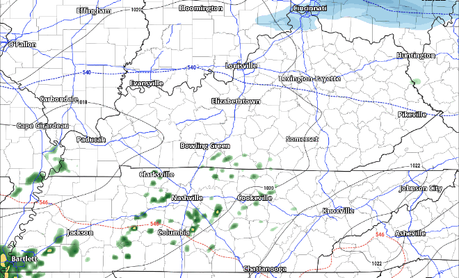
We should get some fairly efficient melting of anything that is still hanging on. We’re on our way to highs in the low 50s, with some rain coming this afternoon.
HRRR model gives a guess on how things play out, with rain starting this afternoon, lasting thru this evening.
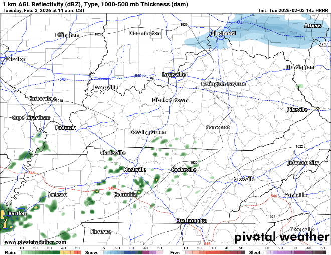
Rainfall totals will be fairly light, with totals up to 0.25″.
It wouldn’t totally shock me if a few of us saw some flurries Wednesday morning as the moisture moves on out, but no impacts/accumulation expected from this.
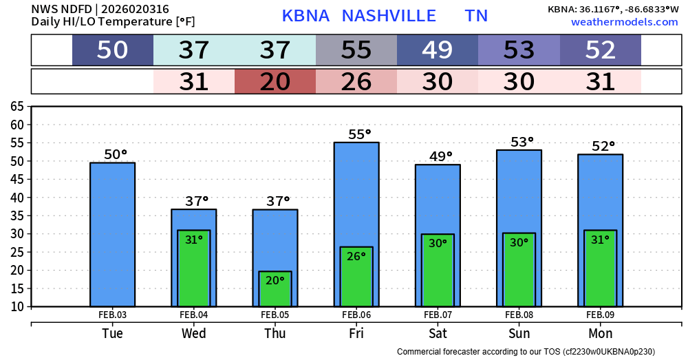
Wednesday and Thursday will be a bit chillier, with highs only in the upper 30s thanks to the front that moves thru tonight.
Thankfully, we’ll “warm” up a bit later this week. Highs in the 50s return by Friday. No additional precipitation chances thru early next week.
I won’t go too far into this, because our dear friend and founder, David, has already let the “rathog” hear it. Although I’ve seen far worse on various social media platforms – but that I won’t repeat.
Regardless of your stance on Phil, he has predicted 6 more weeks of winter. It is also important to know, that he does not have the best track record on his predictions.
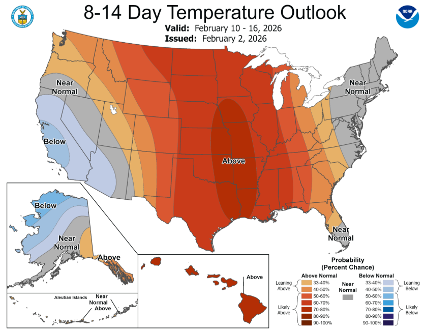
All I’ll say on this, especially given the recent prolonged cold weather that we’ve experienced, that the next 7-14 days looks to bring above-average temperatures for us. Long-range models think we see highs in the 60s later next week – yes, please.
Categories: Featured Blog