
Temperatures will continue to be dangerously cold this weekend – especially to those still without power. Please, check in on your neighbors, especially those who may be elderly or have medical issue.
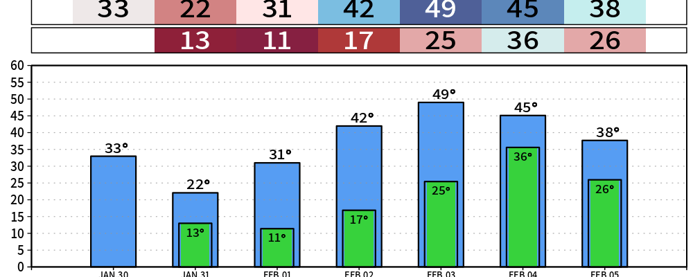
Our Cold Weather Advisory begins tonight at midnight, running thru Monday at noon.
Wind chill values Saturday and Sunday mornings will be near 0°. Wind chills the entire day Saturday will be stuck in the single digits. If you must be outdoors, please layer up and take breaks indoors.
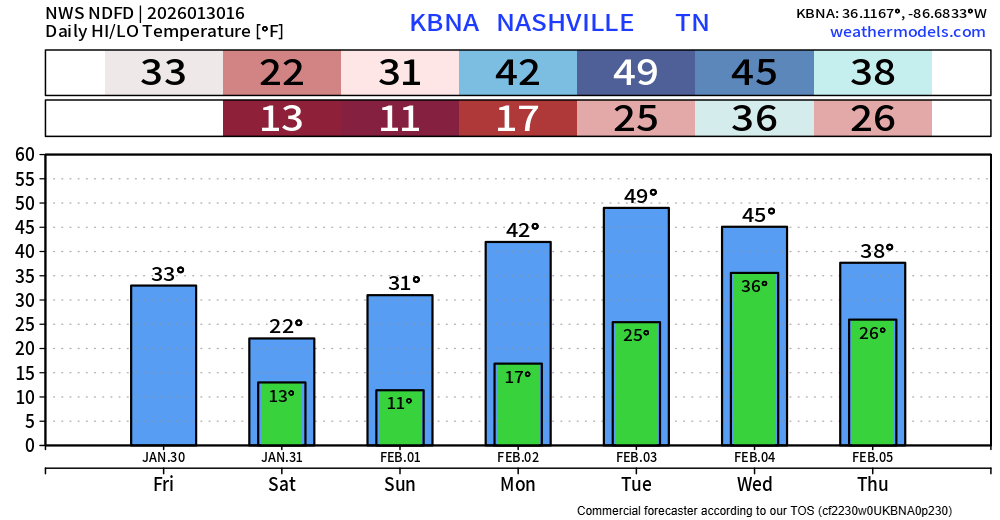
The good news is that highs will be in the 40s Monday thru Wednesday, even getting close to 50° on Tuesday.
We still have a chance of seeing some flakes today and Saturday. This looks to be very light, likely a dusting at most.
This could create a few more slick spots on roads but no widespread issues. We’ll keep you posted with any updates/changes to this on all of our socials.
Next chance of precipitation will come in the form of rain on Wednesday.
“The bulk of the precipitation on Wednesday appears to be rain, though some wrap- around moisture could occur behind the cold front Wednesday night that could support a changeover to snow flurries into Thursday morning. Too early to say for certain at this point.” – NWS Nashville
Categories: Featured Blog