
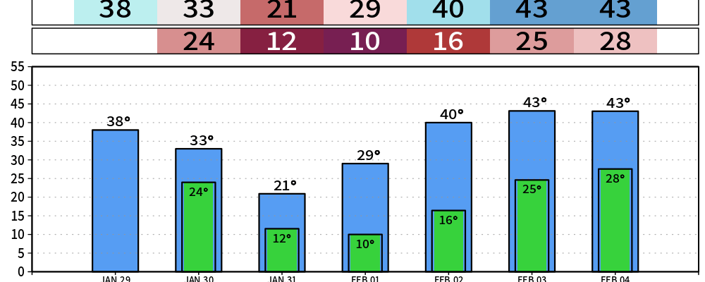
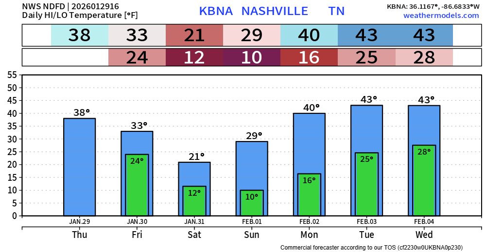
Despite the scattered cloud cover today, we should see at least some melting with a couple hours of above freezing temperatures. Unfortunately, today might be the last day we see above freezing temps until Monday.
We’ll have a Cold Weather Advisory from midnight Friday night thru noon Monday.
Saturday will be the coldest, with high temperatures only in the low 20s. Wind chill values will be near 0° Saturday and Sunday mornings.
Please take the necessary precautions against the cold. Check in on your family and neighbors – especially those that still may be without power. Protect your pipes as well. If you do have to be outside (even for a short amount of time), be sure to wear multiple layers.
We’ll make it back above freezing midday Monday and will enjoy a few days reaching 40°.
We’re also still looking at the potential for some snowflakes on Friday and Saturday. If we do see anything, it would be all snow – no freezing rain or sleet.
Models are pretty set on us getting between maybe a dusting and 0.5″ – this could cause some additional slick spots on the roads, but no widespread issues.
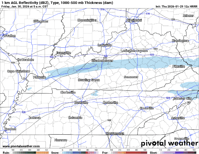
HRRR gives a guess on our quick shot of snow on Friday, it thinks sometime mid-morning thru early afternoon:
We could see some additional flurries during the day on Saturday.
Categories: Featured Blog