
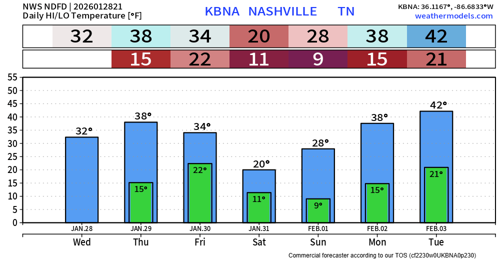
We finally got above freezing as we made it to 33° at BNA at the 3p observation. This, paired with sun has helped the melting process some. Additional melting will happen on Thursday, as most of us get into the upper 30s.
Another heads up for your Thursday AM commute, some fog will be possible during the overnight/morning hours again. With temperatures below freezing, it’s possible we could see some slick spots form on roads – especially on bridges and overpasses. Prepare to take it a bit slower in the morning.
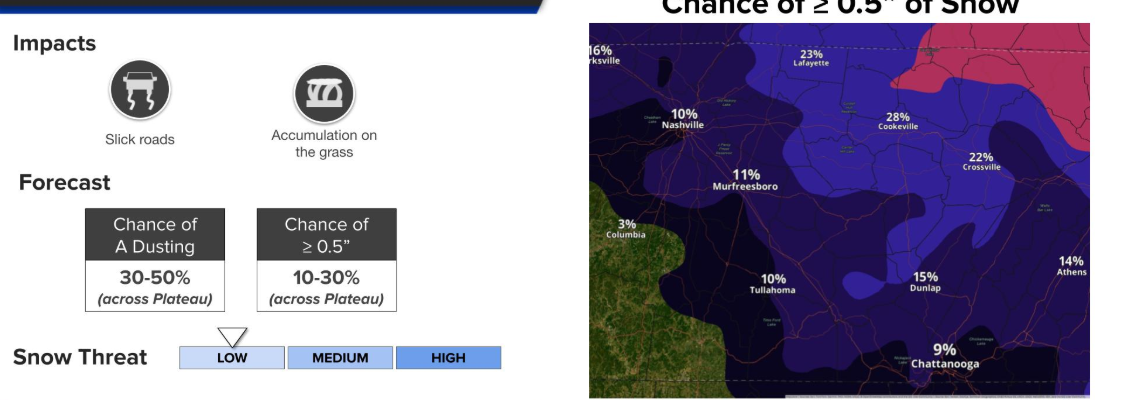
Only chance of precip over the next 5 or so days will be a low chance for some light snow Friday/Saturday.
Models are in fairly good agreement that if we were to get any snow, totals would be fairly light. They are also in agreement that this would be all snow. No sleet or freezing rain, just snow – if anything.
For now, chances of 0.5″ or more of snow are only around 10% for us. Higher for folks to our east on the Plateau.
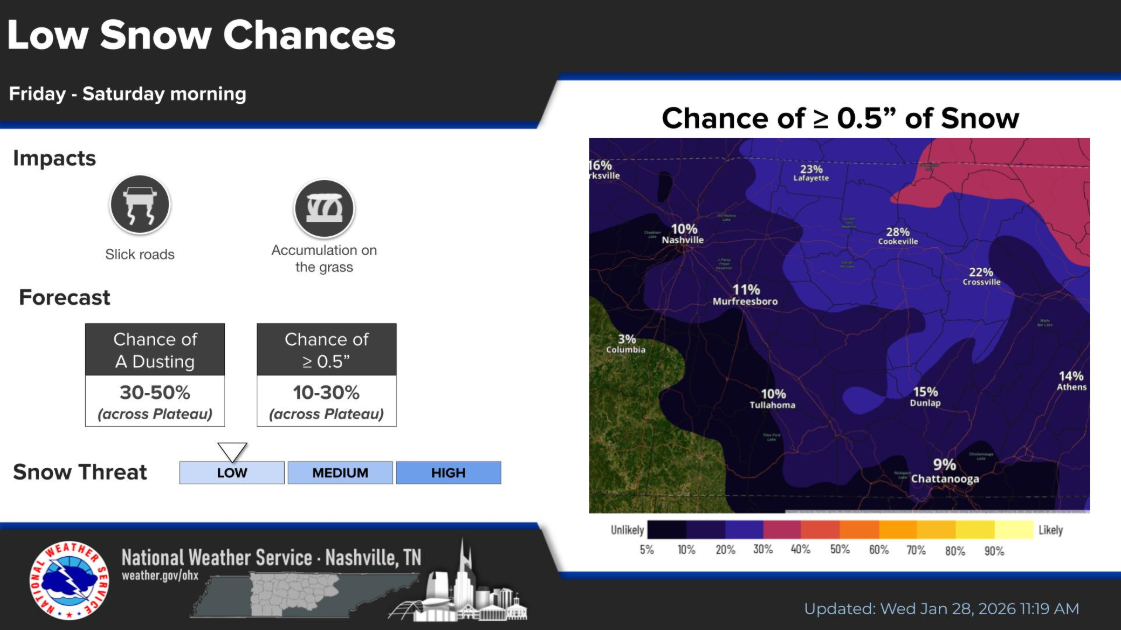
These numbers will probably change between now and then. We’ll keep y’all posted.
The bigger story will be our next multi-day stretch of below freezing temperatures, with low temps in the single digits.
Temperatures will drop below freezing Friday evening and will stay below 32° until midday Monday. Please plan to check in on your friends, family, and neighbors – especially those that may still be without power. Also don’t forget about pipes and pets as well.
Categories: Featured Blog