
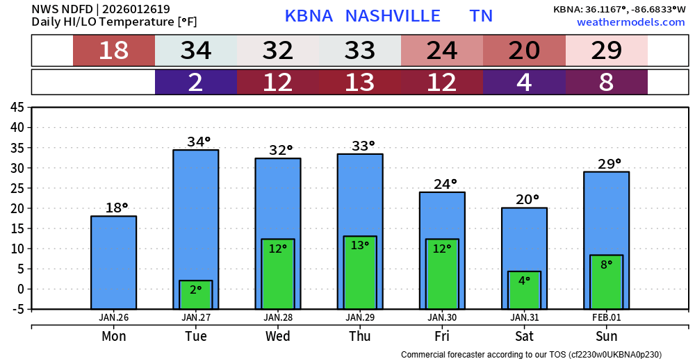
Our ongoing Cold Weather Advisory will switch to an Extreme Cold Warning today starting at 6p, running thru noon on Tuesday. Our low temperatures tonight will get close to 0°, with wind chill values as low as -11°.
We will continue to pass along any updates on warming centers for both of our two counties on all of our socials. There are several open in both Davidson and Williamson counties.
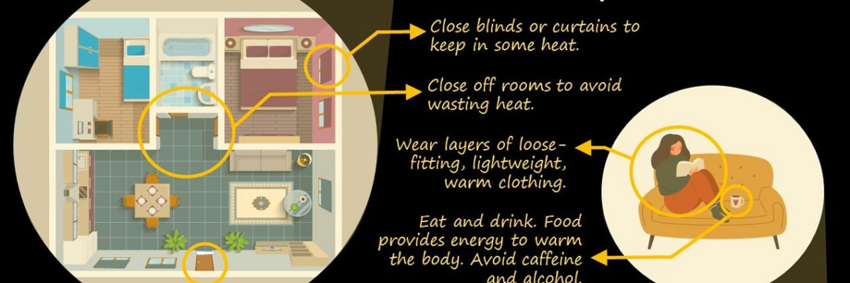
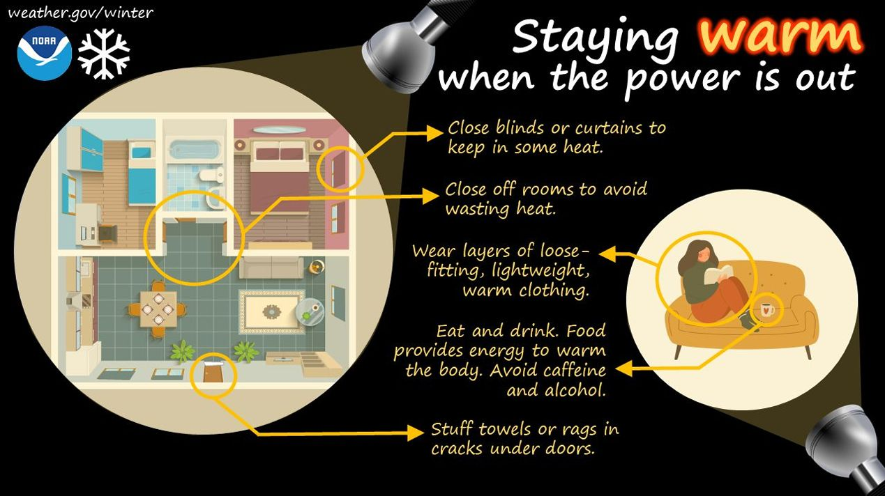
Please check in on your neighbors, especially those that may be elderly are have medical issues. Please take precautions against the cold. If you must be outside, wear several layers.
Unfortunately, additional power outages cannot be completely ruled out. Stress on the power lines and trees from the ice will continue, along with gusts up to 20mph possible today. Wind gusts up to 35mph will be possible Tuesday morning. Please continue to be very cautious around any trees, as the combination of ice and wind may cause more to come down.
If you must be out driving, continue to take it slow, giving plenty of room between you and other cars. Back roads will likely take several days to clear.
We’ll see plenty of sun today, which will help some with melting. Temperatures will climb very close to the freezing mark Tuesday thru Thursday, which will help some more. Low temperatures will continue to be dangerously cold throughout the week.
As of right now, no additional chances of rain or snow this week.
Categories: Featured Blog