
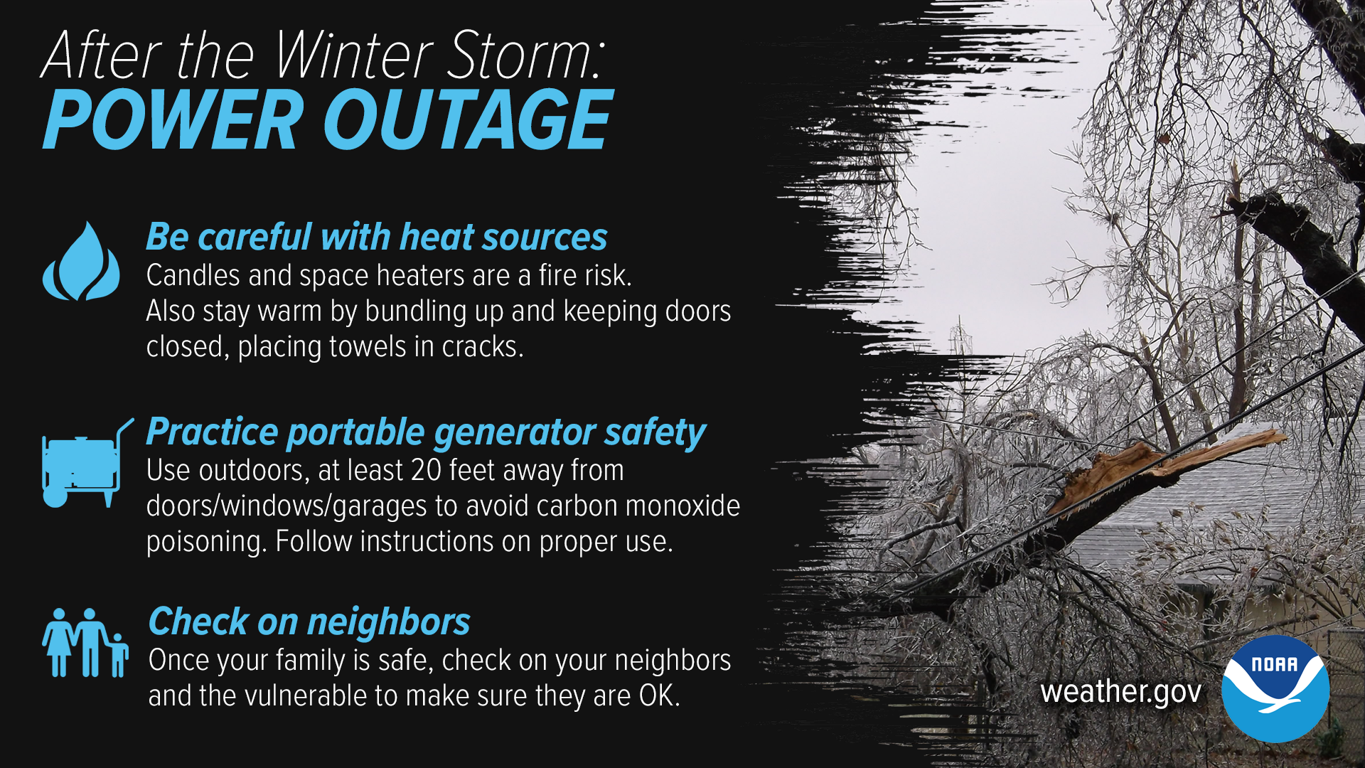
Wind gusts up to 25mph thru the overnight hours will continue to put more stress on trees and power lines, with potential for more to come down. Please remain vigilant around any lines or trees. Always treat a downed power line if it were live.
Precipitation is essentially over with. Some flurries will be possible thru the rest of today.
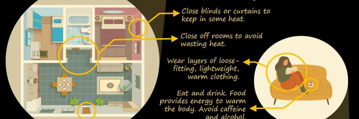
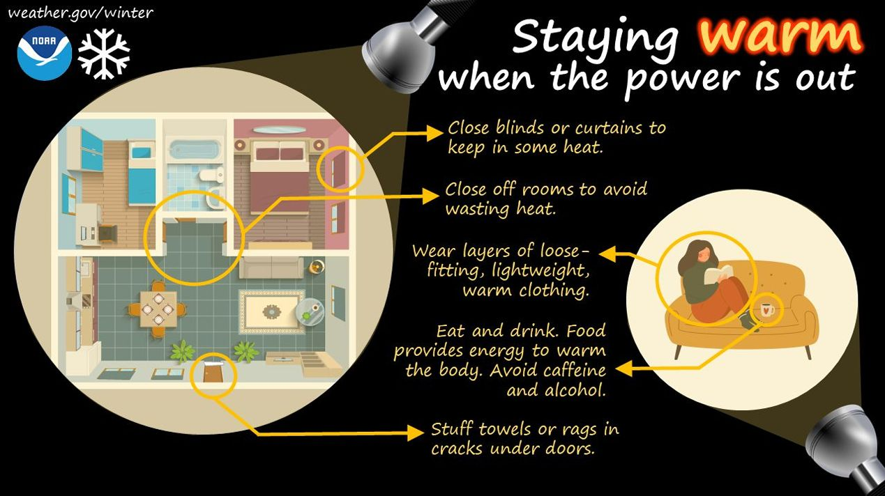
The main concern over the next several days will be the dangerous cold temperatures. Please check in on neighbors, especially those that may be elderly or have medical issues. Be kind to each other.
Temperatures will struggle to make it over freezing thru at least Saturday. Many nights/mornings will get down into the single digits, slowing down the melting process. The sun will help out some.
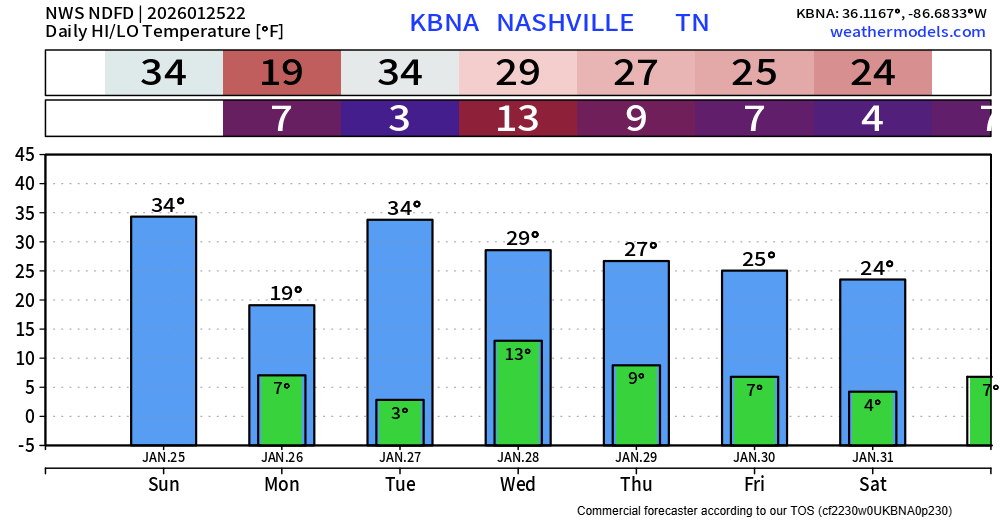
Temperatures will continue to drop thru early Monday morning. Any remaining liquid or slush left will turn into solid ice. Please avoid travel, road conditions will be treacherous – especially back roads.
“Temperatures will not get above the teens Monday. For those that do not have a heat source, this is life-threatening cold! Especially now that so many have lost power due to ice overnight, please check on your neighbors.” – NWS Nashville
A Cold Weather Advisory will be in effect from midnight tonight thru 6p Monday for wind chills as low as 0° to -5°.
An Extreme Cold Warning will then go into effect starting 6p Monday thru noon on Tuesday. Wind chill values will be as cold as -10° during this time.
Please take precautions against this dangerous cold, especially those that may still be without power. We will continue to post updated information about warming shelters on all of our socials. If you have to be outside, please wear multiple layers – hypothermia can set in quickly with conditions like this.
No additional precipitation expected thru this week. We will continue to post resources on all of our socials as we learn of them.
Categories: Featured Blog