

- Sleet will transition to freezing rain over the next several hours
- Road conditions are rapidly deteriorating, travel is highly discouraged
- Ice accumulations of 0.5 – 0.75″ will cause potential power outages/tree damage
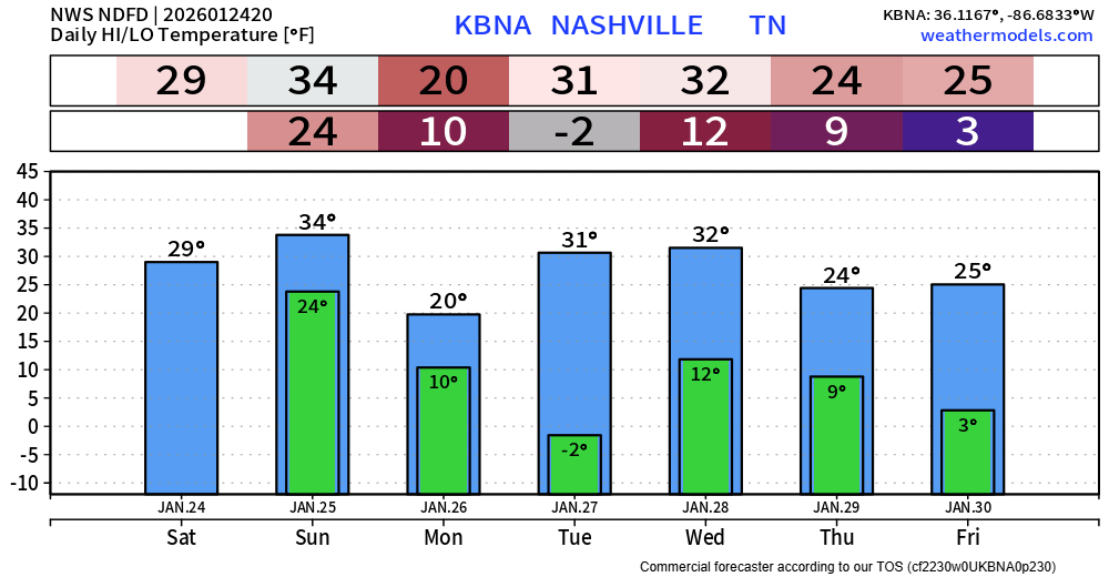
- Dangerous cold to follow, temperatures will struggle to make it above freezing for days, wind chill near -10° early next week
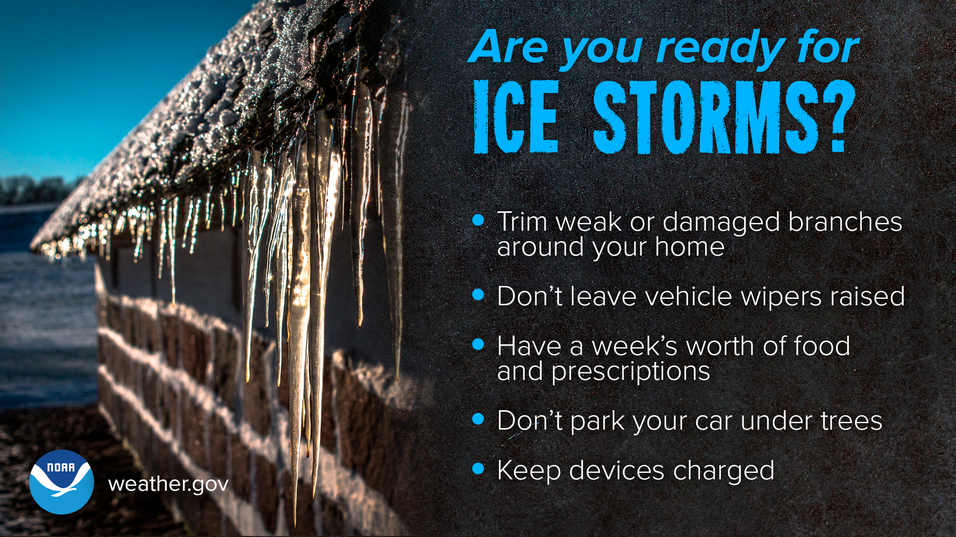
Our focus is quickly turning from our snowy start to the potential for damaging ice accumulation. Hope for the best, plan for the worst.
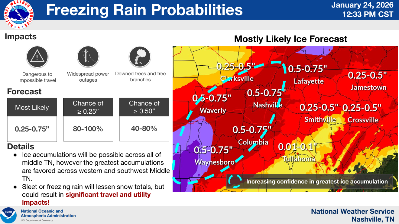
NWS Nashville has our expected ice accumulation at 0.5 – 0.75″. Those amounts would spell trouble for trees and electrical infrastructure. Travel would be very dangerous.
Timing:
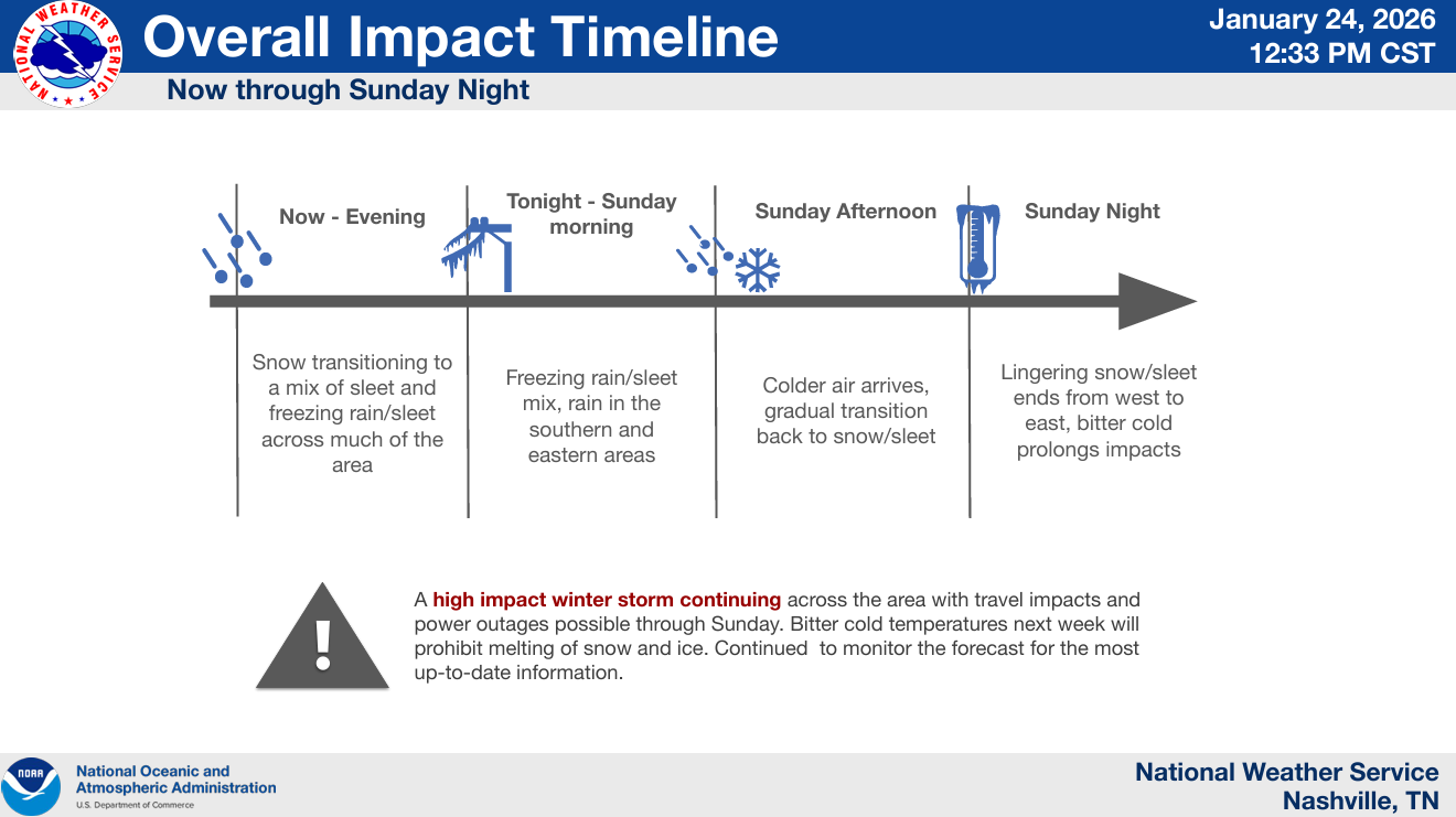
Most of us have begun the transition to sleet. Models expect us to switch over to freezing rain at some point later this evening, continuing through the overnight hours. This freezing will likely continue thru at least midday Sunday. It is possible some of us briefly make it above freezing at some point Sunday morning, which could help briefly, but certainly not eliminate the potential threats. Sometime Sunday afternoon we briefly switch back to sleet/snow before precipitation ends.
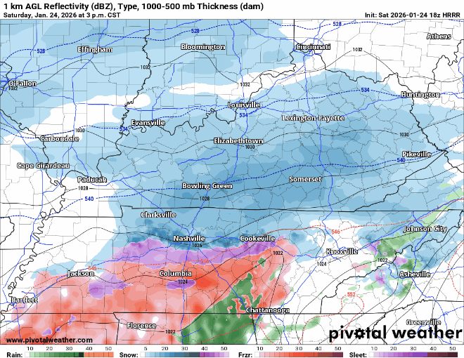
The latest HRRR model gives a guess, looping from 3p today to 5p Sunday – to be used as guidance, not gospel. Timestamp in upper left.
In terms of power outages, I think the potential for that starts later tonight, but especially into Sunday as precipitation rates increase – along with some wind gusts up to 20mph.
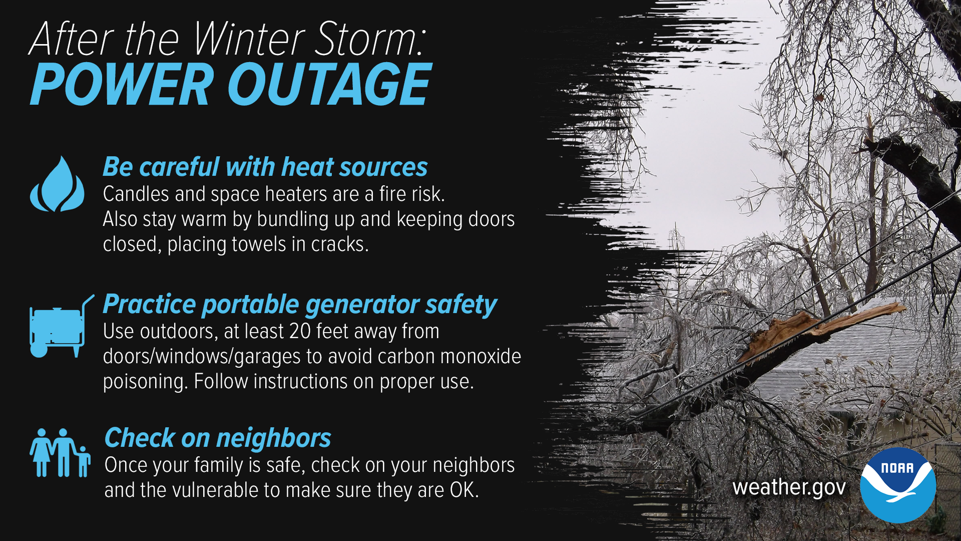
With power outages possible, now is the time to prepare for impacts. Have ways to keep warm if you do lose power, practice safety with generators (emphasis, please use generators safely) and indoor heat sources. Check in on your neighbors, especially those that may be elderly.
The roads are already bad – and will only get worse as the freezing rain starts. There have already been numerous wrecks reported already. Trying to drive on ice is not like trying to drive on snow, back roads will especially be in rough shape. Please plan to stay off the roads this weekend, the roads will turn into a skating rink.
Prolonged Dangerous Cold:
Temperatures will struggle to make it above freezing over at least the next 6 days. This will slow the melting process down quite a bit, although we’ll still see some due to the sun.
This cold will especially be dangerous for those that may lose power. Be sure to have other sources of heat.
Low temperatures will be near the single digits most of next week. Tuesday morning we could have air temperatures below 0°. Monday and Tuesday morning wind chill values near -10° will be possible.
“Again, for those that lose power, this will be a critical time with multiple nights of temperatures in the teens. Please, check on your people, make sure they’re safe and have warm shelter.” – NWS Nashville
We’ll be here with you throughout the entirety of the event and continue posting to all of our socials. Stay connected!
Categories: Featured Blog
Getting scary in West Nashville at 5am Sunday. Trees in my neighborhood are covered in ice and breaking all over.