
- A Winter Storm Warning will be in effect midnight Friday night thru 6p Sunday night
- Travel will become hazardous starting late Friday night into early Saturday morning, worsening throughout the weekend
- Power outages and tree damage cannot be ruled out if some higher freezing rain totals occur
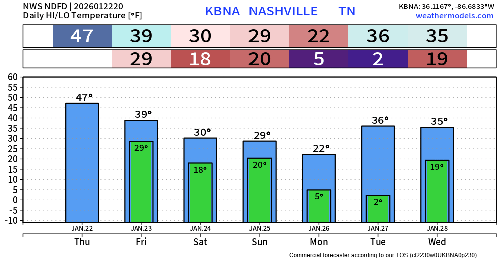
- Brutal cold to follow our winter storm, with lows near 0° early next week
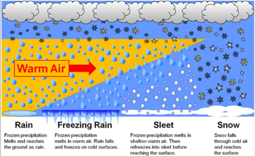
It’s become increasingly likely that we see a mix of all frozen precipitation: snow, sleet, and freezing rain. Models have been fairly consistent on thinking that we will deal with more freezing rain/sleet than snow, although we’ll probably see some of it all.
To set the stage, the graphic below goes over the different types of precipitation. A lot goes into it, and the difference of 1-2° aloft can make a huge difference on whether we see snow, sleet, or freezing rain. This is why there has been a bit more uncertainty with this forecast, 31° or 32.5° makes a ton of difference.
Timing:
The graphic below from NWS Nashville shows a breakdown on current thinking for timing.
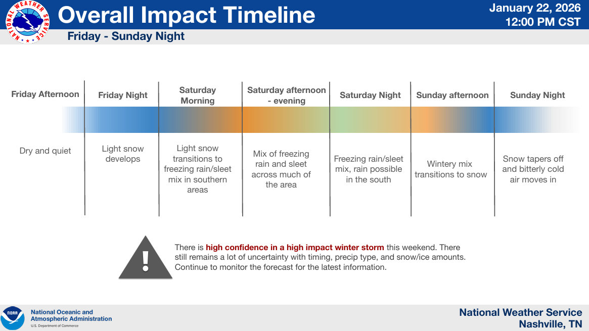
Precip will likely start as snow late Friday night into early Saturday morning. Temperatures aloft will warm up, causing the transition to a mix of sleet/freezing rain. This will likely last thru Saturday night into early Sunday. There is a low possibility that we briefly go above freezing Saturday night, but in that case, we’d quickly go back below freezing. We’ll likely end off with some snow on Sunday as things taper off.
This is not set in stone, but a good overall view on current thinking.
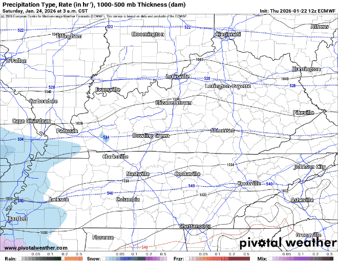
This is just one run of one model (the Euro) and is not meant to be taken literally. This just gives a general idea on what the radar could look like. To be used as guidance, not gospel.
Snow/Ice Totals:
Probabilities for impactful freezing rain continue to rise, up to ~70% of greater than 0.25″.
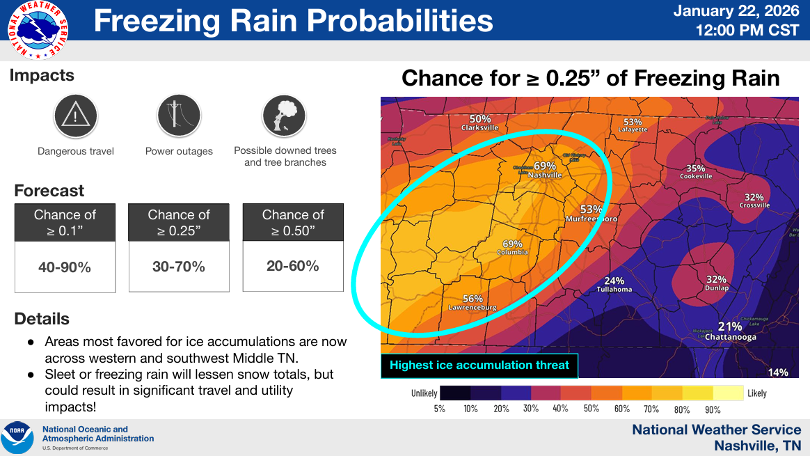
Increasing threat for freezing rain has caused the probability of meaningful snowfall totals to decrease, down to ~30-40% of 3″ or greater of snow.
Generally speaking, for now, higher snow totals to the N, higher odds of ice accumulation to the S.
These numbers will continue to change, although confidence continues to increase that we see more issues from freezing rain/sleet than just exclusively snow.
Impacts:
The decrease in expected snowfall does not equal a decrease in expected impacts. In fact, freezing rain can cause more problems than snow.
Travel issues will start late Friday night thru Saturday morning – and only get worse throughout the day. If you have any errands to run, I’d highly recommend getting them done by dinner on Friday.
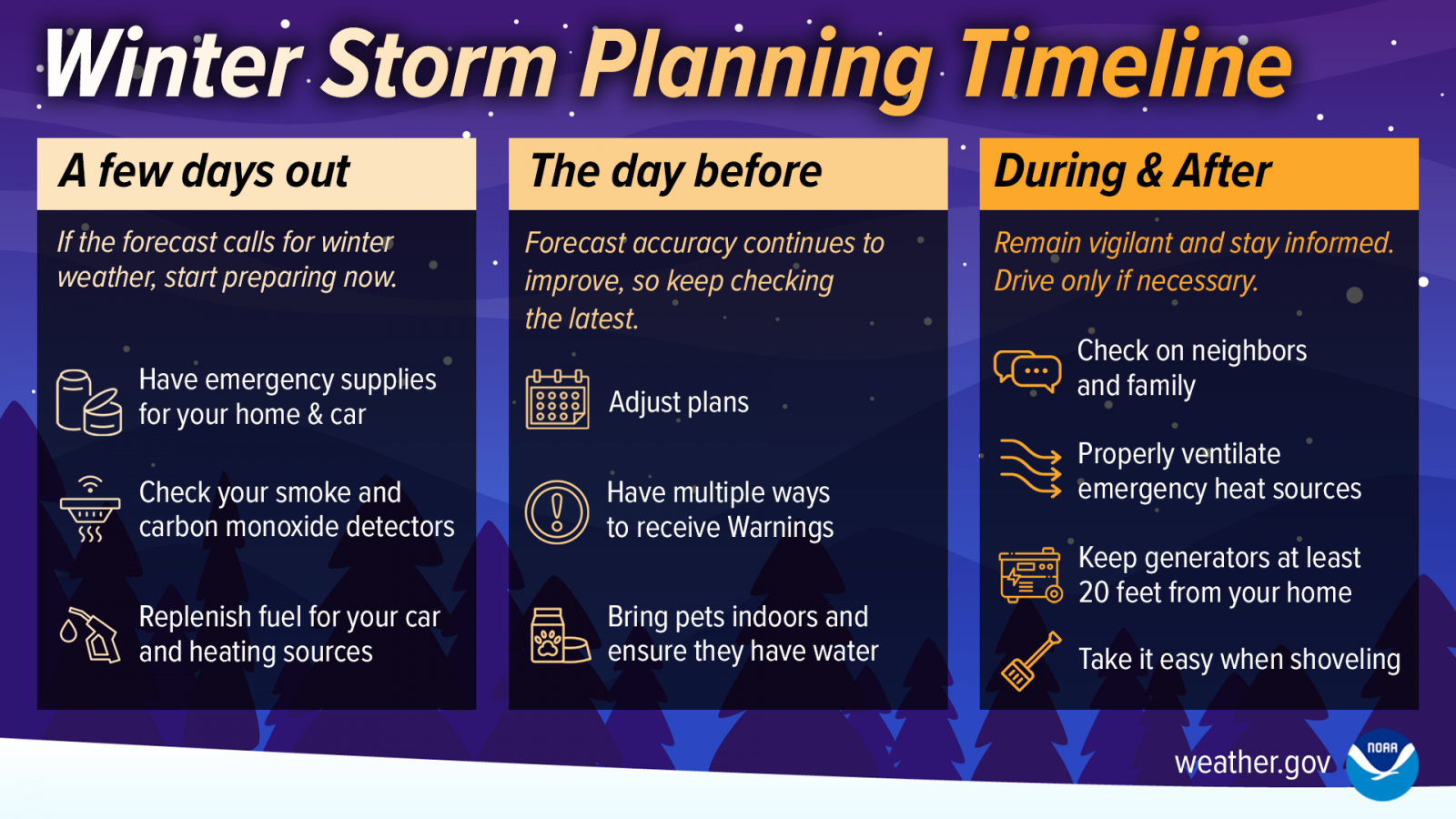
We are on getting close to the day before timeframe. With freezing rain in the forecast, it’s not a bad idea to prepare for potential power outages. Hope for the best, plan for the worst.
We don’t know how exactly the roads will be, or if your flight will be delayed/canceled. But, if you have any travel plans this weekend, I would highly reconsider them.
Brutal Cold:
Following the winter storm, we’ll have some brutally cold temperatures to deal with early next week.
Temperatures will likely not return above freezing until Tuesday or Wednesday, slowing the melting process.
Low temperatures Monday and Tuesday will be close to 0°. Prepare to protect any exposed pipes and drip faucets.
This forecast has been nothing short of difficult. High-res models are coming into range as we speak, and confidence will continue to increase. We will be able to get into the nitty gritty deets later tonight and tomorrow (Friday) as things become more clear. Be prepared to change preparation quickly, especially as we shift the focus from snow to more of a freezing rain potential.
We’ll be posting updates on all of our socials as new info comes in, with more blogs to come.
Categories: Featured Blog
Sorry if this has already been covered, but do you guys think you’ll do another live YouTube before things hit the fan tomorrow? Thank you for absolutely everything you do!
Stay tuned to our social media channels for updates. We’re considering hosting a live stream this afternoon. -LM