
If you’ve stepped outside today, you’ll notice a big difference in the temperature compared to the low 70s we got a couple of days ago. The pesky NW breeze isn’t helping anything either.
Temps will differ some this week, but generally they’ll bounce back and forth around average for this time of year. Most mornings will start below freezing, some with a hard freeze.
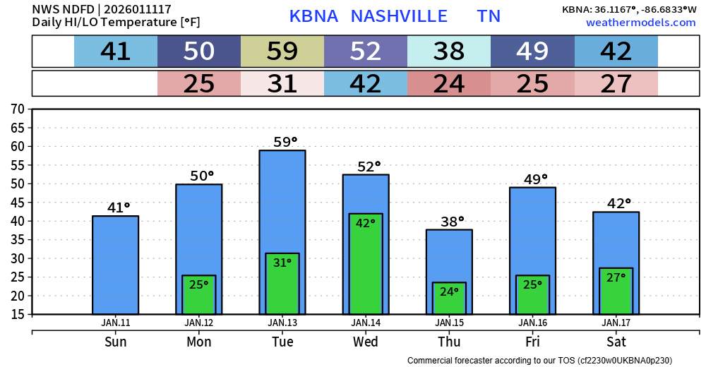
Only legit chance at some precipitation this week (for now) will be on Wednesday.
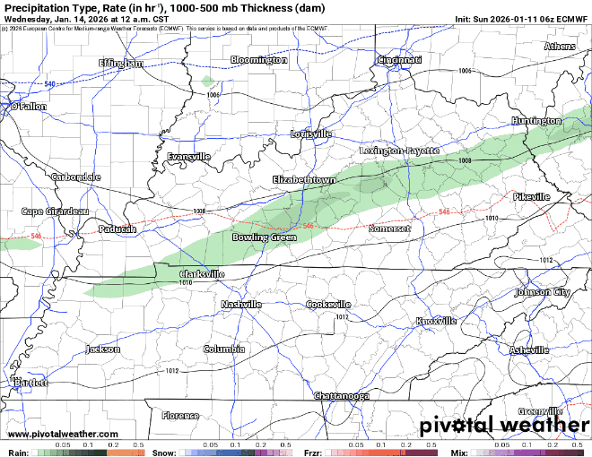
On and off rain showers will be with us during the day on Wednesday. We could see a brief change over to some wintry mix/snow by Wednesday night but not really expecting any accumulation right now with temperatures at the surface expected to stay just above freezing. I suppose this could change, but this does not look like a meaningful snow event by any means.
Euro model gives its latest guess:
“But the pattern remains unsettled heading into the weekend as another trough digs into the eastern CONUS. Wide model disagreement is still in place for this system and what is means for Middle TN. Right now, this system looks to bring at least a low chance for precipitation to the area this weekend.” says NWS Nashville. This will be our next system to watch.
Categories: Featured Blog