
Some additional drizzle will be possible thru the afternoon today. Clouds are likely to stick around for most, if not all of the day.
A cold front will move thru Sunday morning, marking the beginning of our colder temperatures. The also means some gusts around 20 mph will be common throughout the day tomorrow.
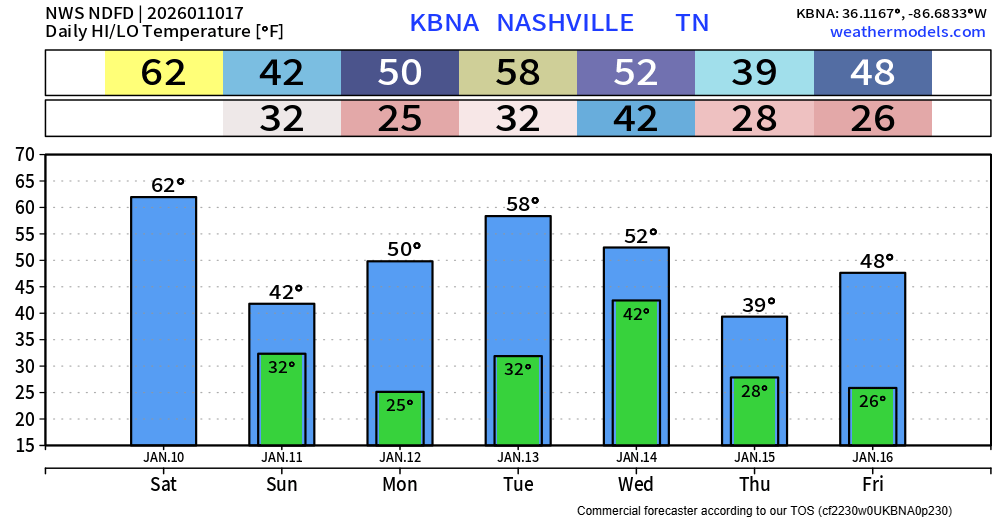
Temperatures will vary a good bit throughout the week, depending on the day. Some cooler than others.
Next rain chances come around Wednesday. Some models hint at this ending with maybe some flakes mixed in, but that’s all, just some flakes – no accumulation currently expected.
Long-range models suggest maybe some mixed precipitation chances next weekend, but we are still wayyy too far out. Models will flip flop every run. Shield your eyes from any crazy model runs, which you may or may not see.
Categories: Featured Blog