
We no longer are outlooked for any severe weather probabilities for today. The question of “will any CAPE (storm fuel) show up?” has been answered – and the answer is no.
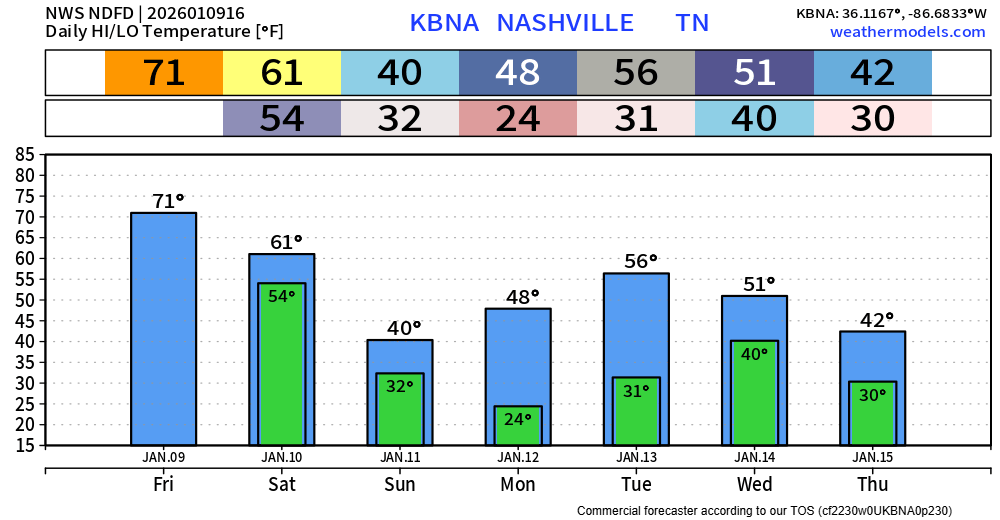
We’ll be dry thru this early evening – likely we’ll see some decent sun as well as we try and tie the daily record high of 71° today.
Showers will return this evening, probably holding off until after dinner time-ish. We’ll see those on/off showers continue thru midday on Saturday.
Originally, models predicted we would be set up right in the slot of heavy rain. Now, models have way backed off on that thinking. Heavy rain no longer seems to be a threat for us. We are technically still under a Flood Watch until noon on Saturday – so can’t totally rule out some rises on some creeks, but very unlikely we deal with any widespread flooding issues. I also wouldn’t be surprised to see our Flood Watch let go early.
After our showers clear out sometime midday, maybe afternoon on Saturday, we’ll have a dry rest of the weekend.
Temperatures come down to close to average for this time of year starting Sunday, sharp difference from our low 70s we’ve been getting.
These temperatures are likely to continue thru at least the next 10 days or so. Next rain chances come around maybe Wednesday.
Categories: Featured Blog