
Clouds will be fairly pesky today, lingering for a while. Regardless, we’ll still have comfortable temperatures as highs warm into the mid 60s.
Temps well above average will continue thru Friday. We’ll get close to our daily record high Thursday and Friday (71°).
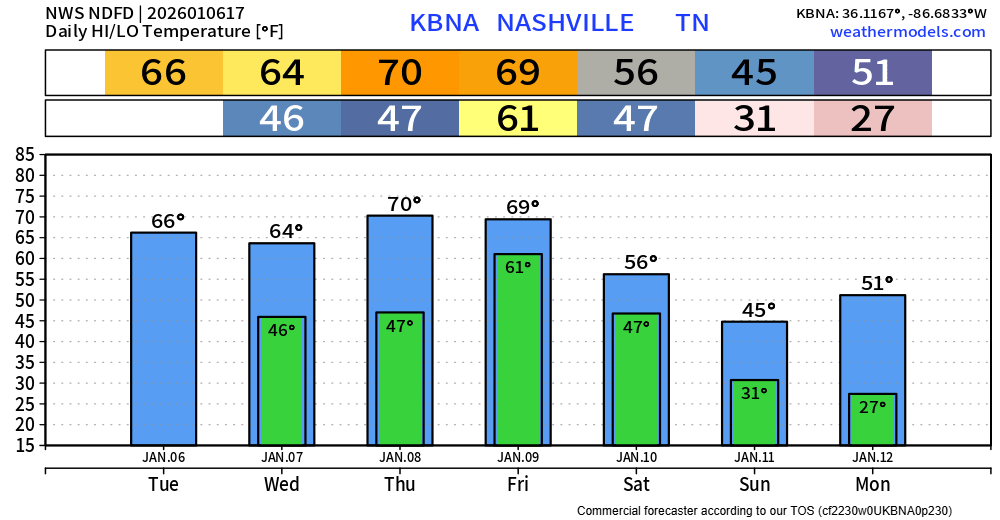
Models have trended towards holding off most, if not all, of the rain until Friday – leaving Thursday mostly dry.
There is still a good amount of uncertainty regarding Friday’s severe weather threat.
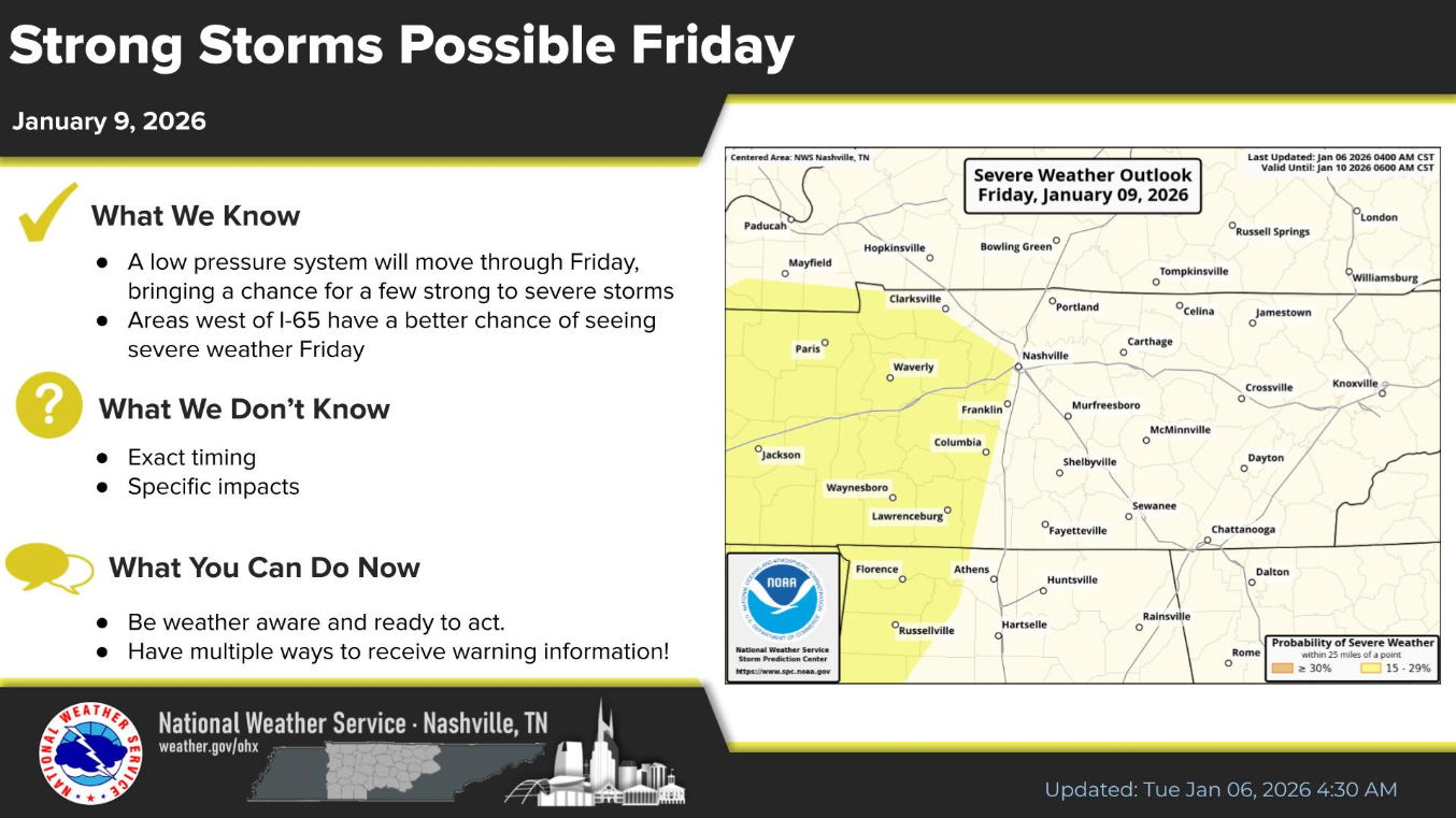
The Storm Prediction Center continues to have the western portions of Davidson and Williamson counties outlooked with a 15% chance of severe weather within 25 miles. This appears to be a Friday afternoon/evening threat.
However, there are a lot of questions that have yet to be answered. The big question is whether or not these storms will have any CAPE (storm fuel) to work with. No CAPE = no severe weather.
This is just one of the many questions that we just don’t have the answer to right now. Confidence will continue to increase over the next couple of days as we get more and more model data in, especially the high-res models.
One thing that there’s a little more confidence in is that we’re likely to see some solid rainfall from this. Rainfall totals right now look to be in the 1.5-2″ range, with locally higher amounts possible. Not expecting widespread flooding issues, but some minor flooding can’t be ruled out.
I’m sure things will change between now and Friday as more data rolls in, we’ll keep you posted on all socials and in future blogs.
We should clear out by Saturday morning. Reality check in regard to temperatures will come on Sunday, as we cool down to more seasonal temps.
Categories: Featured Blog