
First batch of rain should move out of here by lunchtime-ish, we’ll get a break for a couple of hours. In this break, we’ll likely see some non-thunderstorm wind gusts of 25-35mph. Be sure to secure any outdoor decorations.
The Storm Prediction Center has re-introduced our 5% chance of damaging straight-line winds within 25 miles. We are not included in any tornado or hail probabilities.
Any severe threat we’ll be watching will come from a cold front that pushes thru this evening. Most of us will just see some heavy rain, gusty winds with this – but we can’t rule out a portion of the line reaching severe criteria (58mph+) with damaging straight-line winds.
HRRR model below gives a guess, best guess on ETA right now appears to be from 5-8p.
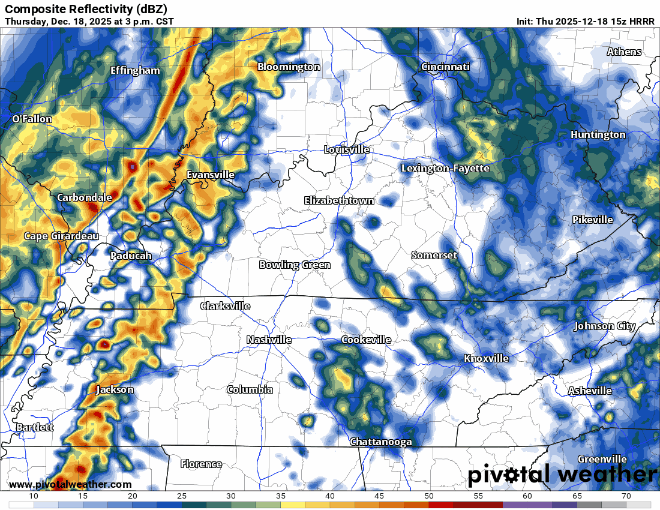
We’ll be watching every radar scan and posting updates as needed on all of our socials.
Post cold front, Friday will be dry and cold with highs only reaching the low to mid 40s.
Saturday and Sunday will be both likely be dry, nicer temps on Saturday though.
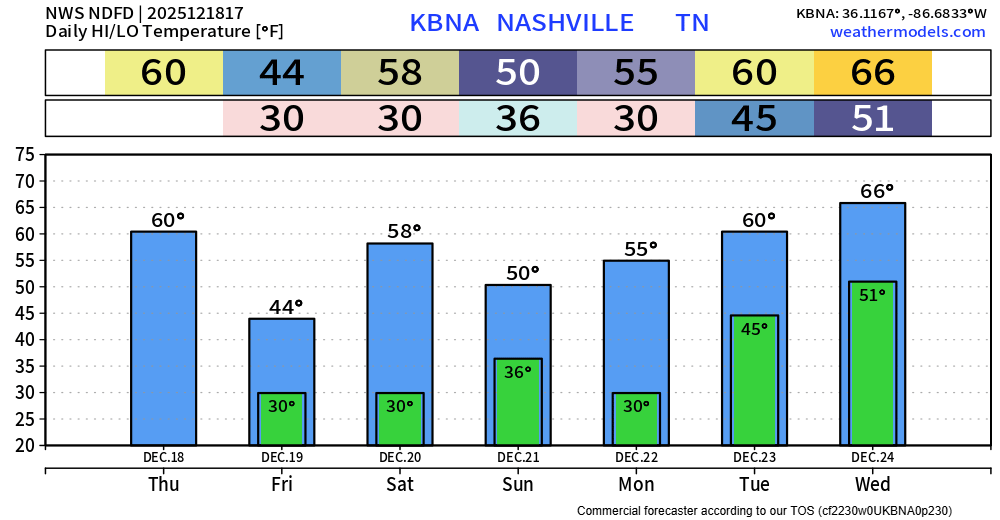
Next week we resume our warming trend. High temps reaching the mid 60s for Christmas Eve. We may end up near 70° for Christmas Day. No meaningful rain chances as of right now.
Categories: Featured Blog