
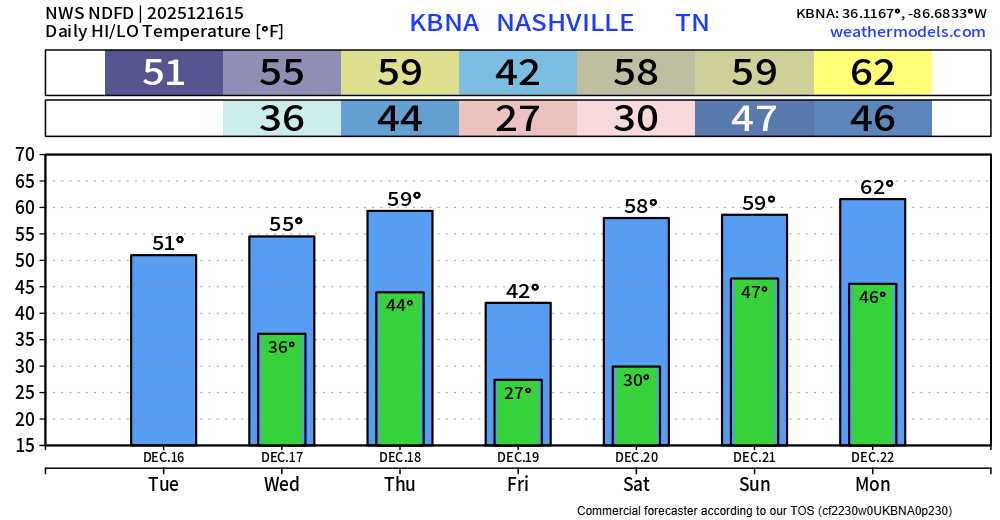
These clouds have been fairly stubborn this morning but should eventually give way to some sun. We’ll make it close to 50° this afternoon.
Maybe a few quick sprinkles Wednesday morning, but most likely just some clouds. Highs into the mid 50s.
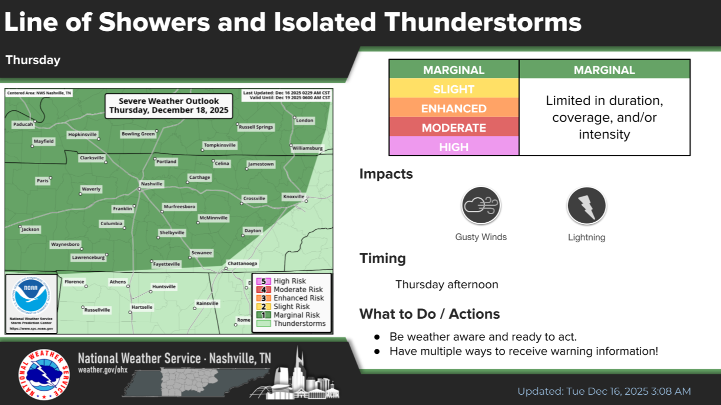
Thursday a cold front will push thru during the afternoon/evening. There appears there might be just enough wind energy for a very low threat of some damaging straight-line winds with a storm or two. The Storm Prediction Center has outlooked our area with a 5% chance of damaging straight-line winds within 25 miles to account for this – no tornado concerns.
The Euro model gives an estimated guess below:
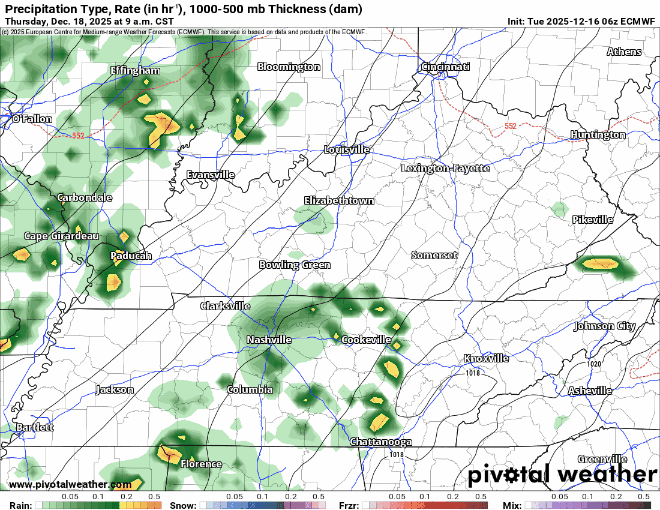
Bottom line: most of us will just deal with some showers, perhaps heavy at times. There may be one or two storms on the stronger side that produce some gusty winds, but with very little to no storm fuel available, this does not look like much. As always, we’ll keep an eye on things and keep y’all updated.
That cold front will briefly keep things cool on Friday with highs only reaching the low 40s. Thankfully we quickly return to the upper 50s by this weekend. We will have some low rain chances to deal with on Saturday and Sunday, but more on that later – those chances look very meh right now.
Categories: Featured Blog